Steinbok Peak facts for kids
Quick facts for kids Steinbok Peak |
|
|---|---|

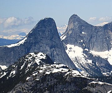
Eastern aspect of Steinbok (left) and Ibex Peak
|
|
| Highest point | |
| Elevation | 2,012 m (6,601 ft) |
| Prominence | 242 m (794 ft) |
| Parent peak | Ibex Peak (2039 m) |
| Geography | |
| Location | British Columbia, Canada |
| Parent range | North Cascades |
| Topo map | NTS 92H/11 |
| Climbing | |
| First ascent | 1961 by Dick Culbert |
| Easiest route | West Ridge |
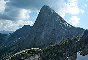
Steinbok Peak is a mountain in British Columbia, Canada. It stands about 2,012 meters (6,601 feet) tall. This impressive peak is part of the North Cascades mountain range. It is located in the southwestern part of British Columbia.
Steinbok Peak is found about 12 kilometers (7.5 miles) northwest of Coquihalla Summit. It is also close to Ibex Peak, which is a bit taller. Water from the peak flows into streams that feed the Anderson River. The mountain got its name from the steinbok, a type of small antelope. This name fits with other nearby peaks that are also named after animals. The name was officially recognized in 1976. Steinbok Peak was even used in the 1991 movie K2 to represent another famous mountain.
How Mountains Formed
The Cascade Range mountains, including Steinbok Peak, began forming millions of years ago. This happened during a time called the late Eocene Epoch. The North American Plate (a huge piece of Earth's crust) slowly moved over the Pacific Plate. This movement caused a lot of volcanic activity.
Also, small pieces of Earth's crust, called terranes, crashed into the continent. These collisions helped create the North Cascades about 50 million years ago.
Ice Age Effects
During the Pleistocene period, which started over two million years ago, glaciers covered much of the land. These huge sheets of ice moved forward and then melted back many times. As they moved, they carved out the landscape. This is why many river valleys in the area have a "U" shape.
The combination of land being pushed up (called uplift) and cracks in the Earth's crust (called faulting) worked with the glaciers. These forces together created the tall peaks and deep valleys we see in the North Cascades today.
The North Cascades are known for their very rugged landscape. They have sharp, rocky peaks, long ridges, and deep valleys carved by glaciers. There are also tall granite spires. All these geological events created the varied landscape and big changes in height across the Cascade Range. This also leads to different climates and types of plants in the area.
Weather at Steinbok Peak
Steinbok Peak has a marine west coast climate. This means it gets a lot of rain and snow. Most of the weather systems come from the Pacific Ocean. They travel east towards the Cascade Range. When these weather systems hit the mountains, they are forced to rise. This process is called orographic lift. As the air rises, it cools and drops its moisture as rain or snow.
Because of this, the Cascade Mountains get a lot of precipitation. This is especially true in winter, when most of it falls as snow. Temperatures can get very cold, sometimes dropping below -20 degrees Celsius (-4 degrees Fahrenheit). With wind, it can feel even colder. The best time to climb Steinbok Peak is usually from July through September. This is when the weather is most favorable.
Climbing Routes
People have found several ways to climb Steinbok Peak. Here are some of the established routes:
- West Ridge - This route was first climbed in 1961.
- Southeast Ridge - This route was first climbed in 1975.
- NE Buttress (Flavelle-Howe) - This route was first climbed in 1979.
 | Selma Burke |
 | Pauline Powell Burns |
 | Frederick J. Brown |
 | Robert Blackburn |


