
Stephenson, Michigan facts for kids
Quick facts for kids
Stephenson, Michigan
|
|
|---|---|

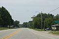
Looking south along U.S. Route 41
|
|

Location within Menominee County and the state of Michigan
|
|

Stephenson, Michigan
Location in Michigan

Stephenson, Michigan
Location in the United States
|
|
| Country | United States |
| State | Michigan |
| County | Menominee |
| Settled | 1870 |
| Incorporated | 1898 (village) 1969 (city) |
| Area | |
| • Total | 1.08 sq mi (2.81 km2) |
| • Land | 1.08 sq mi (2.81 km2) |
| • Water | 0.00 sq mi (0.00 km2) |
| Elevation | 676 ft (206 m) |
| Population
(2020)
|
|
| • Total | 816 |
| • Density | 752.07/sq mi (290.36/km2) |
| Time zone | UTC-6 (Central (CST)) |
| • Summer (DST) | UTC-5 (CDT) |
| ZIP Code |
49887
|
| Area code(s) | 906 |
| FIPS code | 26-76380 |
| GNIS feature ID | 0638791 |
Stephenson is a city located in Menominee County, which is in the U.S. state of Michigan. In 2020, about 816 people lived there. The city is surrounded by Stephenson Township. However, it is managed separately from the township. Stephenson is part of the Marinette, Wisconsin, area, which is a smaller urban area.
Contents
History of Stephenson
A train station was built in Stephenson in 1872 for the Chicago and North Western Railway. A post office opened here on July 13, 1874. It was first called "Wacedah."
The post office was later renamed "Stephenson" on January 10, 1876. This was to honor Samuel M. Stephenson, a local leader. Samuel M. Stephenson served in the government for Michigan. He was a representative and a senator. He also served in the United States Congress from 1889 to 1896.
Stephenson became an official village in 1898. Later, in 1968, it officially became a city.
Geography and Climate
Stephenson is in the southern part of Menominee County. U.S. Route 41 runs through the city. This road goes south about 21 miles to Menominee, which is the main city of the county. It goes north about 20 miles to Powers.
The city covers about 1.09 square miles (2.81 square kilometers) of land. There is no water area within the city limits. The Little Cedar River flows through Stephenson. This river flows south and eventually joins the Menominee River.
Stephenson's Climate
Stephenson has a climate with big changes in temperature throughout the year. Summers are warm to hot and can be humid. Winters are cold, sometimes very cold. This type of weather is called a humid continental climate. On climate maps, it is often shown as "Dfb."
Population Information
| Historical population | |||
|---|---|---|---|
| Census | Pop. | %± | |
| 1880 | 180 | — | |
| 1890 | 456 | 153.3% | |
| 1900 | 395 | −13.4% | |
| 1910 | 527 | 33.4% | |
| 1920 | 550 | 4.4% | |
| 1930 | 447 | −18.7% | |
| 1940 | 612 | 36.9% | |
| 1950 | 791 | 29.2% | |
| 1960 | 820 | 3.7% | |
| 1970 | 800 | −2.4% | |
| 1980 | 967 | 20.9% | |
| 1990 | 904 | −6.5% | |
| 2000 | 875 | −3.2% | |
| 2010 | 862 | −1.5% | |
| 2020 | 816 | −5.3% | |
| U.S. Decennial Census | |||
People in Stephenson (2010)
In 2010, there were 862 people living in Stephenson. These people lived in 358 households. About 212 of these were families. The city had about 791 people per square mile.
Most people in Stephenson were White (97.3%). A small number were from other racial backgrounds. About 2.2% of the population was Hispanic or Latino.
About 24.9% of households had children under 18. Many households (42.2%) were married couples. About 34.4% of households had only one person living there. Also, 21.5% of households had someone aged 65 or older living alone.
The average age of people in the city was 47.9 years. About 21.7% of residents were under 18. About 28.7% were 65 or older. The city had slightly more females (53.7%) than males (46.3%).
Images for kids
-
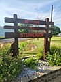
Welcome sign south
-
Sign
-
Welcome sign
-
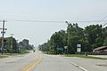
Looking south in Stephenson


See also
 In Spanish: Stephenson (Míchigan) para niños
