
Stickney Township, Illinois facts for kids
Quick facts for kids
Stickney Township
|
|||
|---|---|---|---|
|
|||

Location in Cook County
|
|||

Cook County's location in Illinois
|
|||
| Country | United States | ||
| State | Illinois | ||
| County | Cook | ||
| Established | 1901 | ||
| Area | |||
| • Total | 12.67 sq mi (32.8 km2) | ||
| • Land | 12.48 sq mi (32.3 km2) | ||
| • Water | 0.19 sq mi (0.5 km2) 1.52% | ||
| Elevation | 614 ft (187 m) | ||
| Population
(2020)
|
|||
| • Total | 41,514 | ||
| • Density | 3,276.6/sq mi (1,265.1/km2) | ||
| Time zone | UTC-6 (CST) | ||
| • Summer (DST) | UTC-5 (CDT) | ||
| ZIP codes |
60402, 60455, 60459, 60629, 60638, 60804
|
||
| FIPS code | 17-031-72689 | ||


Stickney Township is one of 29 townships in Cook County, Illinois. It was created in 1901. As of 2020, about 41,514 people live here. Most of them, around 71%, live in the city of Burbank.
The main offices for the township are in Burbank. Other towns in the township include Stickney and Forest View. Parts of Bedford Park and Bridgeview are also in the township. There are also smaller communities like Central Stickney and Nottingham Park.
Stickney Township has clear borders. To the north, it's near Pershing Road. Cicero Avenue is to the east, and 87th Street is to the south. Harlem Avenue forms the western border. However, some parts of Chicago, like Garfield Ridge and Clearing, are not included. These areas contain Chicago Midway International Airport. A famous horse racing track, Hawthorne Race Course, is located within the township. The Chicago Sanitary and Ship Canal, a historic waterway, also runs through the northwest part of the township.
Contents
Exploring Stickney Township's Location and Area
Stickney Township covers an area of about 12.67 square miles (32.81 square kilometers). Most of this area, about 98.48%, is land. The rest, about 1.52%, is water.
What Are Stickney Township's Borders?
Stickney Township shares its northern border with Berwyn and Cicero townships. To the west, it borders Lyons Township. To the south, you'll find Worth Township. On the east, it borders parts of Chicago, including West Lawn and Ashburn.
Stickney Township was once part of a larger area called Lake Township. In 1889, Chicago took over much of Lake Township. The remaining part then joined Lyons Township until 1901, when Stickney Township was officially formed.
Cities, Towns, and Villages in Stickney Township
Several communities are located within Stickney Township:
- Bedford Park (most of it)
- Bridgeview (a small part)
- Burbank
- Chicago (small parts)
- Forest View
- Stickney
Unincorporated Communities in Stickney Township
Some areas are not officially part of a city or village. These are called unincorporated communities:
- Central Stickney
- Glenn
- Nottingham Park (partially in Lyons Township)
Small parts of the city of Chicago are still within Stickney Township. The northern part has industrial areas near the Stevenson Expressway. The southern part includes the Midway Hotel Center and Bedford City Square.
Neighboring Townships Around Stickney
Stickney Township is surrounded by several other townships:
- Berwyn Township (north)
- Cicero Township (north)
- Worth Township (south)
- Palos Township (southwest)
- Lyons Township (west)
- Riverside Township (northwest)
Cemeteries in the Area
Mount Auburn Memorial Cemetery is located within Stickney Township.
Major Roads and Transportation
Important highways run through the township, helping people travel around:
 Interstate 55
 Illinois Route 43
 Illinois Route 50
There is also a heliport called Rose Packing Company Heliport for helicopters.
Understanding Stickney Township's Population
In 2020, the population of Stickney Township was 41,514 people. There were about 13,090 households, which are groups of people living together. The population density was about 3,276 people per square mile.
Who Lives in Stickney Township?
The people living in Stickney Township come from many different backgrounds. About 55% of the population is White. About 2% are African American, and nearly 2% are Native American. About 2.7% are Asian. A large part of the population, about 46%, identifies as Hispanic or Latino.
How Do Families Live in the Township?
Out of all households, 36.4% had children under 18 living with them. More than half, 52.26%, were married couples. About 13.87% were families with a female head of household and no spouse. The average household had about 3 people, and the average family had about 3.5 people.
Age Groups in Stickney Township
The population includes people of all ages. About 25.8% of the people were under 18 years old. About 27.4% were between 25 and 44 years old. People aged 65 or older made up about 14.4% of the population. The average age in the township was 38 years old.
Income and Economy
The median income for a household in the township was about $67,223. For families, the median income was higher, around $76,811. This means that half of the households earned more than this amount, and half earned less. About 10% of the total population lived below the poverty line.
| Historical population | |||
|---|---|---|---|
| Census | Pop. | %± | |
| 1910 | 962 | — | |
| 1920 | 877 | −8.8% | |
| 1930 | 2,500 | 185.1% | |
| 1940 | 4,457 | 78.3% | |
| 1950 | 11,079 | 148.6% | |
| 1960 | 31,404 | 183.5% | |
| 1970 | 41,752 | 33.0% | |
| 1980 | 38,757 | −7.2% | |
| 1990 | 37,297 | −3.8% | |
| 2000 | 38,673 | 3.7% | |
| 2010 | 40,772 | 5.4% | |
| 2020 | 41,514 | 1.8% | |
| U.S. Decennial Census | |||
Learning and Schools in Stickney Township
Students living south of I-55 (also known as the Stevenson Expressway) attend specific schools. They go to schools in Central Stickney School District 110, like Charles J. Sahs Elementary School. They also attend schools in Burbank School District 111. After elementary school, they usually go to Reavis High School.
Students living north of I-55, where fewer people live, attend different schools. They go to schools in Lyons School District 103. After that, they attend Morton West High School in Berwyn.
Notable People from Stickney Township
- Ralph A. Beezhold (1927-2007) was an Illinois state representative and a businessman. He lived in Stickney Township for many years.
Images for kids
-
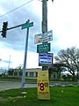
A signpost at Central Avenue near I-55, marking the boundary of Central Stickney, Illinois.

See also
 In Spanish: Municipio de Stickney para niños
