Stone Ridge, Virginia facts for kids
Quick facts for kids
Stone Ridge, Virginia
|
|
|---|---|
| Country | |
| State | |
| County | |
| Area | |
| • Total | 2.61 sq mi (6.75 km2) |
| • Land | 2.58 sq mi (6.69 km2) |
| • Water | 0.02 sq mi (0.05 km2) |
| Elevation | 365 ft (111 m) |
| Population
(2010)
|
|
| • Total | 15,039 |
| • Density | 5,770/sq mi (2,228/km2) |
| Time zone | UTC−5 (Eastern (EST)) |
| • Summer (DST) | UTC−4 (EDT) |
| ZIP code |
20105 (Aldie)
|
| FIPS code | 51-75702 |
Stone Ridge is a community in Loudoun County, Virginia, United States. It's called a "census-designated place" because it's an area that the government counts as a separate community for population surveys, even though it's not officially a city or town.
Many homes in Stone Ridge use Aldie as their mailing address. The community is also located close to Washington Dulles International Airport. In 2020, about 15,039 people lived in Stone Ridge. It was designed as a "planned, mixed-use community" by Van Metre Homes. This means it was carefully planned to include homes, shops, and other services all in one area.
Contents
Getting Around Stone Ridge
Stone Ridge is very close to a main road called U.S. Route 50. This road helps connect the community to other places like Lenah and Chantilly. Several other important roads also run through or around Stone Ridge.
These roads include Tall Cedars Parkway (also known as Virginia State Route 2200) and Stone Springs Boulevard (Virginia State Route 2625). Goshen Road (Virginia State Route 616) is on the western side, and Gum Spring Road (Virginia State Route 659) is mostly on the eastern side. Northstar Boulevard is another important road nearby.
Stone Ridge also has bus stops at the Village Center and Stone Springs Hospital. These stops are the end of the 88 bus route, which helps people travel to communities further east along U.S. Route 50, like South Riding. The 88X bus route goes all the way to the Wiehle-Reston East Metro Station.
Where is Stone Ridge?
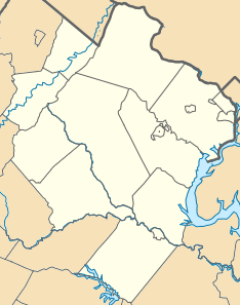
Stone Ridge is located in the southeastern part of Loudoun County. It's south of U.S. Route 50 (also called John Mosby Highway) and west of State Route 659 (Gum Spring Road).
If you travel on U.S. 50, Stone Ridge is about 31 miles (50 km) west of Washington, D.C.. It's also about 41 miles (66 km) southeast of Winchester. Leesburg, which is the main town of Loudoun County, is about 15 miles (24 km) north. Manassas National Battlefield Park is about 9 miles (14 km) to the south.
Stone Ridge shares its northern border with Arcola and its eastern border with South Riding.
Waterways Near Stone Ridge
The land in Stone Ridge is about 6.7 square kilometers (2.6 sq mi) in total, with a small part (0.05 square kilometers or 0.02 sq mi) being water. Water from the southern part of Stone Ridge flows south into Foley Branch. This branch then leads to Bull Run, which flows southeast past the national battlefield and into the Occoquan River.
Water from the northern part of Stone Ridge drains into Broad Run. Both the Occoquan River and Broad Run eventually flow into the Potomac River.
Schools and Libraries
Stone Ridge has several schools and a library that serve the community:
- Gum Spring Library (opened in 2013)
- John Champe High School
- Mercer Middle School
- Arcola Elementary School
- Pinebrook Elementary School
- Goshen Post Elementary School
Who Lives in Stone Ridge?
In 2020, the population of Stone Ridge was 15,039 people. The community is made up of people from many different backgrounds.
Here's a look at the different groups of people living in Stone Ridge in 2020:
- White: 39.54%
- African American: 11.02%
- Native American: 0.31%
- Asian: 35.66%
- Pacific Islander: 0.03%
- From other races: 2.75%
- From two or more races: 10.68%
- Hispanic or Latino (who can be of any race): 9.00%
In 2020, the average household income in Stone Ridge was about $153,628. Loudoun County, where Stone Ridge is located, is known for having one of the highest average household incomes of any county in the United States.
See also
 In Spanish: Stone Ridge (Virginia) para niños
 | Kyle Baker |
 | Joseph Yoakum |
 | Laura Wheeler Waring |
 | Henry Ossawa Tanner |


