
Stowe (CDP), Vermont facts for kids
Quick facts for kids
Stowe, Vermont
|
|
|---|---|
.jpeg) |
|

Stowe (CDP), Vermont
Location in Vermont

Stowe (CDP), Vermont
Location in the United States
|
|
| Country | United States |
| State | Vermont |
| County | Lamoille |
| Town | Stowe |
| Area | |
| • Total | 0.82 sq mi (2.13 km2) |
| • Land | 0.81 sq mi (2.11 km2) |
| • Water | 0.008 sq mi (0.02 km2) |
| Elevation | 723 ft (220 m) |
| Population
(2010)
|
|
| • Total | 495 |
| • Density | 608/sq mi (234.6/km2) |
| Time zone | UTC−5 (Eastern (EST)) |
| • Summer (DST) | UTC−4 (EDT) |
| ZIP Code |
05672
|
| Area code(s) | 802 |
| FIPS code | 50-70450 |
| GNIS feature ID | 2586656 |
Stowe is a special area in Vermont, United States. It is known as a census-designated place (CDP). This means it's a part of a town that the government counts separately for population.
Stowe is located in Lamoille County. In 2010, about 495 people lived in the Stowe CDP. The larger town of Stowe had a population of 4,314 people.
Contents
Where is Stowe Located?
Stowe village is in the eastern part of the town of Stowe. It sits along the Little River, where another stream called the West Branch joins it.
How to Get Around Stowe?
Two main roads pass through Stowe. Vermont Route 100 goes north about 9 miles (14 km) to Morrisville. It also goes south about 10 miles (16 km) to Waterbury. From Waterbury, you can get on Interstate 89.
Vermont Route 108 starts in Stowe village. It heads north through a famous mountain pass called Smugglers Notch. This route goes about 17 miles (27 km) to Jeffersonville.
Stowe's Waterways
The Stowe CDP covers about 0.8 square miles (2.1 square kilometers) of land. A small part of this area, about 0.008 square miles (0.02 square kilometers), is water. This water makes up about 1% of the total area.
The Little River flows through Stowe. This river is part of the Winooski River system. The Winooski River flows west and eventually drains into Lake Champlain.
Images for kids
-
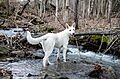
A view of the river in Stowe.
See also
 In Spanish: Stowe (condado de Lamoille) para niños
