Sugarloaf, Colorado facts for kids
Quick facts for kids
Sugarloaf, Colorado
|
|
|---|---|

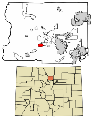
Location of the Sugarloaf CDP in Boulder County, Colorado
|
|
| Country | |
| State | |
| County | Boulder County |
| Government | |
| • Type | unincorporated community |
| Area | |
| • Total | 5.640 km2 (2.178 sq mi) |
| • Land | 5.640 km2 (2.178 sq mi) |
| • Water | 0.000 km2 (0 sq mi) |
| Elevation | 2,390 m (7,842 ft) |
| Population
(2020)
|
|
| • Total | 274 |
| • Density | 48.58/km2 (125.83/sq mi) |
| Time zone | UTC-7 (MST) |
| • Summer (DST) | UTC-6 (MDT) |
| ZIP Code |
Boulder 80302
|
| Area codes | 303 & 720 |
| GNIS feature ID | 2583301 |
Sugarloaf is a small community located in Boulder County, Colorado, in the United States. It is also spelled Sugar Loaf. It is known as a "census-designated place" (CDP). This means it's an area identified by the U.S. Census Bureau for counting people. However, it is not an official town or city with its own local government. In 2020, about 274 people lived in Sugarloaf. The area is served by the Boulder post office.
Contents
A Look Back at Sugarloaf
Sugarloaf has a long history. Its name appeared in Colorado records as early as 1868. The name likely came from an old mining claim called "Sugar Loaf, near Yellow Pine." A mining claim is a piece of land where someone has the right to dig for valuable minerals. "Sugar Loaf" was also a term used for a larger mining district, which included many mining claims.
The Black Tiger Fire
In 1989, a big wildfire caused a lot of damage in Sugarloaf. This fire was called the Black Tiger Fire. It burned about 2,100 acres (850 hectares) of land. It also destroyed 44 houses and other buildings. The fire caused about $10 million in damages.
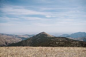
The Black Tiger Fire was the worst wildfire in Colorado's history at that time. It started on July 9, 1989, because of human activity. The fire began in a scenic mountain area and quickly spread up to the top of Sugarloaf Mountain. It moved through neighborhoods where homes were built among the trees. Within the first five to six hours, many homes were lost. Some firefighters from the Sugarloaf Volunteer Fire Department even had their own homes destroyed. Luckily, no one died in the fire, though some people had minor injuries.
Where is Sugarloaf?
Sugarloaf is located in the southern part of Boulder County. It is about halfway between the cities of Boulder and Nederland. To the northeast, it borders another CDP called Mountain Meadows. Part of the southern edge of the community is formed by North Boulder Creek. Sugarloaf Road is the main road that goes through the community.
The Sugarloaf CDP covers an area of about 5.640 square kilometers (2.178 square miles). All of this area is land, with no water.
Who Lives in Sugarloaf?
The United States Census Bureau first defined the Sugarloaf CDP for the 2010 census. This means they officially recognized it as a place to count people.
| Sugarloaf CDP, Colorado | ||
|---|---|---|
| Year | Pop. | ±% |
| 2010 | 261 | — |
| 2020 | 274 | +5.0% |
| Source: United States Census Bureau | ||
Community Life
Sugarloaf has its own volunteer fire department. This department is part of the Sugar Loaf Fire Protection District (SLFPD). As of 2019, the department usually has 30 to 45 members who volunteer their time.
The SLFPD protects an area of about 17 square miles (44 square kilometers). This area includes about 500 homes. The land is mountainous, with elevations ranging from 6,000 to 8,500 feet (1,800 to 2,600 meters). The volunteer fire department was first started in 1967. In 2019, it served about 1,400 people in the community.
See also
 In Spanish: Sugarloaf (Colorado) para niños
 | John T. Biggers |
 | Thomas Blackshear |
 | Mark Bradford |
 | Beverly Buchanan |


