Summit Metro Parks facts for kids
Quick facts for kids Summit Metro Parks |
|
|---|---|
 |
|
| Type | Public park district |
| Location | Summit County, Ohio, United States |
| Nearest city | Akron, Ohio |
| Area | 14,000 acres (5,700 ha) |
| Created | 1921 |
| Visitors | 5,000,000 annually |
| Open | All year |
Summit Metro Parks is a cool system of parks in Summit County, Ohio. It manages over 14,000 acres of land, including 16 developed parks and six special conservation areas. You can explore more than 150 miles of trails, with 22.4 miles of the famous Ohio & Erie Canal Towpath Trail.
These parks are supported by local voters who approve a special tax called a levy. Park rangers are like peace officers. They help keep everyone safe by making sure park rules and laws are followed.
Contents
- History of Summit Metro Parks
- Explore the Parks!
- Cascade Valley/North
- Cascade Valley/South
- Cascade Locks
- Deep Lock Quarry
- Firestone Metro Park
- Furnace Run Metro Park
- Goodyear Heights Metro Park
- Gorge Metro Park
- Hampton Hills Metro Park
- Liberty Metro Park
- Munroe Falls Metro Park
- F.A. Seiberling Nature Realm
- O'Neil Woods Metro Park
- Sand Run Metro Park
- Silver Creek Metro Park
- Springfield Bog Metro Park
- Tallmadge Meadows
- Other Trails to Explore
- Conservation Areas
History of Summit Metro Parks
During big events like World War I, people often looked for peaceful places to relax. Because of this, the United States created the National Park Service in 1916. Ohio then allowed local areas to form their own park districts.
The first park district in Ohio was Cleveland Metroparks, started in 1917. Then, on December 31, 1921, Summit Metro Parks was created. It was first called the Akron Metropolitan Park District.
Early Leaders and Park Planning
It took a little while to get the first park leaders, called commissioners, in place. Finally, in 1923, James Shaw, Maude I. Milar, and Charles B. Raymond were appointed.
In 1925, two new commissioners joined: Edmund D. Eckroad and Frank A. Seiberling. Seiberling was the founder of Goodyear Tire & Rubber Company.
With new leaders, famous landscape architects, the Olmsted Brothers, were asked to plan parks for the whole county. Their father, Frederick Law Olmsted, designed many famous parks, like New York's Central Park. The Olmsted Brothers also worked on parks in other big cities.
First Land Donations and Growth
In June 1925, the first piece of land was given to the park system. It was a small plot called Courtney Park, donated by Joseph Courtney.
In 1926, Harold S. Wagner became the first director of the park district. He had worked with the Olmsted Brothers before.
Between the late 1920s and 1930, over 1,000 acres of land were donated. This meant the park system grew to 1,600 acres across five areas. To help pay for new parks and land, voters approved a small tax in 1928.
Parks During the Great Depression
Less than a year after the tax was approved, the stock market crashed, leading to the Great Depression. Many factories closed, and jobs were hard to find.
To help the economy, President Franklin D. Roosevelt started the New Deal. Part of this was the Civilian Conservation Corps (CCC). This program put millions of people to work across the country. The CCC helped Metro Parks build new parks and finish many projects.
Today, Summit Metro Parks manages about 13,000 acres. This includes 14 developed parks, six conservation areas, and over 125 miles of trails. About 4.5 million people visit the parks each year.
Explore the Parks!
Summit Metro Parks has many different parks, each with its own special features. Here are some of them:
Cascade Valley/North
This park in Akron was named after Sherman and Mary Schumacher, who donated land in 1968. It's one of the wildest areas in Akron. You can find steep ravines and a forest with oak, beech, and sassafras trees. Look for wildflowers like spring beauty and Jack-in-the-pulpit. Great horned owls and woodpeckers live here.
ACTIVITIES: Hiking (Schumacher Trail 1.2 miles; Valley Link Trail 2.8 miles), Picnicking
Cascade Valley/South
Also in Akron, this park has traces of the old Cascade Race waterway from 1833. This waterway helped Akron grow into a busy town. Today, you might see belted kingfishers and herons fishing. In spring, white trillium and wild ginger bloom. The park also has rare plants and a prairie where wild lupines grow.
ACTIVITIES: Hiking (Chuckery Trail 2.4 miles; Highbridge Trail 3.2 miles; Overlook 0.5 miles; Oxbow Trail 1.2 miles), Baseball/Softball, Cross-country Skiing, Fishing, Picnicking, Sledding, Soccer
Cascade Locks
In Akron, the Cascade Locks tell a story of early industry. This part of the Ohio & Erie Canal was very steep. Boats had to go through 15 locks, like steps, to climb the hill. Locks 10 through 16 are in this area. The Mustill House and store, built long ago, are some of Akron's oldest buildings. They served people traveling on the canal. You can see many wildflowers and birds like robins and red-tailed hawks here.
ACTIVITIES: Hiking, Picnicking
Deep Lock Quarry
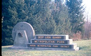
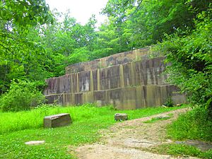
Located in Peninsula, this park has Lock 28, which was the deepest lock on the Ohio & Erie Canal at 17 feet. There's also an old quarry where Berea sandstone was cut for the canal and other buildings. Ferdinand Schumacher, who brought oatmeal to America, bought part of the quarry. The stone was used for grinding oats. The Civilian Conservation Corps used sandstone from here in the 1930s to build park facilities. Today, you'll find many Ohio buckeye trees. The old canal bed is home to frogs, turtles, and salamanders.
ACTIVITIES: Hiking (Buckeye Trail; Cuyahoga Trail 13.1 miles; Quarry Trail 1.2 miles), Fishing, Picnicking
Firestone Metro Park
This park in Akron was once a dairy farm. In 1949, the Firestone Tire and Rubber Company donated land. A dam built nearby in 1956 created a large wetland and marshy meadows. This area is now home to fish, frogs, and turtles. You might see foxes, coyotes, raccoons, and many types of birds, including bald eagles! Be careful of poison sumac in wet areas; always stay on the trails.
ACTIVITIES: Hiking (Redwing Trail 1.1 miles; Walking Course 0.9 miles; Willow Trail 1.6 miles), Cross-country Skiing, Fishing, Picnicking, Sledding
Furnace Run Metro Park
In Richfield, Furnace Run Metro Park started in 1929 with a donation from the Charles Francis Brush Jr. family. Work crews in the 1930s helped develop much of the park. Every March and April, thousands of daffodils bloom along the H.S. Wagner Daffodil Trail. Wagner, the first park director, planted the first bulbs. The park has beech-maple woods, spring wildflowers, and deep ravines. You might spot owls, hawks, and beavers.
ACTIVITIES: Hiking (Daffodil Trail 0.6 miles; Old Mill Trail 1.0 miles; Rock Creek Trail 1.2 miles), Cross-country Skiing, Fishing, Ice Skating, Picnicking, Sledding
Goodyear Heights Metro Park
This Akron park opened in 1930 with land donated by Goodyear Tire & Rubber Company. During the Great Depression, more land was added. Thousands of pine and tulip trees were planted. Today, this 410-acre park has black cherries, oaks, and tuliptrees. Alder Pond has a cattail marsh, which is great for wildlife. You might see muskrats, Canada geese, and large snapping turtles basking in the sun. Owls also live in the woods.
ACTIVITIES: Hiking (Alder Trail 1.4 miles, Parcours Trail 1.8 miles, Piney Woods Trail 2.0 miles), Baseball/Softball, Cross-country Skiing, Fishing, Picnicking, Sledding
Gorge Metro Park
In Cuyahoga Falls, the Gorge has a cool story about a girl named Mary Campbell. She was captured by Delaware Indians in 1759 and reportedly lived in a cave here. The Gorge itself was formed thousands of years ago when glaciers changed the path of the Cuyahoga River. Now, the river rushes over a shale riverbed. Oak, blackgum, and tulip trees grow on the valley walls. This park was once home to the High Bridge Glens Amusement Park, which had a roller coaster!
ACTIVITIES: Hiking (Glens Trail 1.8 miles, Gorge Trail 1.8 miles, Highbridge Trail 3.2 miles), Fishing, Ice Skating, Picnicking
Hampton Hills Metro Park
This park in Akron and Cuyahoga Falls started in 1964. Glaciers carved the ravines and valleys here over 10,000 years ago. The Adam Run Valley has unusual plants called rush. Along the trails, oak, elm, and sycamore trees provide homes for birds and other animals. Girl Scouts planted a grove of white pines in the 1960s. At the Top O' the World Area, you can see open fields with wildflowers like milkwort and goldenrods. Bluebird boxes help these birds nest, and red-tailed hawks hunt for small animals in the meadows.
ACTIVITIES: Hiking (Adam Run 3.2 miles, Spring Hollow Trail 1.6 miles), Picnicking, Soccer
Liberty Metro Park
In Twinsburg, Liberty Park was a camping spot for ancient humans. Later, farmers cleared trees but kept maples for their sweet sap. Today, this 1,759-acre park is a team effort between the City of Twinsburg and Metro Parks. The park has wetlands and vernal pools, which are important for many rare and endangered species. You might see Indiana bats, marsh wrens, ospreys, and bald eagles. Beavers, long-tailed weasels, and many types of frogs and turtles also live here. In 2006, it was named an Important Bird Area.
ACTIVITIES: Hiking (Buttonbush Trail 1.6 miles, Sugarbush Trail 0.6 miles), Baseball/Softball, Picnicking, Play Equipment
Munroe Falls Metro Park
Before Metro Parks bought this land in Munroe Falls in 1978, it was a swimming park called Renner Park. The Renner family created the 13-acre lake in 1937. Today, the sandy soil here allows special plants to grow that are not common in Summit County, like blueberries and ground pine. You can also find black gum and sassafras trees. Beavers, frogs, turtles, and salamanders live in Beaver and Heron ponds.
ACTIVITIES: Hiking (Indian Spring Trail 2.2 miles), Basketball, Boat Rental, Cross-country Skiing, Fishing, Picnicking, Play Equipment, Sledding, Swimming, Tennis, Volleyball
F.A. Seiberling Nature Realm
This park in Akron is named after F.A. Seiberling, who founded Goodyear Tire & Rubber. He was a visionary who helped create the original Akron Metropolitan Park District. He donated over 400 acres to expand Sand Run Metro Park. The Nature Realm itself was purchased by Metro Parks in 1964. It's a special place set aside for studying and enjoying nature.
ACTIVITIES: Hiking (Cherry Lane Trail 0.6 miles, Fernwood Trail 0.5 miles, Seneca Trail 1.4 miles), Picnicking
O'Neil Woods Metro Park
In Bath, William O'Neil, founder of General Tire and Rubber Company, and his wife Grace donated their 242-acre farm in 1972. Their old barn is still there and is a great home for bats! You might see eastern bluebirds nesting in boxes, along with barred owls and pileated woodpeckers. Oak, black willow, and sycamore trees grow here. Yellow Creek, one of the cleanest rivers flowing into the Cuyahoga River, has turtles, frogs, and many fish.
ACTIVITIES: Hiking (Buckeye Trail, Deer Run Trail 1.8 miles), Picnicking
Sand Run Metro Park
This 1000-acre park in Akron opened in 1929. It has been a popular spot for centuries. Mingo Indians once camped near Mingo Pavilion. Portage Path was an important Native American trail. In the 1930s, the Civilian Conservation Corps built Sand Run Parkway and many shelters. Today, you can drive through the ford crossing where Sand Run flows over the parkway. In the cool ravines, you'll find hemlocks, ferns, and skunk cabbage. In spring, beautiful trilliums and other wildflowers bloom. The tall forest is home to squirrels, owls, and pileated woodpeckers. Red-tailed hawks fly over the ridges. A small wetland here is a very active breeding area for amphibians. Every spring, the parkway closes at night so spotted salamanders can cross the road to mate. Many people come to watch this amazing event!
ACTIVITIES: Hiking (Buckeye Trail, Dogwood Trail 1.8 miles, Jogging Trail 6.0 miles, Mingo Trail 3.3 miles, Parcours Trail 1.4 miles, Valley Link Trail 2.8 miles), Ice Skating, Picnicking, Sledding, Soccer
Silver Creek Metro Park
In Norton, this 624-acre park was once the Harter Dairy Farm. You can still see old fields, fences, and a barn from the Civil War era. The park also has tunnels and shafts from a 19th-century mining operation. In the early 1990s, a bathhouse and a 50-acre lake were built. Even though water from the mines makes Silver Creek reddish-brown, fish, frogs, and other animals thrive. The open fields are home to woodcocks, meadowlarks, and eastern bluebirds. Many butterflies flutter among the flowers. Hawks fly overhead, hunting for rabbits and mice. You can find one of the largest northern red oaks in Summit County here, with a trunk 20 feet around!
ACTIVITIES: Hiking (Bridle Trail 7.9 miles, Chippewa Trail 2.0 miles, Pheasant Run Trail 1.2 miles), Boat Rental, Cross-country Skiing, Fishing, Picnicking, Play Equipment, Swimming
Springfield Bog Metro Park
This exciting new park in Springfield Township is the first in southeast Summit County. It's still growing, but the trail and parking lot are ready. In the future, the restored prairie will attract butterflies and birds like bobolinks and meadowlarks, which nest in grasslands.
ACTIVITIES: Hiking (Prairie Trail)
Tallmadge Meadows
This Metro Park in Tallmadge, Ohio, has two trails. The Meadow Loop is an easy 0.35 miles of flat land. The Meadow Trail is 2.0 miles long, going through the woods and past the County Home cemetery.
ACTIVITIES: Hiking
Other Trails to Explore
Bike & Hike Trail
This is a completely paved, 33.5-mile trail. It was one of the first "rails to trails" projects in the county, meaning it was built on an old railroad line. The Akron, Bedford & Cleveland (ABC) Railroad used to run here, carrying people from Akron to Cleveland for 50 cents! Today, you can bike, hike, or rollerblade. East of Route 91, the trail follows the Cuyahoga River, where you might see great blue herons and ducks. Farther north, you can see Brandywine Falls, one of Ohio's highest waterfalls at 75 feet.
ACTIVITIES: Biking, Cross-country Skiing, Hiking, Picnicking, Rollerblading
Ohio & Erie Canal Towpath Trail
This multipurpose trail follows the old Ohio and Erie Canal. The canal was an amazing invention that helped boats travel across different elevations using a series of sandstone locks. The steepest part was near Akron, with 15 locks in just one mile! Mules pulled canal boats along the towpath, allowing goods to be shipped from Lake Erie all the way to the Gulf of Mexico. The canal helped Akron grow a lot when it opened in 1827.
However, railroads became more popular, and the canal was abandoned after a big flood in 1913. For many years, it was forgotten. But in the 1980s, people started thinking about turning the towpath into a trail. The first section opened in 1993, and it quickly became very popular. Now, Metro Parks helps manage parts of this historic trail.
- Akron Area (Botzum to Innerbelt/SR-59): This 9.28-mile stretch has the Cuyahoga and Little Cuyahoga rivers, which are home to many water animals. You might see herons, geese, ducks, and kingfishers. Frogs and salamanders lay their eggs in pools here. Beavers are also active, chewing on cottonwood and sycamore trees.
- Barberton Area (Waterloo Road to Snyder Avenue): Along this 5.11-mile section, you'll find plants that grow well in disturbed soil, like sumac and blackberry. The Tuscarawas River and the canal provide homes for beavers, muskrats, turtles, and frogs. Kingfishers and great blue herons hunt for fish.
- PPG Industries (Eastern Road to Center Road): This 4.54-mile section is on land once used by PPG Industries. From 1899 to 1973, materials from their chemical plant were pumped into settling ponds. In the 1980s, PPG started restoring the land using special soil treatments and planting new vegetation. Now, wildlife like painted turtles, pheasants, and white-tailed deer have returned to these reclaimed areas.
- Clinton Area (Center Road to the Stark County line): This 2.6-mile section has rich, wet soil that supports many wildflowers from spring to fall, attracting butterflies. You'll find trees that love wet areas, like hackberry, elm, and silver maple.
ACTIVITIES: Biking, Camping, Cross-country Skiing, Fishing, Hiking, Picnicking
Conservation Areas
Metro Parks also manages several special conservation areas. These places are kept mostly wild to protect Summit County's natural resources. While they aren't officially open like regular parks, many can be reached by nearby trails.
- Columbia Run Conservation Area
This 366-acre area is surrounded by Cuyahoga Valley National Park. It has steep ravines and old forests. Columbia Run flows through it, providing a home for coldwater fish, including a rare minnow called the southern redbelly dace. Rare birds like cerulean warblers have also been seen here. You can reach this area using the statewide Buckeye Trail.
- Kniss Conservation Area
This is the smallest named conservation area, at 73 acres. It was donated in 1974 and is next to Bath Nature Preserve. These woods were once considered a great example of a beech-maple forest.
- Riding Run Conservation Area
This 705-acre area has fields and forests with rare plants, like the butternut tree. Black-throated green warblers have been seen here. Furnace Run, one of the cleanest rivers flowing into the Cuyahoga River, runs through parts of this area. Some parts of Riding Run are still used for growing sweet corn, continuing a long farming tradition. You can reach this area by nearby bridle trails.
- Waldo Semon Conservation Area
This 122-acre area was donated in 1974 by Waldo Semon, who invented a way to make PVC (vinyl) useful. You can reach these woods by trails in Cuyahoga Valley National Park. The Stanford Trail has a short path to Averill Pond, where beavers, herons, and many amphibians live. Rare plants like satin brome and wild rice also grow here.
- Wetmore Conservation Area
In 1974, Metro Parks kept these 572 wooded acres, which became Wetmore Conservation Area. It has large forests, steep ravines, and clean stream areas. You can reach this land by bridle trails maintained by Cuyahoga Valley National Park.
 | Delilah Pierce |
 | Gordon Parks |
 | Augusta Savage |
 | Charles Ethan Porter |


