
Cleveland Metroparks facts for kids
Quick facts for kids Cleveland Metroparks System |
|
|---|---|

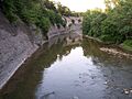
The Chagrin River as viewed from The South Chagrin Reservation
|
|
| Type | Public park district |
| Location | Greater Cleveland, Ohio, United States |
| Area | 25,000 acres (10,000 ha) |
| Created | 1917 |
| Operated by | Cleveland Metroparks Board of Park Commissioners |
| Visitors | 18.5 million |
| Open | All year |
The Cleveland Metroparks is a huge system of nature parks in the Cleveland area of Ohio. These parks, called 'reservations,' mostly surround the city of Cleveland. They stretch along the shore of Lake Erie and follow the rivers and creeks in the region.
People often call them the 'Emerald Necklace' because they form a green ring around the city. The parks cover more than 25,000 acres (about 10,000 hectares). You can find over 300 miles (480 km) of trails for walking, biking, and horseback riding. There are also many picnic spots, nature centers, golf courses, and places to fish. The famous Cleveland Metroparks Zoo is also part of this park system. Four of these park areas are right next to Cuyahoga Valley National Park.
Most of the parks are in the suburbs around Cleveland. But Brookside Reservation is actually inside the city. The Lakefront Reservation has several beach parks along Cleveland's waterfront. A few parks are even outside Cuyahoga County. Part of North Chagrin Reservation is in Lake County. A small part of Bradley Woods Reservation is in Lorain County. The Hinckley Reservation is in Medina County.
The North Chagrin Reservation is home to one of the only old-growth forests in Northeast Ohio. This special forest is called the A.B. Williams Memorial Woods.
Contents
How the Metroparks Started
The idea for the Cleveland Metroparks began with a man named William Albert Stinchcomb. In the early 1900s, he had a vision for a large park system. Stinchcomb was an engineer for the City of Cleveland. In 1902, he became the chief engineer of the City Parks Department. Soon after, he started thinking about an "Emerald Necklace" for the city.
Stinchcomb worked hard to change Ohio's laws. He wanted to allow counties to create park systems. In 1913, he helped pass a law for this, but the Ohio Supreme Court said it was against the state constitution. Stinchcomb didn't give up! He went back to the state government and pushed for new laws. These laws allowed for the creation of the Metropolitan Park District. Today, it is the oldest park district of its kind in Ohio.
In 1915, Stinchcomb got his big chance. He was asked to join the new Cleveland Metropolitan Park District board. This was the same board he had worked so hard to create! Stinchcomb accepted the job. He immediately hired a famous landscape design company, the Olmsted Brothers. They started making plans for connecting parks and buying land. Their plan, called the Cuyahoga County Park and Boulevard System, became the blueprint for today's Metroparks.
In 1917, Stinchcomb helped pass a bill to fund the parks. This bill allowed the park board to collect a small tax. A second tax was later approved to buy more land. By 1921, the park system had grown. It included the Rocky River and Big Creek Reservations. Much of this land was donated. Between 1920 and 1930, the park system grew even more. Land for Hinckley, Brecksville, Bedford, South Chagrin, North Chagrin, and Euclid Creek Reservations was bought. The park's size grew from just over 100 acres to more than 9,000 acres in ten years.
The Metroparks Today
The Metroparks offer free entry and are open almost all day. Their more than 25,000 acres are very popular. Many people come to run, hike, bike, boat, fish, and enjoy nature.
The parks are a major place for outdoor fun in the area. In 2018, over 18.5 million people visited the 18 park areas and the zoo. This makes the Metroparks one of the most visited attractions in Ohio. The Metroparks also have golf courses, which charge a fee. Over 400,000 golfers play there each year.
Each park is special, with different features and landscapes. Some parks have unique attractions. For example, the toboggan chutes at Mill Stream Run Reservation's Chalet are the only ones in Ohio.
Keeping Visitors Safe
The Cleveland Metroparks Police Department keeps the parks safe. It was started in 1917. Their main goal is to make sure millions of visitors have a safe time.
The department's officers were called "Rangers" from 1959 to 2019. In 2019, they went back to their original name, "Police." This helped people understand their role better. These officers have always been fully trained police officers. They patrol the parks 24 hours a day, 7 days a week. They enforce traffic, criminal, and wildlife laws. They use special units like the Motorcycle Unit, K-9 Unit, and Dive Team.
Park Reservations to Explore
| Reservation | Size (Acres) | Fun Facts | What You Can Do | Year Started |
|---|---|---|---|---|
| Acacia | 155 acres (63 ha) | This park is in Lyndhurst. A branch of Euclid Creek flows through it. | Trails, Event hosting. | 2012 |
| Bedford | 2,206 acres (893 ha) | Located in Bedford and Valley View, along Tinker's Creek. It has the Shawnee Hills Golf Course. Tinker's Gorge is a National Natural Landmark. | Trails, cross country skiing, mountain bike trails, bird watching. | 1922 |
| Big Creek | 781 acres (316 ha) | This park runs through five Cleveland suburbs. It features Lake Isaac, Beyer's Pond wildlife sanctuary, and the Lake to Lake Trail. | Trails, cross country skiing, sledding. | 1919 |
| Bradley Woods | 795 acres (322 ha) | In North Olmsted and Westlake. It used to be a quarry for Berea Sandstone. Now it's a forest with many kinds of trees. | Trails, cross country skiing, fishing. | 1962 |
| Brecksville | 3,494 acres (1,414 ha) | Located in Brecksville. It has the Sleepy Hollow Golf Course and seven gorges. The Chippewa Creek Gorge is very famous. The Squire Rich Historical Museum is also here. | Golf, hiking and cross country skiing trails, horse trails, nature center, sledding, stables, bird watching. | 1920 |
| Brookside | 145 acres (59 ha) | This park was originally in the City of Cleveland. It joined the Metroparks in 1993. It's right next to the Cleveland Metroparks Zoo. It has baseball and football fields and a wildlife area. | Trails, cross country skiing. | 1993 |
| Cleveland Metroparks Zoo | 165 acres (67 ha) | It's Ohio's largest zoo, with over a million visitors every year. | 1882 | |
| Euclid Creek | 345 acres (140 ha) | In Euclid, South Euclid and Richmond Heights. It was once a huge quarry. Now it's a wildlife sanctuary. It connects the Heights area to Euclid. It also includes Euclid Beach Park and other lakefront properties. | Trails for hiking, horseback riding, cross country skiing, sledding hills. | 1920 |
| Garfield Park | 213 acres (86 ha) | Located in Garfield Heights. It was called Newburg Park in 1895. It became part of the Metroparks in 1986. Its main feature is Mill Creek. | Trails for hiking and cross country skiing, nature education. | 1986 |
| Hinckley | 2,682 acres (1,085 ha) | In Hinckley Township in Medina County. It's famous for the 'Annual Return of the Buzzards'. It also has Hinckley Lake and amazing glacial rock formations. | Hiking and cross country skiing trails, horse trails, boating, swimming, fishing, sledding hills, bird watching. | 1920 |
| Huntington | 103 acres (42 ha) | Located in Bay Village on Lake Erie. It's home to the Lake Erie Nature & Science Center, Huntington Playhouse, and BAYarts. | Hiking and cross country skiing trails, fishing, nature education, sledding, swimming, bird watching. | 1925 |
| Lakefront | 419 acres (170 ha) | This park includes former state parks like Edgewater Park and Gordon Park. It also has Merwin's Wharf and Wendy Park at Whiskey Island. You'll find beaches, boat ramps, fitness trails, and fishing piers. | Boat ramps, trails, fishing. | 2013 |
| Mill Stream Run | 3,189 acres (1,291 ha) | Added in 1976, this is the biggest park in the Emerald Necklace. It's along the east branch of the Rocky River. It spans Berea, Middleburg Heights, North Royalton and Strongsville. | Hiking trails, cross country skiing, mountain bike trails, horse trails, fishing, nature education, sledding, toboggan chutes, bird watching. | 1976 |
| North Chagrin | 2,140 acres (870 ha) | In Mayfield Village, Gates Mills and Willoughby Hills. It follows part of the Chagrin River. It has the historic Manakiki Golf Course and Squire's Castle. It also has one of Northeast Ohio's only old-growth forests. | Old growth forest, golf, trails, cross country skiing, fishing, nature center, sledding, bird watching. | 1925 |
| Ohio & Erie Canal | 312 acres (126 ha) | Opened in 1999, this park goes through Cuyahoga Heights and Valley View. It follows part of the historic Ohio and Erie Canal and the Cuyahoga River. You can see lots of wildlife from observation decks. | Trails, boating, cross country skiing, mountain bike trails, nature education, bird watching. | 1999 |
| Rocky River | 2,572 acres (1,041 ha) | This park is in many towns, including Rocky River and Berea. It holds the first piece of land bought for the Metroparks. It has three golf courses. It's also famous for its ancient fossils, including the fish Dunkleosteus. | Golf, hiking and cross country skiing trails, boating, fishing, sledding hills, horse stables, horse trails, nature center, bird watching. | 1919 |
| South Chagrin | 1,521 acres (616 ha) | This park is in Bentleyville, Solon and Moreland Hills. It follows part of the beautiful Chagrin River. It has an Arboretum, a Polo Field, and many trails. Henry Church's 1885 sculpture, Squaw Rock, is carved into a large rock by the river. | Trails, cross country skiing, fishing, horse trails, nature education, sledding. | 1925 |
| Washington | 59 acres (24 ha) | Opened in 2003, this is the smallest Metropark. In Newburgh Heights, its main feature is the Washington Golf Learning Center. | Golf, Horticultural Center and School, athletic fields, hiking trails, fishing. | 2003 |
| West Creek | 278 acres (113 ha) | Opened in 2006, this is one of the newer parks. It's in Parma and follows West Creek. It recently had a big renovation and is now home to the Watershed Stewardship Center. It has lots of wildlife. | Trails, mountain bike trails, Watershed Stewardship Center, picnic areas. | 2006 |
Golf Courses for All Ages
The Cleveland Metroparks has several golf courses. They offer different challenges for golfers of all skill levels.
| Golf Course | Holes | Par | Length (Yards) | Quick Facts | What's There | Course Map |
|---|---|---|---|---|---|---|
| Big Met | 18 Holes | Par 72 | 6524 Yards | This course is thought to be Ohio's most played. It has hosted over 6 million rounds of golf since 1926. | Pro shop, snack bar, cart rental, club rental, practice putting greens, continuous cart paths. | map |
| Little Met | 9 Holes | Par 34 | 2527 Yards | This was the first Metroparks golf course. It was built as a temporary course in 1924. | Pro shop, snack bar, cart rental, practice putting greens. | map |
| Manakiki | 18 Holes | Par 72 | 6641 Yards | Located 17 miles east of downtown Cleveland, this is a public course. | Pro shop, golf lessons, snack bar, cart rental, club rental, practice putting green, party rooms, shower service, continuous cart paths. | map |
| Mastick Woods | 9 Holes | Par 31 | 1900 Yards | This course was designed by Harry Burkhardt, the first golf superintendent for the Metroparks. It was built in 1964. | Pro shop, snack bar, cart rental, club rental. | map |
| Seneca | 18 Holes | Par 72 | 6524 Yards | The city of Cleveland built this course using WPA funds. It opened on August 1, 1940. | Pro shop, snack bar, cart rental, club rental, practice putting greens. | map |
| Shawnee Hills | 18 Holes | Par 71 | 6366 Yards | This course has 27 holes, including an 18-hole course and a 9-hole Par 3 course. | Pro shop, snack bar, cart rental, club rental, practice putting greens, driving range, golf lessons, continuous golf cart paths. | map |
| Sleepy Hollow | 18 Holes | Par 71 | 6723 Yards | This course has 18 holes. | Pro shop, golf lessons, snack bar, cart rental, club rental, practice putting green, driving range, party rooms, shower service, continuous cart paths. | map |
| Washington | 9 Holes | Par 29 | 1248 Yards | This golf course makes up most of the Washington Reservation. It has a 9-hole course and a 30-station driving range. | Pro shop, driving range, snack bar, cart rental, club rental, practice putting greens, practice chipping area, continuous cart paths. | map |
Images for kids
-
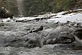
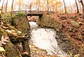
Chippewa Creek in the Brecksville Reservation
-
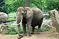
An African elephant at the Cleveland Metroparks Zoo
-
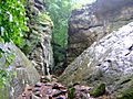
Whipps Ledges at Hinckley Reservation
-
Squire's Castle at the North Chagrin Reservation
-
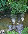
Buttermilk Falls in the North Chagrin Reservation
-
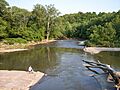
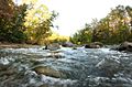
A bend in the Rocky River in the Rocky River Reservation
-
Shale cliffs along the Rocky River in the Rocky River Reservation
-
The Chagrin River as viewed from the South Chagrin Reservation
-
The Chagrin River as viewed from North Chagrin Reservation
-
Water falling over the shale creek bed in Euclid Creek Reservation
-
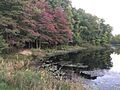
Beyer's Pond, in the Big Creek Reservation, Middleburg Heights
-
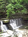
The Great Falls of Tinker's Creek in the Bedford Reservation


See also
- Squire's Castle (North Chagrin Reservation, Willoughby Hills)
