
Richmond Heights, Ohio facts for kids
Quick facts for kids
Richmond Heights, Ohio
|
||
|---|---|---|

|
||
|
||
| Motto(s):
The City with a Brighter Tomorrow
|
||

Location in Cuyahoga County and the state of Ohio.
|
||
| Country | United States | |
| State | Ohio | |
| County | Cuyahoga | |
| Founded | 1917 (as Village of Claribel) | |
| Incorporated | 1918 (renamed to Richmond Heights) |
|
| City Formed | 1960 | |
| Area | ||
| • Total | 4.44 sq mi (11.50 km2) | |
| • Land | 4.43 sq mi (11.48 km2) | |
| • Water | 0.01 sq mi (0.02 km2) | |
| Elevation | 869 ft (265 m) | |
| Population
(2020)
|
||
| • Total | 10,801 | |
| • Density | 2,436.50/sq mi (940.80/km2) | |
| Time zone | UTC-5 (EST) | |
| • Summer (DST) | UTC-4 (EDT) | |
| ZIP code |
44143
|
|
| Area code(s) | 216 | |
| FIPS code | 39-66894 | |
| GNIS feature ID | 1072241 | |
Richmond Heights is a city in Cuyahoga County, Ohio, United States. It is home to about 10,801 people, based on the 2020 census. This city is a suburb of Cleveland, meaning it's a smaller town located near the larger city. It is part of the bigger Cleveland metropolitan area.
Contents
History of Richmond Heights
The city of Richmond Heights has an interesting past. It was first started in 1917. Back then, it was called the Village of Claribel. Just one year later, in 1918, its name was changed to Richmond Heights. It used to be part of a bigger area called Euclid Township. In 1960, it officially became a city.
Exploring Richmond Heights' Geography
Richmond Heights is located at specific coordinates: 41.558183 degrees North and -81.503651 degrees West. It shares its borders with several other towns. To its west is Euclid. To the south are Lyndhurst and South Euclid. On the east side, you'll find Highland Heights. Finally, to the north, it borders Willoughby Hills.
Neighborhoods and Homes
Richmond Heights has different types of neighborhoods. Some well-known areas include the Richmond Bluffs, which are close to the Cuyahoga County Airport. The Rushmore Subdivision is another area, located off Highland Road. Richwood is found south of the Richmond-Highland Roads intersection.
The largest residential area in the city is called the Scottish Highlands. Many homes there are built in the ranch style. You can also find many apartment buildings in Richmond Heights. Some of the biggest apartment complexes are in the Loganberry section. This area is between Brush Road and Chestnut Lane on Chardon Road (Route 6).
Land and Water Area
According to the United States Census Bureau, Richmond Heights covers a total area of about 4.45 square miles (11.50 square kilometers). Most of this area is land, measuring about 4.44 square miles (11.48 square kilometers). Only a very small part, about 0.01 square miles (0.02 square kilometers), is water.
Population and People of Richmond Heights
The number of people living in Richmond Heights has changed over the years. Here's how the population has grown:
| Historical population | |||
|---|---|---|---|
| Census | Pop. | %± | |
| 1920 | 265 | — | |
| 1930 | 418 | 57.7% | |
| 1940 | 507 | 21.3% | |
| 1950 | 891 | 75.7% | |
| 1960 | 5,068 | 468.8% | |
| 1970 | 9,220 | 81.9% | |
| 1980 | 10,095 | 9.5% | |
| 1990 | 9,611 | −4.8% | |
| 2000 | 10,944 | 13.9% | |
| 2010 | 10,546 | −3.6% | |
| 2020 | 10,801 | 2.4% | |
| 2021 (est.) | 10,667 | 1.1% | |
| Sources: | |||
Languages Spoken
Most people in Richmond Heights speak English, about 82.7%. Other languages are also spoken by smaller groups. About 4.8% speak Russian, and 3.1% speak Spanish. You might also hear Slovene (1.9%), Italian (1.7%), Chinese (1.2%), and Croatian (1.1%).
Education Levels
Many adults in Richmond Heights have a good education. Of the people over 25 years old, about 38.5% have earned a bachelor's degree or a higher degree from a college or university.
Understanding the 2010 Census
In 2010, there were 10,546 people living in Richmond Heights. There were 4,766 households, which are groups of people living together. About 2,812 of these were families. The city had about 2,375 people per square mile.
The people living in Richmond Heights came from different backgrounds. About 48.5% were White, and 44.9% were African American. About 4.3% were Asian, and 0.1% were Native American. About 1.8% of the population identified as being of two or more races. People of Hispanic or Latino background made up 1.8% of the population.
In terms of households, 23.7% had children under 18 living with them. About 40.6% were married couples. Many households (41.0%) were not families, meaning individuals lived alone or with non-relatives. About 36.4% of all households were made up of just one person. Also, 13.8% of households had someone aged 65 or older living alone.
The average household had 2.17 people, and the average family had 2.84 people. The average age of people in the city was 46.1 years. About 18.4% of residents were under 18 years old. The city had more females (55.1%) than males (44.9%).
Education in Richmond Heights
Richmond Heights has its own local school district. The main high school is Richmond Heights High School. It has about 335 students. Most students are of African American descent (58%), while 36% are Caucasian. Smaller groups include Asian American (3%), multiracial (2%), and Hispanic (1%) students.
The school's mascot is the Spartans. Their official colors are royal blue and white. In the past, the Richmond Heights Schools faced challenges with passing special taxes called "levies." These levies help fund the schools. When they didn't pass, it led to teachers going on strike for better pay. It also caused the loss of school transportation and band programs. Students even had to "pay-to-play" for sports.
However, in 2009, a levy was passed. This meant the school would get more tax money from the city. This helped bring back things like transportation for students.
Images for kids
-
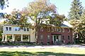
Greenwood Farm
See also
 In Spanish: Richmond Heights (Ohio) para niños
