
Sunset, Florida facts for kids
Quick facts for kids
Sunset, Florida
|
|
|---|---|
 |
|

Location in Miami-Dade County and the state of Florida
|
|

U.S. Census Bureau map showing CDP boundaries
|
|
| Country | |
| State | |
| County | |
| Area | |
| • Total | 3.56 sq mi (9.22 km2) |
| • Land | 3.51 sq mi (9.09 km2) |
| • Water | 0.05 sq mi (0.12 km2) |
| Elevation | 7 ft (2 m) |
| Population
(2020)
|
|
| • Total | 15,912 |
| • Density | 4,533.33/sq mi (1,750.25/km2) |
| Time zone | UTC-5 (Eastern (EST)) |
| • Summer (DST) | UTC-4 (EDT) |
| ZIP codes |
33173, 33183 (Miami)
|
| Area code(s) | 305, 786, 645 |
| FIPS code | 12-69812 |
| GNIS feature ID | 1867214 |
Sunset is a place in Miami-Dade County, Florida, United States. It is called a census-designated place (CDP). This means it's an area that looks like a town but isn't officially set up as a city.
Sunset is part of the larger Miami metropolitan area in South Florida. In 2020, about 15,912 people lived there. The U.S. Postal Service uses the ZIP Codes 33173 and 33183 for Sunset.
Contents
Where is Sunset Located?
Sunset is located about 11 miles (18 km) southwest of downtown Miami. You can find it at these coordinates: 25°42′21″N 80°21′23″W / 25.70583°N 80.35639°W.
It shares borders with several other communities. These include Kendale Lakes, Westwood Lakes, Olympia Heights, Glenvar Heights, and Kendall.
The total area of Sunset is about 3.6 square miles (9.3 square kilometers). A very small part of this area, about 0.05 square miles (0.13 square kilometers), is water.
How Many People Live in Sunset?
The number of people living in Sunset has changed over the years. Here's a quick look at the population counts from different years:
| Historical population | |||
|---|---|---|---|
| Census | Pop. | %± | |
| 1980 | 13,531 | — | |
| 1990 | 15,810 | 16.8% | |
| 2000 | 17,150 | 8.5% | |
| 2010 | 16,389 | −4.4% | |
| 2020 | 15,912 | −2.9% | |
| source: | |||
Population Details from 2020
In 2020, there were 15,912 people living in Sunset. There were 4,964 households, which are like homes where people live together. Out of these, 3,754 were families.
The table below shows the different groups of people living in Sunset based on the 2020 census. It separates people by race and ethnicity.
| Race / Ethnicity (NH = Non-Hispanic) | Pop 2010 | Pop 2020 | % 2010 | % 2020 |
|---|---|---|---|---|
| White (NH) | 2,666 | 2,115 | 16.27% | 13.29% |
| Black or African American (NH) | 109 | 103 | 0.67% | 0.65% |
| Native American or Alaska Native (NH) | 2 | 3 | 0.01% | 0.02% |
| Asian (NH) | 315 | 292 | 1.92% | 1.84% |
| Pacific Islander or Native Hawaiian (NH) | 0 | 5 | 0.00% | 0.03% |
| Some other race (NH) | 36 | 33 | 0.22% | 0.21% |
| Mixed race or Multiracial (NH) | 97 | 185 | 0.59% | 1.16% |
| Hispanic or Latino (any race) | 13,164 | 13,176 | 80.32% | 82.81% |
| Total | 16,389 | 15,912 | 100.00% | 100.00% |
Getting Around Sunset
Two important roads pass through the southeast part of Sunset. These are the Don Shula Expressway Toll Road and the Snapper Creek Expressway. These roads help people travel easily in and out of the area.
Schools in Sunset
Miami-Dade County Public Schools is in charge of the public schools in Sunset. Here are some of the schools located in or near the area:
Elementary Schools
- Snapper Creek Elementary School
- Blue Lakes Elementary School
Middle Schools
- Glades Middle School
High Schools
- Southwest Miami Senior High School
Charter Schools
- True North Classical Academy
Images for kids
-
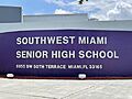
Southwest Miami Senior High School

See also
 In Spanish: Sunset (Florida) para niños
