Sunshine Coast Regional District facts for kids
Quick facts for kids
Sunshine Coast
|
|
|---|---|
|
Regional district
|
|
| Sunshine Coast Regional District | |

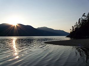
Sechelt Inlet
|
|

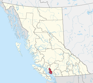
Location in British Columbia
|
|
| Country | Canada |
| Province | British Columbia |
| Administrative office location | Sechelt |
| Government | |
| • Type | Regional district |
| • Body | Board of Directors |
| Area | |
| • Land | 3,773.73 km2 (1,457.05 sq mi) |
| Population
(2016)
|
|
| • Total | 29,970 |
| • Density | 7.94/km2 (20.6/sq mi) |
| Website | scrd.ca |
The Sunshine Coast Regional District is a special area in British Columbia, Canada. It is located on the southern mainland coast. This area is across the Strait of Georgia (which is part of the Salish Sea) from Vancouver Island.
The Sunshine Coast shares borders with other regional districts. To the north, it borders the Qathet Regional District. To the east, it borders the Squamish-Lillooet Regional District. Across Howe Sound, to the south, it borders the Metro Vancouver District. The main offices for the regional district are in the town of Sechelt.
Contents
Exploring the Sunshine Coast
Most of the Sunshine Coast is not heavily populated. The Coast Mountains cover the inland parts of the region. Most people live along the beautiful coastline. In the middle of the coast, near the town of Sechelt, the coastal area forms a peninsula. This peninsula is separated from the inland mountains by Sechelt Inlet.
In 2016, a census showed that about 29,970 people lived here. The land area is about 3,778 square kilometers (1,458 square miles).
How to Get There
The Sunshine Coast is usually reached by boat or plane. There are no roads that connect it directly to the rest of the province.
- From Vancouver, you can take a ferry from Horseshoe Bay to Gibsons. This ferry crosses Howe Sound.
- At the northern end of the peninsula, other ferries run from Earl's Cove to Saltery Bay.
Communities and Areas
The Sunshine Coast is made up of different types of communities and areas.
Main Towns and Districts
Indian Reserves
These are areas set aside for First Nations communities:
- Chekwelp 26
- Chekwelp 26A
- Schaltuuch 27
Unincorporated Areas
These are areas that are not part of a city or town:
- Roberts Creek
- Halfmoon Bay
- Madeira Park
- Garden Bay
- Egmont
- Hopkins Landing
Electoral Areas
These areas are represented by elected officials on the regional district board. The population figures are from the 2011 Census.
- Pender Harbour/Egmont/Madeira Park (Electoral Area A) - Population: 2,678
- Halfmoon Bay (Electoral Area B) - Population: 2,675
- Roberts Creek (Electoral Area D) - Population: 3,244
- Elphinstone (Electoral Area E) - Population: 3,482
- West Howe Sound (Electoral Area F) - Population: 2,043
Population Facts
Here are some facts about the population of the Sunshine Coast, based on information from 2011:
- Total Population: 28,619 people
- Population Change (2006–2011): The population grew by 3.1%
- Number of Homes: 12,839 dwellings
- Land Area: 3,776.62 square kilometers
Provincial Parks
The Sunshine Coast is home to several beautiful provincial parks, which are protected natural areas:
- Mount Richardson Provincial Park
- Tetrahedron Provincial Park
- Spipiyus Provincial Park
 | Leon Lynch |
 | Milton P. Webster |
 | Ferdinand Smith |

