Surrey, North Dakota facts for kids
Quick facts for kids
Surrey, North Dakota
|
|
|---|---|

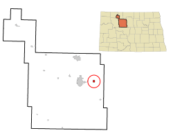
Location of Surrey, North Dakota
|
|
| Country | United States |
| State | North Dakota |
| County | Ward |
| Founded | June 18, 1900 |
| Incorporated | 1951 |
| Area | |
| • Total | 2.12 sq mi (5.49 km2) |
| • Land | 2.11 sq mi (5.47 km2) |
| • Water | 0.01 sq mi (0.02 km2) |
| Elevation | 1,614 ft (492 m) |
| Population
(2020)
|
|
| • Total | 1,357 |
| • Estimate
(2022)
|
1,393 |
| • Density | 642.52/sq mi (248.04/km2) |
| Time zone | UTC-6 (Central (CST)) |
| • Summer (DST) | UTC-5 (CDT) |
| ZIP code |
58785
|
| Area code(s) | 701 |
| FIPS code | 38-77180 |
| GNIS feature ID | 1036290 |
Surrey is a small city located in Ward County, North Dakota, in the United States. In 2020, about 1,357 people lived there. Surrey officially became a city in 1951. It is part of the larger Minot area.
Contents
History of Surrey
Surrey was founded a long time ago, on June 18, 1900. It got its name from a place in England called Surrey. Officials from the Great Northern Railway chose the name.
Surrey was one of several towns along the Great Northern's railroad route that were named after places in England. These towns were built between Devils Lake and Minot. Other towns with English names included Berwick, Leeds, Norwich, Penn, Rugby, Tunbridge, and York.
Geography and Land Area
Surrey is a small city in terms of its size. The United States Census Bureau says that the city covers about 0.99 square miles (2.56 square kilometers). Most of this area, about 0.98 square miles (2.54 square kilometers), is land. Only a tiny part, about 0.01 square miles (0.026 square kilometers), is water.
Population Changes in Surrey
The number of people living in Surrey has changed over the years. Here's a look at the population counts from different censuses:
| Historical population | |||
|---|---|---|---|
| Census | Pop. | %± | |
| 1960 | 309 | — | |
| 1970 | 361 | 16.8% | |
| 1980 | 999 | 176.7% | |
| 1990 | 856 | −14.3% | |
| 2000 | 917 | 7.1% | |
| 2010 | 934 | 1.9% | |
| 2020 | 1,357 | 45.3% | |
| 2022 (est.) | 1,393 | 49.1% | |
| U.S. Decennial Census 2020 Census |
|||
Surrey's Population in 2010
In 2010, there were 934 people living in Surrey. These people lived in 334 households, and 264 of these were families. The city had about 953 people per square mile (368 people per square kilometer).
Most of the people in Surrey were White (95.3%). There were also smaller numbers of African American, Native American, and Asian residents. About 1.4% of the population was Hispanic or Latino.
Many households (39.2%) had children under 18 living with them. Most households (65.6%) were married couples. The average household had 2.80 people, and the average family had 3.09 people.
The average age of people in Surrey was 32.5 years old. About 28.2% of residents were under 18. Also, 7.8% of the people were 65 years old or older. The population was almost evenly split between males (51.2%) and females (48.8%).
Travel and Transportation
The Amtrak train called the Empire Builder goes through Surrey. This train travels between Seattle/Portland and Chicago. It uses the BNSF tracks. However, the train does not stop in Surrey. The closest train station is in Minot, which is about 8 miles (13 kilometers) to the west.
Surrey's Climate
Surrey has a type of weather known as a humid continental climate. This means there are big differences in temperature throughout the year. Summers are usually warm to hot, and sometimes humid. Winters are cold, and can be very cold. On climate maps, this type of climate is shown as "Dfb" using the Köppen Climate Classification system.
See also
 In Spanish: Surrey (Dakota del Norte) para niños

