
Taylor County, Kentucky facts for kids
Quick facts for kids
Taylor County
|
|
|---|---|

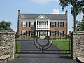
Entrance to Clay Hill, located along Kentucky Route 289.
|
|

Location within the U.S. state of Kentucky
|
|
 Kentucky's location within the U.S. |
|
| Country | |
| State | |
| Founded | 1848 |
| Named for | Zachary Taylor |
| Seat | Campbellsville |
| Largest city | Campbellsville |
| Area | |
| • Total | 277 sq mi (720 km2) |
| • Land | 266 sq mi (690 km2) |
| • Water | 10 sq mi (30 km2) 3.8% |
| Population
(2020)
|
|
| • Total | 26,023 |
| • Estimate
(2023)
|
26,443 |
| • Density | 93.95/sq mi (36.27/km2) |
| Time zone | UTC−5 (Eastern) |
| • Summer (DST) | UTC−4 (EDT) |
| Congressional district | 1st |
Taylor County is a special area, called a county, located in the state of Kentucky. In 2020, about 26,023 people lived there. The main town, or county seat, is Campbellsville.
People from states like Virginia and Pennsylvania first settled this area after the American Revolutionary War. Taylor County was officially created in 1848. It was named after Zachary Taylor, who was a famous army general and later became a U.S. President. Taylor County was the 100th county made in Kentucky.
Contents
Exploring Taylor County's Geography
Taylor County covers a total area of about 277 square miles. Most of this is land, about 266 square miles. The rest, about 10 square miles, is water.
The Heart of Kentucky: A Special Shape
Taylor County has a unique shape, like a heart. It also claims to be the exact center of Kentucky. There's even an old marker from 1916 that people thought was the state's center. This marker was placed by a group called the U.S. Coast and Geodetic Survey.
However, other counties nearby disagree about where the true center is. This is because of the old methods used to figure out the geographic centers of states.
Neighboring Counties Around Taylor County
Taylor County shares its borders with several other counties. These are its neighbors:
- Marion County (to the north)
- Casey County (to the east)
- Adair County (to the southeast)
- Green County (to the south and west)
- LaRue County (to the northwest)
Historical Events: The Battle of Tebbs Bend
An important event from the American Civil War happened in Taylor County. This was a small fight known as the Battle of Tebbs Bend.
People and Population in Taylor County
| Historical population | |||
|---|---|---|---|
| Census | Pop. | %± | |
| 1850 | 7,251 | — | |
| 1860 | 7,481 | 3.2% | |
| 1870 | 8,226 | 10.0% | |
| 1880 | 9,259 | 12.6% | |
| 1890 | 9,353 | 1.0% | |
| 1900 | 11,075 | 18.4% | |
| 1910 | 11,961 | 8.0% | |
| 1920 | 12,236 | 2.3% | |
| 1930 | 12,047 | −1.5% | |
| 1940 | 13,556 | 12.5% | |
| 1950 | 14,403 | 6.2% | |
| 1960 | 16,285 | 13.1% | |
| 1970 | 17,138 | 5.2% | |
| 1980 | 21,178 | 23.6% | |
| 1990 | 21,146 | −0.2% | |
| 2000 | 22,927 | 8.4% | |
| 2010 | 24,512 | 6.9% | |
| 2020 | 26,023 | 6.2% | |
| 2023 (est.) | 26,443 | 7.9% | |
| U.S. Decennial Census 1790-1960 1900-1990 1990-2000 2010-2020 |
|||
In 2000, there were 22,927 people living in Taylor County. These people lived in 9,233 homes, and 6,555 of these were families. On average, there were about 85 people per square mile.
Most people in the county, about 93.62%, were White. About 5.06% were Black or African American. Other groups made up smaller parts of the population. About 0.82% of the people were Hispanic or Latino.
Understanding the Age Groups in Taylor County
The people in Taylor County are of different ages.
- About 23.40% were under 18 years old.
- About 10.40% were between 18 and 24.
- About 26.90% were between 25 and 44.
- About 24.10% were between 45 and 64.
- About 15.20% were 65 years old or older.
The average age in the county was 38 years. For every 100 females, there were about 92.70 males.
Communities in Taylor County
Taylor County has one main city and many smaller communities.
City
- Campbellsville (This is the county seat, the main town)
Unincorporated Communities
These are smaller towns and areas that are not officially cities:
- Acton
- Bengal
- Black Gnat
- Elk Horn
- Finley
- Hatcher
- Hobson
- Mannsville
- Merrimac
- Saloma
- Spurlington
- Sweenyville
- Yuma
Education in Taylor County
Students in Taylor County attend schools in different districts:
- Campbellsville Independent School District
- Taylor County School District
Images for kids
-
Entrance to Clay Hill, located along Kentucky Route 289.
See also
 In Spanish: Condado de Taylor (Kentucky) para niños
