
Taylorsville, Georgia facts for kids
Quick facts for kids
Taylorsville, Georgia
|
|
|---|---|

Farmers Supply Company in Taylorsville
|
|

Location in Bartow County and the state of Georgia
|
|
| Country | United States |
| State | Georgia |
| Counties | Bartow, Polk |
| Area | |
| • Total | 1.49 sq mi (3.86 km2) |
| • Land | 1.49 sq mi (3.86 km2) |
| • Water | 0.00 sq mi (0.00 km2) |
| Elevation | 732 ft (223 m) |
| Population
(2020)
|
|
| • Total | 252 |
| • Density | 168.90/sq mi (65.22/km2) |
| Time zone | UTC-5 (Eastern (EST)) |
| • Summer (DST) | UTC-4 (EDT) |
| ZIP code |
30178
|
| Area code(s) | 770/678/470/943 |
| FIPS code | 13-75664 |
| GNIS feature ID | 0323966 |
Taylorsville is a small town located in the state of Georgia, USA. It's special because it's in two different counties: Bartow County and Polk County. In 2020, about 252 people lived here, which was a bit more than in 2010.
Contents
Discovering Taylorsville's Past
Taylorsville got its name from Edward G. Taylor. He surveyed the area around 1870. The state government of Georgia officially made Taylorsville a town in 1916.
Taylorsville's Location and Weather
Taylorsville covers an area of about 1.5 square miles (3.86 square kilometers). All of this area is land.
Understanding Taylorsville's Climate
Taylorsville has a humid subtropical climate. This means it has cool to mild winters. The summers are hot and humid.
| Climate data for Taylorsville, Georgia | |||||||||||||
|---|---|---|---|---|---|---|---|---|---|---|---|---|---|
| Month | Jan | Feb | Mar | Apr | May | Jun | Jul | Aug | Sep | Oct | Nov | Dec | Year |
| Mean daily maximum °F (°C) | 56 (13) |
62 (17) |
66 (19) |
77 (25) |
84 (29) |
90 (32) |
95 (35) |
94 (34) |
86 (30) |
77 (25) |
62 (17) |
51 (11) |
75 (24) |
| Mean daily minimum °F (°C) | 29 (−2) |
32 (0) |
46 (8) |
51 (11) |
65 (18) |
71 (22) |
78 (26) |
76 (24) |
61 (16) |
49 (9) |
40 (4) |
29 (−2) |
52 (11) |
| Source: Weatherbase | |||||||||||||
Taylorsville's Population Over Time
| Historical population | |||
|---|---|---|---|
| Census | Pop. | %± | |
| 1880 | 95 | — | |
| 1890 | 87 | −8.4% | |
| 1900 | 139 | 59.8% | |
| 1910 | 197 | 41.7% | |
| 1920 | 258 | 31.0% | |
| 1930 | 220 | −14.7% | |
| 1940 | 233 | 5.9% | |
| 1950 | 260 | 11.6% | |
| 1960 | 226 | −13.1% | |
| 1970 | 253 | 11.9% | |
| 1980 | 266 | 5.1% | |
| 1990 | 269 | 1.1% | |
| 2000 | 229 | −14.9% | |
| 2010 | 210 | −8.3% | |
| 2020 | 252 | 20.0% | |
| U.S. Decennial Census | |||
Who Lives in Taylorsville? (2020 Census)
In 2020, there were 252 people living in Taylorsville. These people lived in 100 households. About 70 of these households were families.
| Race | Num. | Perc. |
|---|---|---|
| White (non-Hispanic) | 235 | 93.25% |
| Mixed (two or more races) | 10 | 3.96% |
| Hispanic or Latino | 6 | 2.38% |
| Black or African American (non-Hispanic) | 2 | 0.79% |
| American Indian or Alaskan Native | 2 | 0.79% |
| Asian | 0 | 0% |
| Native Hawaiian and Pacific Islander | 0 | 0% |
| Other | 3 | 1.19% |
Taylorsville's Community in 2010
In 2010, the town had 210 people. Most of the people were White (93.45%). A smaller number were African American (4.37%). Some people were from other races or mixed races. About 1.75% of the population was Hispanic or Latino.
There were 93 households in Taylorsville. Many households (28%) had children under 18. Most households (64.5%) were married couples. The average household had 2.46 people. The average family had 2.84 people.
The population was spread out by age. About 21.4% were under 18. About 17% were 65 or older. The average age in Taylorsville was 38 years old.
Learning in Taylorsville: Schools
Students in Taylorsville go to schools managed by the Bartow County School District.
- Euharlee Elementary School
- Taylorsville Elementary School
- Woodland Middle School (located in Euharlee)
- Woodland High School (located in Cartersville)
Some students who live in the part of Taylorsville that is in Polk County attend schools in the Polk County School District.
Staying Healthy in Taylorsville: Healthcare
The Floyd Primary Care Center helps people in Taylorsville and nearby Rockmart. This center also has a special place for people with diabetes.
Several hospitals are close to Taylorsville for more serious medical needs:
- Wellstar Paulding Regional Hospital, in Hiram
- Cartersville Medical Center, in Cartersville
- Floyd Medical Center, in Rome
- Redmond Regional Medical Center, in Rome
- WellStar Kennestone Regional Medical Center, which is about 36 miles away in Marietta
For emergencies, the Bartow County Fire Department and EMS provide help to Taylorsville residents.
Georgia Power Plant Bowen: A Big Power Source
Plant Bowen is a large power station near Taylorsville. It uses coal to make electricity. It is about 14 kilometers (9 miles) west-south-west of Cartersville.
Plant Bowen is one of the biggest coal-fired power plants in North America. It has the largest power-making ability in the United States. It creates a lot of electricity, over 22,630,000 MWh in 2006. This power station is connected to the electricity grid of the southeastern U.S. It is owned and run by Georgia Power.
Famous People from Taylorsville
- Willard Nixon (1928–2000), a baseball player for the Boston Red Sox.
- Charlie Sproull (1919–1980), a baseball player for the Philadelphia Phillies.
Images for kids
-
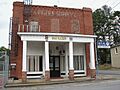
Farmers Supply Company in Taylorsville
-
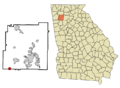
Location in Bartow County and the state of Georgia
See also
 In Spanish: Taylorsville (Georgia) para niños
