Cartersville, Georgia facts for kids
Quick facts for kids
Cartersville, Georgia
|
|||
|---|---|---|---|

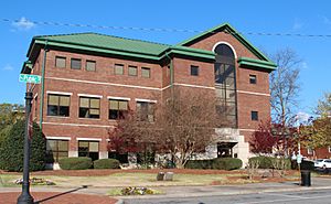
Cartersville City Hall
|
|||
|
|||

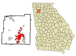
Location in Bartow County, Georgia
|
|||
| Country | United States | ||
| State | Georgia | ||
| County | Bartow | ||
| Incorporated | 1850 | ||
| Named for | Farish Carter | ||
| Area | |||
| • Total | 28.74 sq mi (74.44 km2) | ||
| • Land | 28.62 sq mi (74.12 km2) | ||
| • Water | 0.12 sq mi (0.32 km2) | ||
| Elevation | 787 ft (240 m) | ||
| Population
(2020)
|
|||
| • Total | 23,187 | ||
| • Density | 810.20/sq mi (312.82/km2) | ||
| Time zone | UTC−5 (Eastern Time) | ||
| • Summer (DST) | UTC−4 (Eastern Daylight Time) | ||
| ZIP Codes |
30120, 30121
|
||
| Area code(s) |
|
||
| FIPS code | 13-13688 | ||
| GNIS feature ID | 0355017 | ||
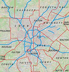
Cartersville is a city in Georgia, United States. It is the main city, or county seat, of Bartow County. Cartersville is found on the northwest side of the big Atlanta metropolitan area. In 2020, about 23,187 people lived here.
Contents
History of Cartersville
Long ago, English settlers first called this area Birmingham. The town officially became Cartersville in 1854. It was named after a person named Colonel F. Carter from Milledgeville.
After the American Civil War, a nearby town called Cassville was destroyed. So, in 1867, Cartersville became the main city for Bartow County. It officially became a city in 1872.
Geography and Location
Cartersville is located in the southern part of Bartow County. It is about 42 miles northwest of downtown Atlanta. It is also about 76 miles southeast of Chattanooga, Tennessee.
The Etowah River flows through a wide valley south of the city center. This river goes west to Rome, where it joins to form the Coosa River. The Coosa River is a branch of the Alabama River. The city's area reaches east to the Allatoona Dam. This dam creates Lake Allatoona, a large lake managed by the U.S. Army Corps of Engineers. Red Top Mountain State Park is on a piece of land in the lake, just outside the city. Nancy Creek also flows nearby.
The U.S. Census Bureau says Cartersville covers about 29.3 square miles. Most of this area, about 29.1 square miles, is land. Only a small part, about 0.2 square miles, is water.
Downtown Cartersville Fun
Downtown Cartersville has many cool places to visit. You can find shops, theaters, museums, churches, and restaurants. This downtown area is small and has a lot of history. This makes the town feel very welcoming.
The Grand Theatre hosts shows for many schools and dance groups. These include the Steps of Faith Dance Company and Cartersville City Ballet. They also hold pageants and scholarship events here. Downtown Cartersville also has yearly Christmas parades. Plus, they have monthly car shows that are fun to see.
Getting Around Cartersville
Interstate 75 is a major highway that runs north and south through the area. It passes along the eastern side of Cartersville. You can get on or off I-75 at five different exits near the city.
U.S. Highway 41 runs parallel to I-75. It goes through the eastern part of downtown. This highway leads north to Calhoun and Dalton. It also goes south to Marietta.
Other important roads include U.S. Highway 411, State Route 20, State Route 61, State Route 113, and State Route 293. These roads connect Cartersville to many other towns and cities.
Nearby Communities
Several communities are located right next to Cartersville. These include:
- Adairsville (to the north-northwest)
- Cassville (to the north)
- Emerson (to the south)
- Euharlee (to the west)
- Kingston (to the northwest)
- Stilesboro (to the southwest)
- White (to the north)
- Grassdale Road (to the west)
Population of Cartersville
| Historical population | |||
|---|---|---|---|
| Census | Pop. | %± | |
| 1870 | 2,232 | — | |
| 1880 | 2,037 | −8.7% | |
| 1890 | 3,171 | 55.7% | |
| 1900 | 3,135 | −1.1% | |
| 1910 | 4,067 | 29.7% | |
| 1920 | 4,350 | 7.0% | |
| 1930 | 5,250 | 20.7% | |
| 1940 | 6,141 | 17.0% | |
| 1950 | 7,270 | 18.4% | |
| 1960 | 8,668 | 19.2% | |
| 1970 | 10,138 | 17.0% | |
| 1980 | 9,247 | −8.8% | |
| 1990 | 12,035 | 30.2% | |
| 2000 | 15,925 | 32.3% | |
| 2010 | 19,731 | 23.9% | |
| 2020 | 23,187 | 17.5% | |
| U.S. Decennial Census 1850-1870 1870-1880 1890-1910 1920-1930 1940 1950 1960 1970 1980 1990 2000 2010 2020 |
|||
Cartersville first appeared as a town in the 1870 U.S. Census. Before the 1960 U.S. Census, the city grew to include the nearby community of Atco.
Cartersville in 2020
| Group | Number | Percent |
|---|---|---|
| White (not Hispanic) | 14,608 | 63.0% |
| Black or African American (not Hispanic) | 4,144 | 17.87% |
| Native American | 50 | 0.22% |
| Asian | 346 | 1.49% |
| Pacific Islander | 11 | 0.05% |
| Other/Mixed | 977 | 4.21% |
| Hispanic or Latino | 3,051 | 13.16% |
In 2020, there were 23,187 people living in Cartersville. There were 7,835 households and 5,285 families.
Cartersville in 2010
In 2010, about 19,010 people lived in Cartersville. The population of Cartersville is growing quite a lot. There were 5,870 households and 4,132 families.
About 63.93% of the people were White. About 29.64% were African American. Other groups included Asian, Native American, and Pacific Islander people. About 7.28% of the population was Hispanic or Latino.
In the city, about 25.9% of people were under 18 years old. About 14.4% were 65 years or older. The average age was 36 years.
Fun Places to Visit
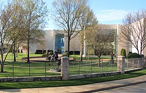
- The Booth Western Art Museum is a big art museum in Cartersville. It is the second-largest art museum in Georgia. It has the biggest space in the country for Western art. It is connected with the Smithsonian Institution.
- The Etowah Indian Mounds is an old Native American site. It is located in Bartow County, south of Cartersville.
- Tellus Science Museum used to be called the Weinman Mineral Museum. It is also connected with the Smithsonian Institution. It has the first digital planetarium in North Georgia. NASA has even put a camera there to watch for meteors.
- The world's first outdoor Coca-Cola sign was painted in 1894. You can still see it in downtown Cartersville on the wall of Young Brothers Pharmacy.
- Rose Lawn is a house museum. It was once the home of a famous speaker named Samuel Porter Jones. A building in Nashville was built for him. It later became the Grand Ole Opry.
- The Bartow History Museum is in the Old Cartersville Courthouse. This building was built around 1870. It is in downtown Cartersville on East Church Street.
- Savoy Automobile Museum shows off many different cars. It also has original artworks.
- The Pine Mountain Recreation Area has trails that go up a mountain. From the top, which is 1562 feet high, you can see Cartersville. You can also see Atlanta and Allatoona Lake. The city's Parks & Recreation department takes care of these trails.
Schools in Cartersville
The schools in the Cartersville City School District are:
- Cartersville Primary School
- Cartersville Elementary School
- Cartersville Middle School
- Cartersville High School
There is also a private Montessori school:
- Lifesong Montessori School
Cartersville also has a college campus:
- Georgia Highlands College
Cartersville Economy
Making things, tourism, and services are important for the city's economy. Some of the big employers in Cartersville include:
- Anheuser-Busch
- Georgia Power
- Komatsu
- Shaw Industries, a big company that makes flooring
- Phoenix Air is based at the Cartersville Airport.
The city also has Piedmont Cartersville Medical Center and the Hope Center. This makes Cartersville a place where people from nearby areas can get healthcare.
Notable People from Cartersville
- Amos Akerman (1821–1880), a politician who worked for President Ulysses S. Grant.
- Bill Arp (Charles Henry Smith; 1826–1903), a writer for newspapers.
- Robert Benham, the first African-American judge on the Georgia Supreme Court.
- Ronnie Brown, an NFL running back.
- Bob Burns (1950–2015), a founding member and drummer for the band Lynyrd Skynyrd.
- Rebecca Latimer Felton (1835–1930), the first female United States Senator.
- Andre Fluellen, an NFL defensive tackle.
- W. J. Gordy, a potter.
- A. O. Granger (1846–1914), a business leader who started the Etowah Iron Company.
- Ashton Hagans, an NBA point guard.
- Corra Harris, an author.
- Joe Frank Harris (1936–), a former governor of Georgia.
- Keith Henderson, a former NFL running back.
- Sam Howard, a professional baseball player for the Pittsburgh Pirates.
- Samuel Porter Jones (1847–1906), a famous speaker.
- Cledus T. Judd, a country music singer.
- Wayne Knight (1955–), an actor.
- Robert Lavette, a professional football player.
- Trevor Lawrence, a quarterback for the Jacksonville Jaguars.
- Lottie Moon, a Baptist missionary to China.
- Chloë Grace Moretz, an actress and model.
- Donavan Tate, a top pick in the 2009 baseball draft.
- Mark Thompson, a NASCAR driver.
- Benjamin Walker, an actor.
- Butch Walker (1969–), a singer-songwriter and producer.
- Hedy West (1938–2005), a folk singer and songwriter.
- Rudy York (1913–1970), a professional baseball player.
See also
In Spanish: Cartersville (Georgia) para niños
 | Precious Adams |
 | Lauren Anderson |
 | Janet Collins |


