
Teesdale Way facts for kids
Quick facts for kids Teesdale Way |
|
|---|---|

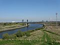
The Teesdale way in the Tees Corridor
|
|
| Length | 100 miles (160 km) from Dufton 90 miles (140 km) from county boundaries |
| Trailheads | Dufton, Cumbria/Middleton-in-Teesdale, County Durham South Gare, Redcar |
| Use | Hiking |
| Waymark | 'Dipper Badge' |
The Teesdale Way is a super long walking path in England. It stretches for about 100 miles (160 km) (that's 160 kilometers!) from the mountains of Cumbria all the way to the North Sea coast in North Yorkshire. Imagine walking across a whole part of England! This path also connects to other famous walks like the Pennine Way and the E2 European Walk.
Contents
What is the Teesdale Way?
The Teesdale Way is a special route designed for hikers and walkers. It lets you explore different parts of England, from quiet countryside to busy towns. The path is marked with a special 'Dipper Badge' symbol, so you know you're on the right track.
Where does the Teesdale Way start and end?
The Teesdale Way officially begins in a place called Dufton in Cumbria. At first, it shares its path with another famous walk, the Pennine Way. But when it reaches Middleton-in-Teesdale, it becomes its own unique trail with its own special markers.
The journey ends at a spot called South Gare, which is near Redcar. Along the way, you'll pass through areas that were once very important for making ships and other industrial things. This gives you a peek into the history of the North East of England.
How long is the walk?
The full Teesdale Way is about 100 miles (160 km) long. If you start from the county border near Cow Green Reservoir, it's about 90 miles (140 km). A big part of the path, about 67 miles (108 km), is also part of the European E2 path.
What kind of places does the path go through?
The path takes you through many different types of landscapes:
- Upper Teesdale: This is the higher, more rural part of the path. You'll see historic towns like Piercebridge and Barnard Castle.
- Lowland Tees Valley: Between Yarm and Croft-on-Tees, the river winds slowly through flatter land.
- Industrial Teesside: As you get closer to the coast, you'll walk through busy areas like Middlesbrough, Stockton-on-Tees, and Thornaby-on-Tees. These places show off the region's industrial past.
The Black Path
A section of the Teesdale Way, about 4 miles (6.4 km) long, between Middlesbrough and Redcar, was once known as 'The Black Path'. Steelworkers used to walk this path to get to their jobs.
Thornaby and Bassleton Woods
Near Thornaby, the path goes through beautiful ancient woodlands called Thornaby Woods and Bassleton Wood. Thornaby Woods is quite large, about 17 acres (6.9 ha) (7 hectares). You can see old trees like oak and elm there. Sometimes, you might even spot roe deer!
What can you see along the Teesdale Way?
The Teesdale Way is packed with interesting sights, from natural wonders to impressive bridges and historical ruins.
Amazing Waterfalls
- High Cup Nick: A dramatic U-shaped valley.
- Cauldron Snout: A long, rocky waterfall.
- High Force: One of England's most powerful waterfalls.
- Low Force: A beautiful series of smaller waterfalls.
Cool Bridges and Structures
- Middlesbrough Transporter Bridge: A unique bridge that carries cars across the river in a moving platform.
- Tees Newport Bridge: Another impressive bridge over the River Tees.
- A19 Tees Viaduct: A very tall bridge carrying a major road.
- Tees Barrage: A barrier that controls the river's flow, with a white water course for watersports.
- Infinity Bridge: A modern, curvy bridge that looks like an infinity symbol.
- Princess of Wales Bridge and Teesquay Millennium Bridge: More modern bridges for walkers.
- Victoria Bridge: An older, historic bridge.
Nature Spots
- Teessaurus Park: A fun park with large metal dinosaur sculptures!
- Maze Park Nature Reserve: A place to see wildlife near Middlesbrough.
- Black Bobbies Field Nature Reserve, Bowesfield Nature Reserve, Bassleton Wood: More places to enjoy nature and spot animals.
- Gainford Spa Nature Reserve: A peaceful spot with natural springs.
Historic Places and Ruins
- Piercebridge Roman Fort and Piercebridge Roman Bridge: Remains of an ancient Roman fort and bridge.
- Egglestone Abbey: The ruins of an old monastery.
- Cotherstone Castle: What's left of an old castle.
- Mortham Tower: An old tower near Greta Bridge.
- Medieval village of Newsham: The remains of a village from long ago.
Museums and Stately Homes
- Great Holme Museum: A museum in Eaglescliffe.
- Bowes Museum: A grand museum in Barnard Castle with amazing collections.
- Rokeby Park: A beautiful historic house.
- Eggleston Hall: Another lovely stately home.
Charming Village Churches
The path passes many old and beautiful churches in small villages, like St John's Church in Low Dinsdale, All Saints Church in Girsby, and St Mary's Church in Piercebridge. Each has its own history and charm.
Other Interesting Sights
- South Gare: The very end of the path, a pier stretching into the sea.
- Butterfly World: A place to see many different kinds of butterflies in Eaglescliffe.
- Octagonal Market Cross: A unique old structure in Barnard Castle.
Towns and Villages along the Way
The Teesdale Way connects many towns and villages. Here are some of the main ones you'll pass through:
- Dufton
- Middleton-in-Teesdale
- Barnard Castle
- Piercebridge
- Yarm
- Eaglescliffe
- Thornaby-on-Tees
- Stockton-on-Tees
- Middlesbrough
- Redcar (near the end at Warrenby)
Images for kids
-
The Teesdale way in the Tees Corridor
