
Tesnatee Creek facts for kids
Tesnatee Creek is a cool stream in Georgia. It flows into a bigger river called the Chestatee River. Tesnatee Creek is about 12 miles (19 kilometers) long. Its name, Tesnatee, comes from the Cherokee language. It means "wild turkey"!
The Journey of Tesnatee Creek
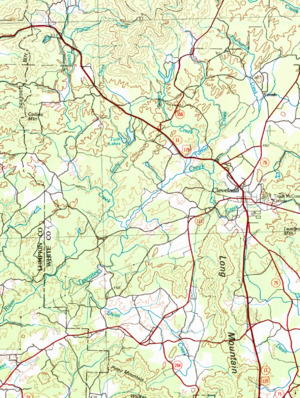
Tesnatee Creek starts where two smaller streams meet. These streams are Thurmond Creek and Freeman Creek. This meeting point is in a place called Yonah, in White County. It's west of Yonah Mountain and north of Cleveland.
The creek flows southwest for about 2.6 miles. It crosses U.S. Route 129 near Cleveland. Then, it briefly turns west. Here, it picks up water from Cox Creek.
After that, Tesnatee Creek turns southwest again. It flows for another 2.6 miles. Along the way, it gets water from two small, unnamed branches. Finally, it meets Town Creek.
When Tesnatee Creek joins Town Creek, it gets much wider. It starts to look more like a small river. It winds southwest, then west, for about 2.9 miles. Here, it picks up Shoal Creek. Shoal Creek drains water from southern White County.
Just before Tesnatee Creek flows into the Chestatee River, it is joined by Chateen Creek. The creek then crosses into Lumpkin County. Soon after, it flows into the Chestatee River.
Tesnatee Creek's Watery Neighborhoods
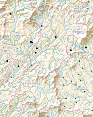
A watershed is an area of land. All the rain and snow that falls in a watershed drains into a specific river or stream. Tesnatee Creek's watershed is divided into two main parts. The United States Geological Survey calls these "sub-watersheds."
- Upper Tesnatee Sub-watershed: This area is about 28 square miles. It's located north and west of Cleveland.
- Lower Tesnatee Sub-watershed: This area is about 18 square miles. It's southwest of Cleveland. It's also north of the Wahoo Creek-Little River watershed.
