The Calf facts for kids
Quick facts for kids The Calf |
|
|---|---|

|
|
| Highest point | |
| Elevation | 676 m (2,218 ft) |
| Prominence | 383 m (1,257 ft) |
| Parent peak | Cross Fell |
| Listing | Marilyn, Hewitt, Nuttall |
| Geography | |
| OS grid | SD667970 |
| Topo map | OS Landranger 98 |
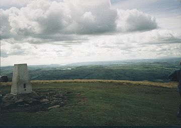
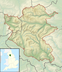
The Calf is a tall mountain in England. It stands 676 meters (about 2,218 feet) high. It is the highest point in an area called the Howgill Fells. These fells are part of the beautiful Yorkshire Dales National Park. The Calf is located in Cumbria, a county in northwest England.
Climbing The Calf
You can climb The Calf from different directions. One popular way is from the town of Sedbergh to the south. This path is known for being easy to follow. Another route starts from the east, going past a waterfall called Cautley Spout. You can also walk up the long valley of Langdale from the north.
Views from the Top
When you reach the top of The Calf, you get amazing views! Even though the summit is quite flat, you can see far into the distance. On a clear day, you might spot the peaks of the Lake District, which are about 20 miles away. You can also see the famous Yorkshire Three Peaks and many other hills in the Howgill Fells.
Calders Hill
Close to The Calf is another hill called Calders. It is about 1 kilometer (0.6 miles) south-southeast of The Calf's summit. Calders is 674 meters (about 2,211 feet) high. It is classified as a Hewitt, which is a type of hill in England, Wales, and Ireland that is at least 2,000 feet (610 meters) high.
 | James B. Knighten |
 | Azellia White |
 | Willa Brown |


