Howgill Fells facts for kids
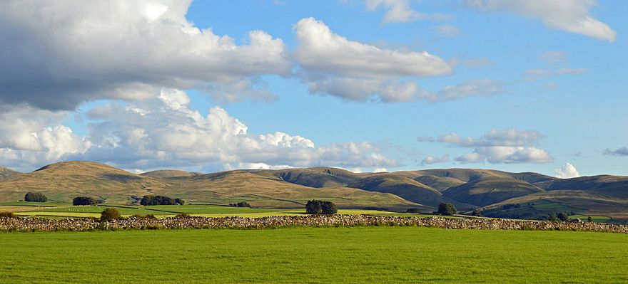
The Howgill Fells are a group of hills in Northern England. They are located between two famous national parks: the Lake District and the Yorkshire Dales. You can find them roughly in a triangle formed by the towns of Sedbergh, Kirkby Stephen, and Tebay.
The name "Howgill" comes from an old language called Old Norse. The word haugr means a hill or a burial mound, and gil means a narrow valley. So, Howgill basically means "hill valley."
Where are the Howgill Fells?
The Howgill Fells have natural borders. To the west, they are next to the River Lune and the M6 motorway. The northern part is also bordered by the upper parts of the River Lune. To the east, you'll find the River Rawthey.
These hills are home to some notable peaks. Two of them are called Marilyns. A Marilyn is a hill in the British Isles that is at least 150 meters (about 492 feet) higher than the land around it. The two Marilyns here are:
- The Calf, which is about 2,218 feet (676 meters) high.
- Yarlside, which is about 2,096 feet (639 meters) high.
There are also five smaller peaks known as Hewitts. A Hewitt is a hill in England, Wales, or Ireland that is at least 2,000 feet (610 meters) high.
Since 2017, all of the Howgill Fells have been part of the Yorkshire Dales National Park. This means they are protected for their natural beauty. They are located in the modern county of Cumbria. Before 1974, they were split between the old counties of West Riding of Yorkshire and Westmorland.
How the Howgill Fells were Formed (Geology)
The Howgill Fells are different from many other places in the Yorkshire Dales. Most of the Dales are made of Carboniferous Limestone, which creates unique cave systems and rocky landscapes. However, the Howgills are made from older rocks. These rocks are mostly slates and gritstones from the early Palaeozoic Era.
The oldest rocks in the Howgills are from the Ordovician period. These can be found near Backside Beck in the east. Above these are even more rocks from the Silurian period, including dark grey mudstones and siltstones. Most of the Howgill Fells are made of sandstone.
The rocks in the Howgills have been folded over millions of years. Imagine pushing a rug from both ends – it forms wrinkles. The Earth's forces did something similar to these rocks, creating large folds. There are also many smaller folds within these larger ones.
The area also has many faults. A fault is a crack in the Earth's crust where rocks have moved past each other. These faults help shape the edges of the Howgill Fells.
Impact of Glaciers
During the Quaternary period, huge sheets of ice called glaciers covered the Howgill Fells. When these glaciers melted, they left behind a lot of material called till in the valleys and lower areas.
One special feature created by glaciers is Cautley Crag. This is a well-formed glacial cirque, which is a bowl-shaped hollow carved out by a glacier.
After the glaciers melted, rivers formed. These rivers left behind sands and gravels in the valley floors. You can also find peat on some hills, which is partly decayed plant matter. In some places, like around Cautley Spout, there is also scree, which are piles of broken rocks at the base of a cliff.
The Lune Gorge, which forms the western edge of the Howgills, is a major meltwater channel. This means it was carved out by huge amounts of water flowing from melting glaciers.
 | James Van Der Zee |
 | Alma Thomas |
 | Ellis Wilson |
 | Margaret Taylor-Burroughs |


