Thompson, New York facts for kids
Quick facts for kids
Thompson, New York
|
|
|---|---|

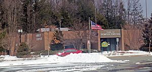
Town hall on Route 42, 2013
|
|

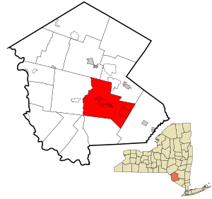
Location of Thompson in Sullivan County, New York
|
|
| Country | United States |
| State | New York |
| County | Sullivan |
| Area | |
| • Total | 87.50 sq mi (226.62 km2) |
| • Land | 84.09 sq mi (217.79 km2) |
| • Water | 3.41 sq mi (8.83 km2) |
| Elevation | 1,476 ft (450 m) |
| Population
(2020)
|
|
| • Total | 16,550 |
| • Density | 189.14/sq mi (73.030/km2) |
| Time zone | UTC-5 (Eastern (EST)) |
| • Summer (DST) | UTC-4 (EDT) |
| FIPS code | 36-73627 |
| GNIS feature ID | 0979543 |
Thompson is a town in the southern part of Sullivan County, New York, United States. In 2020, the population was 16,550 people. The town is named after William A. Thompson. He was an early settler and the first judge of Sullivan County.
Contents
Discovering Thompson's Past
The land that is now Thompson was first home to the Munsee Lenape Native Americans. The first European settlers arrived in 1749. They were two farmers who started a small community near Dutch Pond.
Thompson officially became a town in 1803. It was created from a larger area called Mamakating. Later, in 1826, a part of Thompson was taken from the town of Fallsburg.
Thompson's Geography
Thompson covers a total area of about 87.4 square miles (226.6 square kilometers). Most of this area, about 84.1 square miles (217.8 square kilometers), is land. The rest, about 3.3 square miles (8.8 square kilometers), is water.
People of Thompson
Thompson has grown quite a bit over the years. In 1820, there were fewer than 2,000 people living here. By 2020, the population had grown to 16,550.
| Historical population | |||
|---|---|---|---|
| Census | Pop. | %± | |
| 1820 | 1,897 | — | |
| 1830 | 2,459 | 29.6% | |
| 1840 | 2,610 | 6.1% | |
| 1850 | 3,198 | 22.5% | |
| 1860 | 3,834 | 19.9% | |
| 1870 | 3,514 | −8.3% | |
| 1880 | 3,763 | 7.1% | |
| 1890 | 3,462 | −8.0% | |
| 1900 | 3,739 | 8.0% | |
| 1910 | 4,196 | 12.2% | |
| 1920 | 4,597 | 9.6% | |
| 1930 | 5,950 | 29.4% | |
| 1940 | 6,054 | 1.7% | |
| 1950 | 6,912 | 14.2% | |
| 1960 | 8,792 | 27.2% | |
| 1970 | 11,418 | 29.9% | |
| 1980 | 13,550 | 18.7% | |
| 1990 | 13,711 | 1.2% | |
| 2000 | 14,189 | 3.5% | |
| 2010 | 15,308 | 7.9% | |
| 2020 | 16,550 | 8.1% | |
| U.S. Decennial Census 2020 | |||
In 2000, there were 14,189 people living in Thompson. They lived in 5,543 households. About 30% of these households had children under 18 living with them. The average household had about 2.44 people.
The people in Thompson come from many different backgrounds. In 2000, most residents were white, but there were also many African American, Asian, and Native American residents. A significant portion of the population was also of Hispanic or Latino heritage.
The average age of people in Thompson in 2000 was 38 years old. About 26% of the population was under 18 years old.
Places in Thompson
The town of Thompson includes several smaller communities and locations:
- Ateres – a village near Kiamesha Lake.
- Bridgeville – a small community southeast of Monticello.
- Coopers Corners – a small community west of Monticello.
- East Monticello – a location east of Monticello.
- Emerald Green – a small community near the eastern town line.
- Glen Wild – a small community east of Monticello. You can find historic buildings here like the Anshei Glen Wild Synagogue and the Glen Wild Methodist Church.
- Harris – a small community north and west of Monticello.
- Kiamesha Lake – a small community north of Monticello.
- Maplewood – a small community west of Monticello.
- Melody Lake – a location near the southern town line.
- Monticello – This is a village and the main center of Sullivan County.
- Rock Hill – a small community southeast of Monticello.
- Sackett Lake – a location in the southwestern part of the town.
- Thompsonville – a small community in the eastern part of the town.
See also
 In Spanish: Thompson (Nueva York) para niños
 | Selma Burke |
 | Pauline Powell Burns |
 | Frederick J. Brown |
 | Robert Blackburn |

