
Three Forks, Montana facts for kids
Quick facts for kids
Three Forks
|
|
|---|---|

Three Forks and the Tobacco Root Mountains
|
|

Location of Three Forks, Montana
|
|
| Country | United States |
| State | Montana |
| County | Gallatin |
| Government | |
| • Type | Montana Incorporated City, Elected Mayor and City Council |
| Area | |
| • Total | 1.50 sq mi (3.88 km2) |
| • Land | 1.44 sq mi (3.73 km2) |
| • Water | 0.06 sq mi (0.15 km2) |
| Elevation | 4,075 ft (1,242 m) |
| Population
(2020)
|
|
| • Total | 1,989 |
| • Density | 1,382.21/sq mi (533.74/km2) |
| Time zone | UTC-7 (Mountain (MST)) |
| • Summer (DST) | UTC-6 (MDT) |
| ZIP code |
59752
|
| Area code | 406 |
| FIPS code | 30-73975 |
| GNIS feature ID | 0777603 |
| Website | http://www.threeforksmontana.us |
Three Forks is a small city in Gallatin County, Montana, United States. It's a special place because it's near where three big rivers meet to form the Missouri River. This river is the longest single river in North America!
The city gets its name from these three rivers: the Jefferson, Madison, and Gallatin. They all come together in a nearby area called Missouri Headwaters State Park. In 2020, about 1,989 people lived in Three Forks. It's also part of a larger area near Bozeman, Montana.
Contents
Exploring Three Forks' Past

The three rivers that meet here were named in 1805 by Meriwether Lewis. He was part of the famous Lewis and Clark Expedition. He named them after important leaders of the United States at the time:
- Thomas Jefferson, who was the President.
- James Madison, who was the Secretary of State.
- Albert Gallatin, who was the Secretary of the Treasury.
This area is now part of Missouri Headwaters State Park. It's also a U.S. National Historic Landmark, which means it's a very important historical site.
Lewis and Clark's Visit
The Lewis and Clark expedition arrived at this spot on July 28, 1805. Meriwether Lewis wrote in his journal about their decision to name the rivers. They thought it was important to give these new rivers names that honored the country's leaders.
The Jefferson River was the largest of the three. Because they named it a separate river, some people today argue about which river is longer: the Missouri or the Mississippi. This is because rivers can change over time due to things like dams.
Honoring Sacagawea
A very important person in the history of this area is Sacagawea. She was a Native American woman who helped the Lewis and Clark Expedition as a guide and interpreter. In 1800, she was captured by a tribe near where Three Forks is now. Later, she returned to this same area with Lewis and Clark.
Today, there's a statue of Sacagawea in a park off Main Street in Three Forks. It reminds everyone of her bravery and help.
How Three Forks Began
The city of Three Forks was officially started on September 17, 1908. A man named John Q. Adams helped plan the town. He worked for a company connected to the Chicago, Milwaukee and St. Paul Railway, a big railroad company.
Some buildings were even moved from an "Old Town Three Forks" to the new city. Three Forks became a key spot for the Milwaukee Road railroad in Montana. It was an important hub from 1908 until the railroad stopped operating in the area in 1980.
The town faced some tough times early on. There were economic problems and crop failures. A big earthquake hit the town on June 27, 1925, damaging many buildings. Because of these challenges, the town's population didn't grow as much as some had hoped. However, things got better after World War II, and the population has slowly grown since then.
Three Forks' Location and Weather
Three Forks is located at 45°53′29″N 111°33′6″W / 45.89139°N 111.55167°W.
The city covers about 1.50 square miles (3.88 square kilometers). Most of this area is land, with a small part being water.
Climate in Three Forks
 Three Forks experiences a climate with warm summers and cold winters. The image above shows the typical temperatures throughout the year.
People of Three Forks
| Historical population | |||
|---|---|---|---|
| Census | Pop. | %± | |
| 1910 | 674 | — | |
| 1920 | 1,071 | 58.9% | |
| 1930 | 884 | −17.5% | |
| 1940 | 876 | −0.9% | |
| 1950 | 1,114 | 27.2% | |
| 1960 | 1,161 | 4.2% | |
| 1970 | 1,188 | 2.3% | |
| 1980 | 1,247 | 5.0% | |
| 1990 | 1,203 | −3.5% | |
| 2000 | 1,728 | 43.6% | |
| 2010 | 1,869 | 8.2% | |
| 2020 | 1,989 | 6.4% | |
| U.S. Decennial Census | |||
The population of Three Forks has changed over the years. The table above shows how many people lived in the city during different census years.
Population in 2010
In 2010, there were 1,869 people living in Three Forks. These people lived in 785 households, and 524 of those were families. Most of the people living in Three Forks were White (98.1%). About 2.1% of the population was Hispanic or Latino.
The average age of people in Three Forks was about 40.8 years old. About 24.8% of the residents were under 18 years old.
Getting Around and Local Features
Three Forks Airport is a small airport located just a mile southeast of the town. It's used for public flights.
There's also a very large beaver dam in the Three Forks area. It's huge, measuring about 2,139 feet (650 meters) long!
Learning in Three Forks
Three Forks has its own public school system, called Three Forks Public Schools. It includes both elementary and high schools. Students from kindergarten all the way through 12th grade attend these schools. The sports teams at Three Forks High School are called the Wolves.
The Three Forks Community Library is the public library where everyone can go to read books and learn.
Local News
The local newspaper for the area is called the Three Forks Voice. It's published every week and shares news about the community.
Fun Things to Do
Three Forks is a great place for tourists! It's located where Interstate 90 and U.S. Route 287 meet, making it easy to get to.
One popular attraction nearby is Lewis and Clark Caverns State Park. This park has amazing caves to explore, which brings many visitors to the Three Forks area.
Images for kids
-
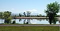
The Bridger Mountains from Three Forks
-
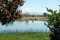
The Bridger Mountains from Three Forks
-
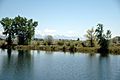
The Bridger Mountains from Three Forks
-
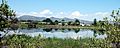
Three Forks


See also
 In Spanish: Three Forks (Montana) para niños
