Missouri Headwaters State Park facts for kids
|
Three Forks of the Missouri
|
|

Confluence of Madison and Jefferson
|
|
| Location | Gallatin County, Montana |
|---|---|
| Nearest city | Three Forks, Montana |
| Area | 1,500 acres (610 ha) |
| Built | 1805 |
| NRHP reference No. | 66000433 |
Quick facts for kids Significant dates |
|
| Added to NRHP | October 15, 1966 |
| Designated NHL | October 9, 1960 |
Missouri Headwaters State Park is a cool state park in Montana. It's famous because it marks the official start of the mighty Missouri River. This park is also home to the Three Forks of the Missouri National Historic Landmark. It got this special title in 1960.
Why is it so important? Because the famous Lewis and Clark Expedition camped here way back in 1805! Today, you can visit the park for day trips or even go camping. It's a great place for hiking, hunting, and enjoying water activities. You'll find it near Three Forks, Montana, about 4,045 feet (1,233 m) above sea level.
Where the Rivers Meet
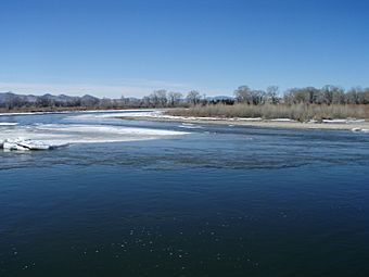
Most of Missouri Headwaters State Park sits on a piece of land surrounded by water. The Gallatin River is on the east side. The Missouri River and the Madison River are on the west.
There are also smaller parts of the park. One is on the east bank of the Gallatin River. Another is an island in the Missouri River. This island is just below where the Madison and Jefferson Rivers join together. The park covers a total area of about 532 acres (215 ha). The Jefferson River meets the Madison and Missouri rivers right in the middle of the park.
A Place in History
The Lewis and Clark Expedition arrived at this special spot on July 26, 1805. Just two days later, on July 28, Meriwether Lewis wrote in his journal. He said that he and Captain Clark agreed on something important. They decided not to call any of these three streams the Missouri River. Instead, they chose to name them after important leaders. These leaders were the President of the United States and the Secretaries of the Treasury and State.
Lewis and Clark were probably the first non-native explorers to see this area. At first, they weren't sure which way to go. So, they explored each of the three river branches. Finally, on July 30, they decided to travel up the Jefferson River. The expedition also passed through these forks again on their way back, on July 13, 1806.
As more people explored and settled the western United States, the forks area became a popular campsite. Fur trappers often used it as a stopping point. Later, in the 1960s, groups that wanted to protect nature started buying land to create this state park.
The Longest River Debate
Lewis and Clark's decision not to call the Jefferson River part of the Missouri led to a big debate. People still argue about which is the longest river in North America. Is it the Missouri or the Mississippi? They are almost the same length!
The Missouri River was traditionally known as the longest. However, about 72 miles of its path have changed. This happened because the riverbed was reshaped. This was mainly done for many hydroelectric power plants in the area. These plants use water to make electricity. Because of these changes, some now say the Mississippi is longer.
But if the Jefferson River were counted as part of the Missouri's length, it would still be the longest. Experts from the United States Geological Survey agree on this.
The exact starting point of the Missouri River is also debated. But two main places are often named as the "utmost headwaters." Both of these spots eventually flow into the Jefferson River.
On August 12, 1805, Lewis said he visited the headwaters on Trail Creek. This was just above Lemhi Pass on the Continental Divide. It's in the Beaverhead Mountains at about 8,600 feet high. He described it as:
- the most distant fountain of the waters of the mighty Missouri in surch(sic) of which we have spent so many toilsome days and wristless(sic) nights.
In 1888, Jacob V. Brower visited another spot. He was famous for helping turn the Mississippi River's headwaters into a state park in Minnesota. Brower's site is also claimed to be the furthest point on the Missouri today. He published his findings in 1896 in a book called "The Missouri: Its Utmost Source."
Brower's Spring, as it's now called, is about 8,800 feet high in the Centennial Mountains. A pile of rocks marks this spot. It's the source of Hellroaring Creek. This creek flows into Red Rock River. Then it goes into Clark Canyon Reservoir. From there, it joins the Beaverhead and then the Big Hole River. Finally, all these waters connect with the Jefferson River.
 | Dorothy Vaughan |
 | Charles Henry Turner |
 | Hildrus Poindexter |
 | Henry Cecil McBay |


