Trail Ridge Road facts for kids
Quick facts for kids
U.S. Route 34 |
|
|---|---|
| Trail Ridge Road | |
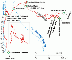
Schematic map of the Trail Ridge Road
|
|
| Route information | |
| Maintained by NPS | |
| Length | 48 mi (77 km) |
| Existed | 1932–present |
| Tourist routes |
|
| Major junctions | |
| West end | Grand Lake |
| East end | Estes Park |
| Location | |
| Counties: | Grand County, Larimer County |
| Highway system | |
| United States Numbered Highways List • Bannered • Divided • Replaced Colorado State Highways |
|
|
Trail Ridge Road
|
|
| NRHP reference No. | 84000242 |
| Added to NRHP | November 14, 1984 |
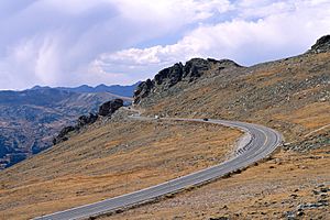
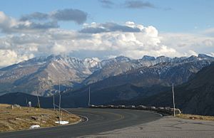
Trail Ridge Road is a famous road in Colorado. It is part of U.S. Highway 34. This road goes through Rocky Mountain National Park. It connects Estes Park in the east to Grand Lake in the west. It is also known as the Trail Ridge Road/Beaver Meadow National Scenic Byway.
The road closes in winter because of heavy snow. It often stays closed until late spring or early summer. This depends on how much snow has fallen. Trail Ridge Road is the highest paved road in Colorado. It is also the highest paved road in Colorado that crosses the Continental Divide.
What is the Trail Ridge Road Like?
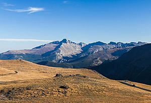
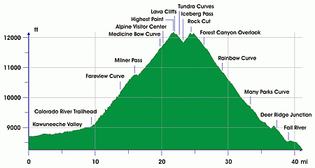
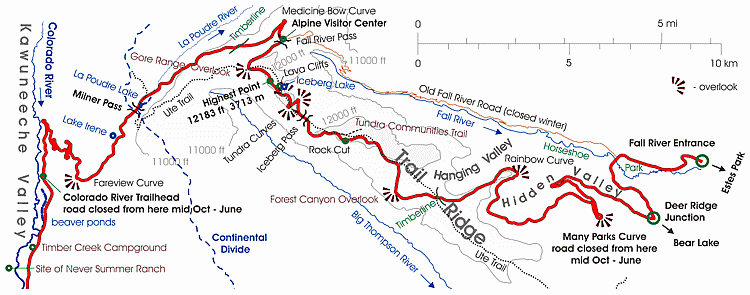
The Trail Ridge Road starts at the Kawuneeche Visitor Center. This is near the park's Grand Lake Entrance. From there, it follows the North Fork of the Colorado River. It goes north through the Kawuneeche Valley.
There are many hiking trails along this part of the road. One important one is the Colorado River Trailhead. This is where the road section closed in winter begins on the west side.
The road crosses the Continental Divide at Milner Pass. This pass is 10,758 feet high. The road reaches its highest point near Fall River Pass. This highest point is 12,183 feet above sea level. Another pass nearby is Iceberg Pass, at 11,827 feet.
The east end of the road is at the Fall River Entrance. However, some guides say it starts earlier, at Deer Ridge Junction. Trail Ridge is a high, flat mountain ridge. It stretches east from the main Rocky Mountains. It lies between Fall River to the north and the Big Thompson River to the south. The road follows this ridge from Fall River Pass to Deer Ridge Junction.
How Old is Trail Ridge Road?
Native Americans used Trail Ridge long ago. They crossed the mountains here to reach hunting grounds. The Arapahoe Indians called the trail "taienbaa." This means "Where the Children Walked." They called it this because it was so steep. Children had to walk and could not be carried. The Ute tribe also crossed the mountains here. They marked their path with stone cairns (piles of rocks). Today, part of the park's Ute Trail follows this old route.
Around 1880, a wagon road was built on the west side. It went along the Kawuneeche Valley. This road connected the town of Grand Lake to mining camps. These camps included Lulu City and Gaskill. The mining boom ended after a few years. The camps were then left empty. Later, hunters and tourists sometimes used the road.
The Fall River Road was the first road into the park's high mountains. It opened in 1921. But it was not good for cars. It was a single-lane road with very steep hills (up to 16%). It also had sharp turns. Heavy snow meant it was only open for a short time each year.
Construction on the new Trail Ridge Road began in 1929. It was finished to Fall River Pass by July 1932. This new road had a gentler slope, with a maximum grade of 7%. The road was fully completed to Grand Lake in 1938. The route followed what the local Arapaho Indians called the Dog Trail.
Some people did not want a road built through the park's alpine tundra. But the director of the National Park Service, Horace Albright, wanted more visitors. So, the road was built. It was designed to blend in with the landscape. This was part of the Park Service's design rules.
See also
 In Spanish: Trail Ridge Road para niños
 | Jessica Watkins |
 | Robert Henry Lawrence Jr. |
 | Mae Jemison |
 | Sian Proctor |
 | Guion Bluford |


