Transport in Perth, Western Australia facts for kids
Perth, Western Australia, has many ways to get around! It has a big network of roads, including freeways, and a good system of trains and buses. A group called Transperth manages all the public transport in the city.
Contents
How Transport in Perth Started
When the Swan River Colony was first settled in 1829, the Swan River was the main way to travel between Perth and the port city of Fremantle. Traveling by land was tricky because the only river crossing near Perth was often too muddy for wagons. The next crossing was far away, about 32 kilometers (20 miles) upstream at Guildford. People also used ferries to cross the river in different spots like North Fremantle and The Narrows.
Getting Around Perth by Road
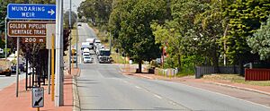
Perth has a huge road system with three main freeways and nine major highways. There are no toll roads, which means you don't have to pay to use them!
Perth's Main Freeways and Highways
- The Mitchell Freeway helps you get from the city center north to places like Joondalup.
- The Kwinana Freeway goes south from the city, past Mandurah, all the way to Bunbury.
- The Graham Farmer Freeway was built in 2000. It includes a tunnel and helps connect different parts of the city, acting like a bypass.
Other important roads connect the city to Fremantle. Stirling Highway runs along the north side of the Swan River. On the south side, Canning Highway connects Fremantle to Midland. Leach Highway is another route that ends near Perth Airport.
Many main roads spread out from Perth like spokes on a wheel, connecting the city to other towns and regions. For example:
- Albany Highway goes southeast to Albany, Western Australia.
- Great Eastern Highway connects to Kalgoorlie in the east.
- Great Northern Highway links Perth to Wyndham in the far north of the state.
Perth's Ring Road System
Perth has a "ring road" system that helps traffic move around the city.
- Roe Highway is the southern part of this ring. It connects the Kwinana Freeway to Midland. There are plans to extend Roe Highway towards Fremantle with new bridges and a tunnel. If this happens, it might become Perth's only toll road.
- Reid Highway is the northern part of the ring road. It continues from Roe Highway and goes west to North Beach.
Understanding Traffic Jams in Perth
Traffic can get busy in Perth, especially during the week.
- On weekdays, the worst traffic is usually in the morning, between 7 AM and 9 AM. Cars often slow down a lot or even stop.
- On weekends, traffic jams are harder to predict. They often happen later in the morning around beaches, shopping centers, or places where kids play sports.
Public Transport in Perth
Transperth runs all the public transport in Perth, including trains, buses, and ferries. If you have a SmartRider card (a travel fare card), train trips in the city center are free! There are also special "CAT" (Central Area Transit) buses that are free for everyone in the city center. These buses run very often, every 8 to 15 minutes.
Perth's Train Network
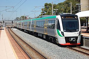
Perth has five main train lines, 76 train stations, and 15 bus stations across the city. These trains help people travel quickly between different suburbs.
Perth's Bus Network
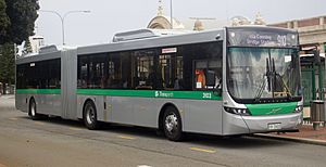
There's a huge bus network that covers the entire Perth area. Many bus routes are designed to take people from their neighborhoods to the main train lines, making it easy to connect to the train system.
Trains to Other Cities
- The Indian Pacific train connects Perth to Adelaide and Sydney on the east coast of Australia.
- The Prospector train travels from Perth to Kalgoorlie, stopping at towns along the way.
- The Australind connects Perth to Bunbury.
- The AvonLink goes to Northam.
A Look Back at Trams in Perth
Perth used to have trams! The first electric trams started running in 1899. The tram network grew and connected many parts of the city, including East Perth, West Perth, and areas south of the Swan River like Victoria Park.
Trams were a very important part of public transport in the early 1900s. However, as more people started using cars, the tram system was slowly removed and stopped running by 1958. You can still see some of Perth's old trams at Whiteman Park.
From 1905 to 1952, Fremantle also had its own smaller tram network, which was separate from Perth's.
Today, you might see tourist buses that look like old trams, but they run on wheels, not rails. They offer tours, like the Kings Park tram tour. In 2012, there were plans for a new light rail system called the Metro Area Express, but these plans were put on hold in 2016.
Cycling in Perth
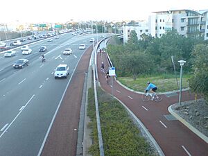
Cycling in Perth is very popular! People ride bikes for fun, to get to work or school, and for sports. Between 1998 and 2009, the number of cyclists in Perth grew by a huge 450%! Many cycling paths run alongside other transport routes, like train lines and freeways, which makes them convenient for commuters.
Perth's Airports
Perth has two main airports:
- Perth Airport is in the east of the city. It handles flights within Australia and international flights to other countries.
- Jandakot Airport is in the southern suburbs. It's used for smaller planes, general aviation, and charter flights.
 | Percy Lavon Julian |
 | Katherine Johnson |
 | George Washington Carver |
 | Annie Easley |


