North Beach, Western Australia facts for kids
Quick facts for kids North BeachPerth, Western Australia |
|||||||||||||||
|---|---|---|---|---|---|---|---|---|---|---|---|---|---|---|---|

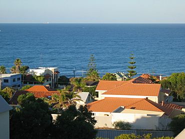
View from Mount Flora
|
|||||||||||||||
| Established | 1940s | ||||||||||||||
| Postcode(s) | 6020 | ||||||||||||||
| Area | 1.7 km2 (0.7 sq mi) | ||||||||||||||
| Location | 16 km (10 mi) NW of Perth CBD | ||||||||||||||
| LGA(s) | City of Stirling | ||||||||||||||
| State electorate(s) | Scarborough | ||||||||||||||
| Federal Division(s) | Moore | ||||||||||||||
|
|||||||||||||||
North Beach is a coastal suburb located north of Perth, the capital city of Western Australia. It's about 16 kilometres (10 miles) from Perth's city centre. You can get there easily using the Mitchell Freeway and Reid Highway. This area is managed by the City of Stirling.
Contents
History of North Beach
The name North Beach simply described its location. It was the most northern of Perth's beaches back in the day. The name was first used in 1888 by a surveyor named Charles Crossland. He was talking about the land owned by Samuel Richard Hamersley.
Early Days and "The Castle"
This area was once part of the Hamersley Estate. This large property also included the suburbs now known as Carine and Hamersley. The Hamersley family moved to the Swan River Colony in 1837. They built a summer house called "The Castle" in 1865. It was a popular spot for their big family and other important people from Perth to spend their summer holidays. Later, "The Castle" became a hotel. It was torn down in 1998 after 75 years.
Pastoral Life and Gold Rush Era
North Beach was first used as a timber reserve. Then, in the 1860s, farmers started settling here. It became a useful stop for cattle drovers traveling along the Coastal Stock Route. This route went between Dongara (near Geraldton) and Fremantle.
When gold was discovered in the goldfields in the 1890s, Afghan camel drivers became a common sight. North Beach was even used as a quarantine area for camels entering the colony. Some orchards also grew fruit here. Today, the only sign of them is an old olive tree on Hope Street.
Getting Around in the Past
In those early days, the only way to reach North Beach was by a wooden block road. This road was built by convicts and later became Wanneroo Road. From there, a limestone track led to North Beach. Over time, more tracks were made through the bushland.
World Wars and Growth
During World War I, the Australian 10th Light Horse Regiment was stationed at Mount Flora. Their job was to watch the coast. They kept their horses in a yard at the corner of what are now Hope and Hale Streets.
During the Great Depression, many people faced hard times. The area near West Coast Drive and North Beach Road became a "tent city". It housed many people who had lost their homes.
After World War II, North Beach grew very quickly. In 1954, it officially became the Postal District of North Beach. By 1961, most of the suburb you see today had already been built and settled.
Star Swamp Bushland Reserve
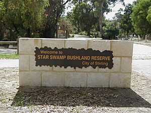
Star Swamp Bushland Reserve is a large natural area. It covers about half of the land in Watermans Bay and North Beach. We don't know exactly where the name came from. But it was first used in 1868 on a lease application.
In 1987, the government protected 96 hectares of Star Swamp. It was made an A-class reserve, which means it's highly protected. Money from the Bicentennial program helped create the Star Swamp Heritage Trail. This trail lets people explore the reserve.
Geography of North Beach
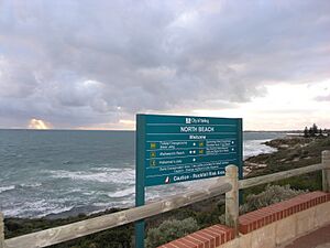
North Beach has clear boundaries. Hale Street is to the north, and Marmion Avenue is to the east. The southern boundary is near Lynn Street. To the west, you'll find West Coast Drive and the beautiful ocean. As mentioned, Star Swamp makes up a big part of the suburb. Reid Highway connects North Beach to the Mitchell Freeway and the city.
In 2001, about 2,949 people lived in North Beach. They lived in 1,270 homes. The average age of residents was 42 years old. Homes in North Beach are a mix of old holiday houses and newer modern homes.
Facilities in North Beach
North Beach is mainly a place where people live. It has small shopping areas along the coast and at Flora Terrace and Castle Street. These shops offer everyday services. For more options, Karrinyup Shopping Centre is nearby.
North Beach also has a tennis club with different types of courts. There are two schools in the suburb: North Beach Primary School and the private Our Lady of Grace school. Carine Senior High School is also close by.
You can enter Star Swamp Bushland Reserve from the eastern side of the suburb. Look for entrances on Hope Street and Groat Street.
Mount Flora Regional Museum
On the northern edge of North Beach is the Mount Flora Regional Museum. It was built in 1936 as a water tower. It was placed at the highest point to provide water to the surrounding areas. In the 1970s, it stopped being used as a water tower. In May 1986, it was turned into a museum and a lookout point. The museum shares the history of the region. It's also home to the North Suburban Historical Society.
Transport in North Beach
North Beach is served by Transperth bus route 423. This bus travels between Warwick and Stirling train stations. Swan Transit operates these buses.
In 1925, the North Beach Bus Company started. Alf Lehman began it with his crimson buses. The James family took over the company in 1928. Back then, REO buses drove on special plank roads. These roads went through wet areas between what is now Tuart Hill and North Beach. The Metropolitan Transport Trust took over the company on September 30, 1961.
 | Laphonza Butler |
 | Daisy Bates |
 | Elizabeth Piper Ensley |


