
City of Stirling facts for kids
Quick facts for kids City of StirlingWestern Australia |
|||||||||||||||
|---|---|---|---|---|---|---|---|---|---|---|---|---|---|---|---|

The City of Stirling within the Perth Metropolitan Area
|
|||||||||||||||
| Established | 1871 | ||||||||||||||
| Area | 105.2 km2 (40.6 sq mi) | ||||||||||||||
| Mayor | Mark Irwin | ||||||||||||||
| Council seat | Stirling | ||||||||||||||
| Region | North Metropolitan Perth | ||||||||||||||
| State electorate(s) |
|
||||||||||||||
| Federal Division(s) | Curtin, Perth | ||||||||||||||
 |
|||||||||||||||
| Website | City of Stirling | ||||||||||||||
|
|||||||||||||||
The City of Stirling is a large area in the northern suburbs of Perth, the capital city of Western Australia. It's about 10 kilometers (6 miles) north of Perth's main city center. This area covers about 105.2 square kilometers (40.6 square miles). It's home to over 223,000 people, making it the biggest local government area in Western Australia by population.
Contents
History of Stirling
How Stirling Started
The City of Stirling began on January 24, 1871. Back then, it was called the Perth Road District. It was set up under a law called the District Roads Act 1871. This district was much bigger than the City of Stirling is today. It included areas that are now separate cities like Wanneroo, Joondalup, Bayswater, and Belmont.
In 1961, a new law changed all road districts into "shires." So, on July 1, 1961, it became the Shire of Perth. At that time, about 84,000 people lived there. Ten years later, on January 24, 1971, it was officially named the City of Stirling.
Discussions About Changing the Name
In May 2021, some people suggested changing the name of the City of Stirling. This was because the city is named after James Stirling, who was the first governor of Western Australia. He was involved in a sad event called the Pinjarra Massacre in 1834. During this event, a group of Noongar people were attacked.
Historians have confirmed James Stirling's role in this event. He wanted to stop the Noongar people from blocking the growth of the colony.
This idea of changing the name was talked about a lot in the news. Some people even suggested using a Noongar name alongside the current one. A report from the city said that changing the name would be very expensive. At a council meeting in June 2021, people discussed the idea. Some thought it would cost too much money and set a difficult example for other places. No decision was made to change the name at that meeting. After this, some Western Australian senators asked for a wider review of place names linked to colonial figures.
How Stirling is Governed
The City of Stirling is divided into seven areas called wards. Each ward has two councillors who help make decisions for the city. These councillors serve for four years. Every two years, half of the councillors are up for election. The mayor, who leads the city, is chosen from among these councillors.
Wards of Stirling
- Balga Ward
- Coastal Ward
- Doubleview Ward
- Hamersley Ward
- Inglewood Ward
- Lawley Ward
- Osborne Ward
Suburbs in Stirling
The City of Stirling is made up of many different suburbs. Here's a list of them, along with how many people live there and their size, based on the most recent Australian census:
| Suburb | Population | Area | Map |
|---|---|---|---|
| Balcatta | 10,813 | [convert: needs a number] | |
| Balga | 13,864 | [convert: needs a number] | |
| Carine | 7,330 | [convert: needs a number] | |
| Churchlands | 3,638 | [convert: needs a number] | |
| Coolbinia | 1,751 | [convert: needs a number] | |
| Dianella | 24,169 | [convert: needs a number] | |
| Doubleview | 9,205 | [convert: needs a number] | |
| Glendalough | 2,628 | [convert: needs a number] | |
| Gwelup | 5,391 | [convert: needs a number] | |
| Hamersley | 5,209 | [convert: needs a number] | |
| Herdsman | 0 | [convert: needs a number] | |
| Inglewood | 5,837 | [convert: needs a number] | |
| Innaloo | 9,592 | [convert: needs a number] | |
| Joondanna | 5,283 | [convert: needs a number] | |
| Karrinyup | 9,886 | [convert: needs a number] | |
| Menora | 2,691 | [convert: needs a number] | |
| Mirrabooka | 8,000 | [convert: needs a number] | |
| Mount Lawley | 11,328 | [convert: needs a number] | |
| Nollamara | 12,779 | [convert: needs a number] | |
| North Beach | 3,689 | [convert: needs a number] | |
| Osborne Park | 4,463 | [convert: needs a number] | |
| Scarborough | 17,605 | [convert: needs a number] | |
| Stirling | 10,165 | [convert: needs a number] | |
| Trigg | 2,855 | [convert: needs a number] | |
| Tuart Hill | 7,541 | [convert: needs a number] | |
| Watermans Bay | 1,369 | [convert: needs a number] | |
| Wembley | 12,061 | [convert: needs a number] | |
| Wembley Downs | 6,743 | [convert: needs a number] | |
| Westminster | 7,042 | [convert: needs a number] | |
| Woodlands | 4,551 | [convert: needs a number] | |
| Yokine | 12,706 | [convert: needs a number] |
Population Growth Over Time
The City of Stirling has grown a lot over the years. Here's how its population has changed:
| Historical population | |||||||||||||||||||||||||||||||||||||||||||||||||||||||||||||
|---|---|---|---|---|---|---|---|---|---|---|---|---|---|---|---|---|---|---|---|---|---|---|---|---|---|---|---|---|---|---|---|---|---|---|---|---|---|---|---|---|---|---|---|---|---|---|---|---|---|---|---|---|---|---|---|---|---|---|---|---|---|
|
|
||||||||||||||||||||||||||||||||||||||||||||||||||||||||||||
Libraries in Stirling
The City of Stirling has six libraries where you can borrow books and learn new things. They are:
- Scarborough Library
- Karrinyup Library
- Dianella Library
- Inglewood Library
- Mirrabooka Library
- Osborne Library
Important Heritage Places
There are many places in the City of Stirling that are important because of their history. As of 2024, there are 641 places listed as heritage sites. Out of these, 20 are so important that they are on the official State Register of Heritage Places. This means they are protected and recognized for their historical value.
Images for kids
-
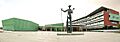
City of Stirling offices.
