Carine, Western Australia facts for kids
Quick facts for kids CarinePerth, Western Australia |
|||||||||||||||
|---|---|---|---|---|---|---|---|---|---|---|---|---|---|---|---|

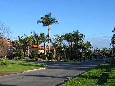
Monyash Road, Carine
|
|||||||||||||||
| Established | 1973 | ||||||||||||||
| Postcode(s) | 6020 | ||||||||||||||
| Area | 4.7 km2 (1.8 sq mi) | ||||||||||||||
| LGA(s) | City of Stirling | ||||||||||||||
| State electorate(s) | Carine | ||||||||||||||
| Federal Division(s) | Moore | ||||||||||||||
|
|||||||||||||||
Carine is a suburb in Perth, the main city of Western Australia. It's about 14 kilometers (9 miles) north of Perth's city center. You'll find it between Marmion Avenue and Mitchell Freeway. Carine is part of the City of Stirling local government area.
Contents
Discovering Carine's Past
How Carine Got Its Name
The name "Carine" comes from two swamps in the area. In 1865, a surveyor named R. Quinn recorded them as "Big Carine Swamp" and "Small Carine Swamp."
Early Days of Carine
Carine was once part of a large property called the Hamersley Estate. This estate also included areas now known as North Beach, Waterman, and Hamersley. The Hamersley family came from Europe in 1837 and settled in the Swan River Colony. They even built a summer house in what is now North Beach.
For a long time, most of Carine remained undeveloped. There were a few market gardens and farms near the swamps. You could also find timber reserves, a small piggery, and horse stables. Beetles Dairy operated in Okely Road until 1915.
Building a Community
In the early 1970s, the southern part of Carine began to be built. This area is south of what is now Reid Highway. In 1973, Carine High School opened its doors. For several years, the high school and a caravan park were the main features.
From 1975 onwards, more homes were built. The last parts of the suburb were finished in 1987. Most buildings were single houses. However, now you can also see more duplexes, which are homes divided into two separate living spaces.
Modern Changes
In 2000, the final section of Reid Highway was completed. This highway now runs through the southern part of Carine. It connects the suburb to the Mitchell Freeway and the city.
In 2013, a plan was announced to redevelop the old Carine Tafe site. This plan includes new townhouses, apartments, and a retirement village. It will also have aged care facilities and mixed-use spaces.
Exploring Carine's Location and People
Where is Carine?
Carine is bordered by Beach Road to the north and North Beach Road to the south. The Mitchell Freeway is to the east, and Marmion Avenue is to the west.
A big part of the suburb is the Carine Regional Open Space. This open space is about one-third of Carine. It sits between Duffy/Monyash Roads and Okely Road.
Who Lives in Carine?
According to the 2016 Australian census, Carine had 6,479 people. Most people lived in detached houses. Many adults in Carine work as managers or professionals. About 65% of people in Carine are married. The suburb has more families living there compared to other parts of Western Australia.
What Can You Do in Carine?
Shopping and Schools
Carine is mainly a place where people live. For basic shopping, residents go to the Carine Glades shopping center. This center is on the northern edge of the suburb. For bigger shopping trips, people visit Karrinyup Shopping Centre or Centro Warwick nearby.
Carine has its own primary school for younger students. It also has a high school for students from grades 7 to 12.
Nature and Fun
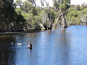
The Carine Regional Open Space is a special wetland area. It has two large swamps. This space is home to many interesting animals. You can find rare waterbirds, frogs, and turtles here. There are walking and bicycle tracks to explore the area.
At the northern end of the open space, you'll find sports facilities. There are ovals for games and even a skateboard ramp for some fun!
Getting Around Carine
Public Transport Options
Carine is well-connected by public transport. The Warwick railway station is in the northeastern part of the suburb. You can take a train from here to Perth's city center.
Transperth buses also serve the area. Bus route 425 travels along Beach Road, Okely Road, Osmaston Road, and Everingham Street. Bus route 424 runs along North Beach Road in the south of Carine. Other bus routes also use Marmion Avenue and Beach Road.
Bus Routes in Carine
- 424 connects Karrinyup Bus Station to Stirling Station. It serves North Beach Road.
- 425 connects Warwick Station to Stirling Station. It serves Beach Road, Okely Road, Osmaston Road, Almadine Drive, Silica Road, Everingham Street, and North Beach Road.
Other Bus Routes on Beach Road
- 423 connects Warwick Station to Stirling Station.
- 441, 442, 443, and 444 connect Warwick Station to Whitfords Station.
 | William M. Jackson |
 | Juan E. Gilbert |
 | Neil deGrasse Tyson |


