Tualatin Mountains facts for kids
Quick facts for kids Tualatin Mountains |
|
|---|---|

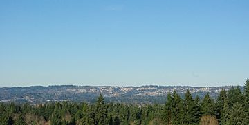
West slope of the mountains from Beaverton looking north
|
|
| Highest point | |
| Peak | Dixie Mountain |
| Elevation | 1,609 ft (490 m) |
| Geography | |
| Country | United States |
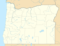
| State | Oregon |
| District | Multnomah County |
| Range coordinates | 45°34′50″N 122°47′45″W / 45.58056°N 122.79583°W |
| Topo map | USGS Linnton |
| Geology | |
| Mountain type | Lava flows |
| Volcanic field | Boring Lava Field, Columbia River Basalt Group |
| Last eruption | 7 million years ago |
The Tualatin Mountains are a group of hills in Oregon, United States. They are also known as the West Hills or Southwest Hills of Portland. These mountains are on the western edge of Multnomah County.
They are part of the Northern Oregon Coast Range. The Tualatin Mountains act like a natural wall. They separate the Tualatin Basin from the Portland Basin. The Tualatin Basin is in Washington County, Oregon. The Portland Basin covers parts of Multnomah County and Clark County, Washington.
The tallest point in these mountains is Dixie Mountain, which is about 1,609 feet (490 meters) high. Other important peaks include Cornell Mountain, at 1,270 feet (390 meters). Council Crest is 1,073 feet (327 meters) tall. Pittock Hill is also notable as the home of the Pittock Mansion.
Even though the slopes are steep and landslides can happen, many homes have been built here. However, a large part of the northern area remains undeveloped. This undeveloped land is within Forest Park, which is about 5,000 acres (20 square kilometers) big. Most of the landscape, both inside and outside the park, is covered in trees.
How the Mountains Formed
The Tualatin Mountains were formed a very long time ago, during the late Cenozoic era. They are mostly made of a type of rock called basalt. This rock came from several lava flows. These flows were part of the larger Columbia River basalts. The mountains can reach heights of over 1,000 feet (300 meters).
People and Paths Through the Hills
People have lived in this area for a very long time. The earliest known residents were the Chinook people, who lived here about 10,000 years ago.
Today, U.S. Route 26, also called the Sunset Highway, is the main road through these hills. It goes through the Vista Ridge Tunnels and over Sylvan Hill. This route, also known as Canyon Road, was very important for Portland's early growth. It connected farms in the Tualatin Basin to the Willamette River, where boats could travel. In the 1800s, it was even a plank road, meaning it was made of wooden planks.
Since 1998, the MAX Light Rail has also run through the hills. The west side line runs mostly next to US 26. Part of this train line goes deep underground through the Robertson Tunnel.
Radio Stations
The Tualatin Mountains are also home to the transmitter for the radio station KLTH.
 | James Van Der Zee |
 | Alma Thomas |
 | Ellis Wilson |
 | Margaret Taylor-Burroughs |


