Tucker, Utah facts for kids
Quick facts for kids
Tucker
|
|
|---|---|

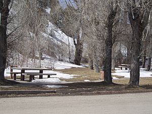
2008 view of the rest stop at the former site of Tucker
|
|
| Country | United States |
| State | Utah |
| County | Utah |
| Abandoned | 1913 |
| Named for | James Tucker |
| Elevation | 6,227 ft (1,898 m) |
| Time zone | UTC-7 (Mountain (MST)) |
| • Summer (DST) | UTC-6 (MDT) |
| GNIS feature ID | 1446752 |
Tucker is a ghost town in Utah County, Utah, United States. It is found near the Spanish Fork River, about 7 miles (11 km) from Soldier Summit. Tucker was once a busy place for the Denver and Rio Grande Western Railroad (D&RGW). It served as a spot where trains could load goods and where workers lived.
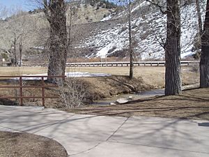
After the town was no longer used, the state of Utah turned the area into a rest area for travelers. In 2009, the original site was covered up to make a new, straighter road for U.S. Route 6. To remember Tucker, Utah built a new rest area about 2 miles (3.2 km) away. This new spot is called the Tie Fork Rest Area.
Contents
The Story of Tucker: A Railroad Town
| Historical population | |||
|---|---|---|---|
| Census | Pop. | %± | |
| 1900 | 211 | — | |
| 1910 | 373 | 76.8% | |
| 1920 | 40 | −89.3% | |
Tucker began as a simple meeting point for two railroad lines. One was the main D&RGW railroad, and the other was a smaller line called the Utah and Pleasant Valley Railway. This smaller line went to mines at Winter Quarters, which is near today's Scofield Reservoir.
A station was built here for "helper engines." These were extra engines that helped push heavy freight trains up the steep Soldier Summit. Because of this, the area quickly grew into a town with about 500 people. It was first called Clear Creek. (The small town of Clear Creek, Utah today is a few miles south of where Tucker used to be.)
Life in Clear Creek (Tucker)
The town of "Clear Creek" had many buildings. There was a boarding house where people could stay, a company store to buy supplies, and a saloon. Many houses were quickly built in the small valley. The town even had its own post office from 1881 to 1919. Around 1900, the town's name was changed to Tucker, named after a person named James Tucker.
Why Tucker Became a Ghost Town
Tucker's story ended in 1913. The railroad decided to change its tracks to make the climb up Soldier Summit less steep. The old track had a very dangerous 4% slope. The new track was built with a more gentle 2.0% slope.
With this new track, the line to Scofield was also changed. It now branched off the main line near Colton. This new route completely bypassed the town of Tucker. It also bypassed an area called Gilluly. The new track was often called the Gilluly loops or Gilluly horseshoe curves because of its winding path up the hill.
The railroad filled in much of the Tucker area to raise the new track high above the valley. All the buildings in Tucker are now gone. Even most of the old railroad path is covered up. Later, in the 1920s, when U.S. Route 50 (which is now U.S. Route 6) was paved, it used the old railroad path. In 1969, the state built a rest area on the site of the old town. A small plaque was the only sign that a ghost town once stood there.
Tie Fork Rest Area: A New Beginning
The old Tucker rest area was on a sharp curve of U.S. Route 6. This curve was at the bottom of a steep 5% slope. In 2009, the Utah Department of Transportation closed the Tucker rest area. They covered it up to build a safer road with a smoother curve and a less steep slope.

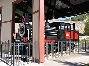
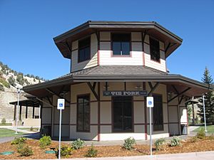
In 2010, a new rest area was opened about 2 miles (3.2 km) downstream from Tucker. It was named the Tie Fork Rest Area, after the nearby canyon. This new rest area was designed to look like an old train depot from the early 1900s. It even has a replica roundhouse and a non-working steam locomotive. This train was built by Original Creations in Carbonville. The buildings were designed by the Archiplex Group from Salt Lake City.
The Tie Fork Rest Area is very popular. It was even voted one of the most beautiful buildings in Utah by the American Institute of Architects. It is also one of the busiest rest areas in the state that is not on a freeway.
The rest area officially opened on August 16, 2010. It gets money and support from several counties in Utah: Carbon County, Emery County, Grand County, and Utah County. It also gets help from the Manti-La Sal National Forest and Utah State Parks. Each of these groups has put up displays at the rest area. They also share the cost of keeping it maintained, which is about $17,000 each year.
 | William Lucy |
 | Charles Hayes |
 | Cleveland Robinson |


