Uncompahgre Plateau facts for kids
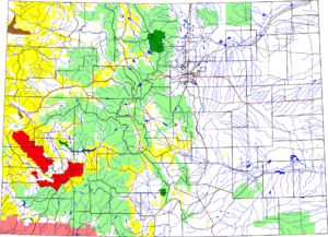
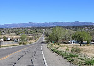
The Uncompahgre Plateau is a special uplifted area in western Colorado. It is part of the larger Colorado Plateau. The name Uncompahgre comes from the Ute language. It means "Dirty Water" or "Rocks that make Water Red." This name describes the water found in the area.
This plateau is quite high, averaging about 2,900 meters (9,500 feet) above sea level. It rises from the Colorado River at 1,400 meters (4,600 feet) up to Horsefly Peak, which is 3,100 meters (10,300 feet) high. The plateau stretches for about 140 kilometers (90 miles) to the southeast. It reaches the edge of the San Juan Mountains.
The Uncompahgre Plateau has clear natural borders. To the west, it is bordered by the San Miguel and Dolores Rivers. The Colorado River forms its northern edge. On the eastern side, you'll find the Gunnison and Uncompahgre Rivers.
Many large canyons cut through the plateau. These include Big Red, Tabeguache, Spring Creek, Roubideau, Escalante, Big Dominquez, and Unaweep. These canyons separate generally flat areas called mesas. The water from the plateau flows into four rivers that are all branches of the Colorado River. These are the Dolores River, Gunnison River, San Miguel River, and Uncompahgre River.
The Uncompahgre Plateau covers about 5,930 square kilometers (2,290 square miles). This area spreads across five counties in Colorado. These counties are Delta, Mesa, Montrose, Ouray, and San Miguel.
Who Manages the Uncompahgre Plateau?
Different groups help manage the land on the Uncompahgre Plateau. This helps keep the area healthy and safe.
- The United States Forest Service manages a large part. Their Uncompahgre National Forest land covers about 2,210 square kilometers (545,907 acres). This is about 37% of the plateau.
- The Bureau of Land Management also manages a big section. They oversee about 2,200 square kilometers (545,280 acres), which is also about 37%.
- The State of Colorado manages a smaller portion. The Colorado State Land Board and Colorado Division of Wildlife own about 35 square kilometers (8,689 acres). This is less than 1%.
- Private property makes up the rest. Most of this land is in the Uncompahgre Valley. It totals about 1,480 square kilometers (365,547 acres), or 25% of the plateau.
How the Uncompahgre Plateau Was Formed
The Uncompahgre Plateau is located in Southwest Colorado. It is a high, dome-shaped area that rises from the Colorado River. Millions of years ago, strong forces deep inside the Earth's crust pushed the land upwards. This lifting action created the plateau's unique shape and high elevation.
See also
 In Spanish: Meseta de Uncompahgre para niños
 | Valerie Thomas |
 | Frederick McKinley Jones |
 | George Edward Alcorn Jr. |
 | Thomas Mensah |


