
Van Buren, New York facts for kids
Quick facts for kids
Van Buren, New York
|
|
|---|---|

Location in Onondaga County and the state of New York.
|
|
| Country | United States |
| State | New York |
| County | Onondaga |
| Government | |
| • Type | Town Council |
| Area | |
| • Total | 36.11 sq mi (93.53 km2) |
| • Land | 35.41 sq mi (91.71 km2) |
| • Water | 0.70 sq mi (1.82 km2) |
| Elevation | 620 ft (189 m) |
| Population
(2020)
|
|
| • Total | 14,367 |
| • Density | 397.87/sq mi (153.608/km2) |
| Time zone | UTC-5 (Eastern (EST)) |
| • Summer (DST) | UTC-4 (EDT) |
| ZIP code |
13027
|
| Area code(s) | 315 |
| FIPS code | 36-76760 |
| GNIS feature ID | 0979576 |
Van Buren is a town in Onondaga County, New York, United States. In 2020, about 14,367 people lived there. The town is named after Martin Van Buren. He was a senator who later became the eighth president of the United States.
Van Buren is located northwest of Syracuse. It is in the northwest part of Onondaga County. The area north and east of New York State Route 690 and south of the Seneca River is mostly suburban. It has many single-family homes, some apartment buildings, parks, and light industry. The rest of the town is mostly rural.
Contents
History of Van Buren

The town was once part of the Central New York Military Tract. This land was used in 1789 to pay soldiers who fought in the American Revolution. Most soldiers sold their land for money. So, land investors briefly owned the town. Later, people who actually lived there bought the land. People started settling in the area around 1791.
The Town of Van Buren was officially created in 1829. It was formed from a part of the Town of Camillus.
Geography and Location
According to the United States Census Bureau, Van Buren covers about 36.1 square miles (93.5 square kilometers). Most of this area, about 35.4 square miles (91.7 square kilometers), is land. The rest, about 0.7 square miles (1.8 square kilometers), is water.
The Seneca River borders Van Buren to the north and west. Across the river is the Town of Lysander. To the southwest, Van Buren borders the Town of Elbridge. To the south is the Town of Camillus, and to the east is the Town of Geddes.
Van Buren includes the southern part of the Village of Baldwinsville. This village became official in 1848. The northern part of Baldwinsville is in the Town of Lysander. The Baldwinsville Central School District was formed in 1949. It covers most of the area in both Van Buren and Lysander.
Roads and Transportation
Several important roads cross Van Buren:
- The New York State Thruway (Interstate 90) runs through the southern part of town.
- New York State Route 690 is a major highway. It connects to Thruway Exit 39 and goes around Baldwinsville to the west.
- New York State Route 31 runs from northeast to southwest. It connects Baldwinsville and Jordan.
- New York State Route 173 runs from northwest to southeast. It connects Van Buren with Fairmount and Onondaga Hill.
- New York State Route 48 follows the Seneca River in eastern Van Buren. Before Route 690 was built, this road carried most of the traffic between Baldwinsville and Syracuse.
- Many county and town roads also make up the local road network.
Population and People
| Historical population | |||
|---|---|---|---|
| Census | Pop. | %± | |
| 1830 | 2,890 | — | |
| 1840 | 3,021 | 4.5% | |
| 1850 | 3,873 | 28.2% | |
| 1860 | 3,037 | −21.6% | |
| 1870 | 3,038 | 0.0% | |
| 1880 | 3,091 | 1.7% | |
| 1890 | 3,444 | 11.4% | |
| 1900 | 3,297 | −4.3% | |
| 1910 | 3,260 | −1.1% | |
| 1920 | 3,425 | 5.1% | |
| 1930 | 3,814 | 11.4% | |
| 1940 | 3,691 | −3.2% | |
| 1950 | 4,900 | 32.8% | |
| 1960 | 8,754 | 78.7% | |
| 1970 | 11,859 | 35.5% | |
| 1980 | 12,585 | 6.1% | |
| 1990 | 13,367 | 6.2% | |
| 2000 | 12,667 | −5.2% | |
| 2010 | 13,185 | 4.1% | |
| 2020 | 14,367 | 9.0% | |
| U.S. Decennial Census | |||
In 2000, there were 12,667 people living in Van Buren. There were 5,288 households and 3,384 families. The town had about 356 people per square mile (137 people per square kilometer). There were 5,618 housing units.
Most people in Van Buren were White (97.05%). A smaller number were African American (0.80%), Native American (0.51%), or Asian (0.41%). About 0.75% of the population was Hispanic or Latino.

About 29.0% of households had children under 18 living with them. About 50.6% were married couples. The average household had 2.37 people. The average family had 2.95 people.
The population was spread out by age. About 23.6% were under 18. About 30.2% were between 25 and 44 years old. About 14.9% were 65 years or older. The average age was 39 years.
The median income for a household in the town was $43,003. For a family, it was $50,724. About 6.6% of the population lived below the poverty line. This included 7.6% of those under 18.
Images for kids
-
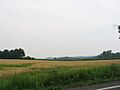
Rolling hills in Van Buren
-
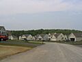
Tract housing in Van Buren
See also
 In Spanish: Van Buren (Nueva York) para niños
