
Camillus, New York facts for kids
Quick facts for kids
Camillus, New York
|
|
|---|---|

Location in Onondaga County and the state of New York.
|
|
| Country | United States |
| State | New York |
| County | Onondaga |
| Government | |
| • Type | Town Council |
| Area | |
| • Total | 34.44 sq mi (89.20 km2) |
| • Land | 34.42 sq mi (89.16 km2) |
| • Water | 0.02 sq mi (0.04 km2) |
| Population
(2020)
|
|
| • Total | 25,346 |
| • Density | 735.95/sq mi (284.148/km2) |
| Time zone | UTC-5 (Eastern (EST)) |
| • Summer (DST) | UTC-4 (EDT) |
| ZIP codes |
13031 13219
|
| Area code(s) | 315 |

Camillus is a town located in Onondaga County, New York, United States. In 2020, the town had a population of 25,346 people.
The Town of Camillus is situated to the west of Syracuse. There is also a village called Camillus within the town. Much of the town acts as a western suburb of Syracuse, meaning many people who work in Syracuse live here.
Contents
Geography of Camillus

Camillus covers a total area of about 34.5 square miles (89.3 square kilometers). Almost all of this area is land.
Several important roads run through Camillus:
- New York State Route 5 is a major highway that goes from east to west across the town.
- New York State Route 173 crosses NY-5 near Fairmount.
- New York State Route 174 meets NY-5 close to Camillus village.
- New York State Route 321 connects with NY-5 at Bennetts Corners.
- New York State Route 695 and New York State Route 297 are state highways found near the eastern edge of the town.
History of Camillus
Most of the land that makes up the Town of Camillus today was once part of the Central New York Military Tract. This was land set aside for soldiers after the American Revolutionary War. A smaller part of the town, especially the area known as Fairmount, was originally part of the Onondaga Reservation. This land became part of New York State in 1795. It was added to Camillus in 1834.
The first pioneer, Joseph Sherwood, arrived around 1795 in the area where the village of Camillus now stands. The Town of Camillus was officially created in 1799. It was formed from land that used to be part of the Town of Marcellus.
Industrial growth in Camillus was greatly helped by the Erie Canal, which opened in 1825. The town also became part of a railroad line in 1838. This line connected Syracuse to Auburn. Two important historical sites in Camillus are the Nine Mile Creek Aqueduct and the Wilcox Octagon House. Both are listed on the National Register of Historic Places, meaning they are recognized for their historical value.
Population and People
| Historical population | |||
|---|---|---|---|
| Census | Pop. | %± | |
| 1820 | 5,791 | — | |
| 1830 | 2,518 | −56.5% | |
| 1840 | 3,957 | 57.1% | |
| 1850 | 3,105 | −21.5% | |
| 1860 | 2,940 | −5.3% | |
| 1870 | 2,423 | −17.6% | |
| 1880 | 2,416 | −0.3% | |
| 1890 | 2,678 | 10.8% | |
| 1900 | 2,453 | −8.4% | |
| 1910 | 2,642 | 7.7% | |
| 1920 | 2,905 | 10.0% | |
| 1930 | 4,066 | 40.0% | |
| 1940 | 4,394 | 8.1% | |
| 1950 | 6,735 | 53.3% | |
| 1960 | 18,328 | 172.1% | |
| 1970 | 26,841 | 46.4% | |
| 1980 | 24,333 | −9.3% | |
| 1990 | 23,625 | −2.9% | |
| 2000 | 23,152 | −2.0% | |
| 2010 | 24,167 | 4.4% | |
| 2020 | 25,346 | 4.9% | |
| U.S. Decennial Census | |||
As of the census in 2000, there were 23,152 people living in Camillus. There were 9,315 households and 6,595 families. The population density was about 672 people per square mile.
The people living in Camillus were mostly White (96.45%). Other groups included Black (0.95%), Native American (0.37%), and Asian (1.10%). About 0.92% of the population was Hispanic or Latino.
About 30.5% of households had children under 18 living with them. Most households (58.1%) were married couples living together. The average household had 2.48 people. The average family had 2.99 people.
The age breakdown of the population was:
- 24.2% were under 18 years old.
- 5.8% were from 18 to 24 years old.
- 27.5% were from 25 to 44 years old.
- 24.2% were from 45 to 64 years old.
- 18.3% were 65 years or older.
The average age in the town was 40 years.
In 2000, the median income for a household in Camillus was $50,198. For a family, the median income was $58,395. The average income per person in the town was $22,591. About 4.3% of the population lived below the poverty line. This included 5.6% of those under 18 and 4.6% of those 65 or older.
Communities and Locations in Camillus
The Town of Camillus includes several smaller communities and specific locations:
- Amboy – A small community in the north-central part of Camillus, located on NY-173.
- Amboy Station – An area just north of Amboy.
- Belle Isle – A location east of Amboy, close to Route 695 and the NYS Fairgrounds.
- Bennetts Corners – A hamlet near the western town border, where NY-5 and NY-321 meet.
- Camillus – This is the main village located in the southwestern part of the Town of Camillus.
- Camillus Airport (NY2) – A small general aviation airport near the northern town line.
- Daniluk Drive – A neighborhood near the western town line, close to NY-5.
- Edgewood Garden – A neighborhood near the northern town line.
- Fairmount – A hamlet located near the eastern border of the town.
- Four Winds – A group of homes within the Hamlet of Newport.
- Fox Chapel – A neighborhood about five minutes from the village of Camillus.
- Garden Terrace – A neighborhood near the northern town line.
- Greenfield Village – A neighborhood next to Amboy and across from Reed Webster park.
- Hidden Knolls – A neighborhood just west of Fairmount, on a hill above Shove Park.
- Memphis – A hamlet at the northern town line, north of Oswego Bitters.
- Newport – A hamlet near the northern town line.
- Ninemile Creek – A stream that flows through the western part of the town.
- North Belle Isle – A hamlet near the eastern town line.
- Orchard Village – A neighborhood near the southern town line.
- Oswego Bitters – A hamlet in the western part of the town on Bitters Road.
- Parson Farms – A neighborhood near the southern town line.
- Pioneer Farms – A neighborhood west of Weatheridge and Fox Chapel.
- Scenic Hills – A neighborhood on the southern town line.
- Sherwood Knolls – A neighborhood near the southern town line.
- Stanley Manor – A neighborhood near the southern town line.
- Syracuse Municipal Airport – A former airport in the northeastern part of the town. It was an early center for flying in the county.
- Warners – A hamlet at the northern town line, north of Newport.
- Weatheridge – A neighborhood southeast of Camillus village.
- Wellington – A neighborhood along NYS Route 5.
- Westerlea – A neighborhood northeast of Camillus village.
- Westview Manor – A neighborhood east of Camillus village.
- West Genesee Terrace – A neighborhood east of Camillus village.
- Wincrest Park – A neighborhood southeast of Camillus village.
Notable People from Camillus
Many interesting people have connections to Camillus:
- Kinsley S. Bingham – A well-known politician.
- Tom Clark – He was the Commissioner of the Professional Bowlers Association (PBA).
- Kelly Cutrone – An American fashion publicist.
- Frank DiPino – A Major League baseball pitcher.
- Sara Virginia Ecker Watts Morrison – She was the First Lady of North Carolina.
- Kim Hill – A soul musician and a former member of the Black Eyed Peas.
- John Katko – A politician.
- Fayette S. Munro – A politician and lawyer.
- Francis Paddock – A politician.
- Susan Wynne – An American ice dancer.
Images for kids
-
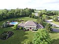
A large suburban house in the western hills of Camillus.
-
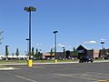
Lowe's in Camillus
-
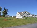
Housing development
-
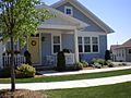
Annesgrove Traditional Neighborhood in Camillus
-
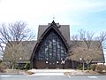
St Joseph's Catholic Church


See also
 In Spanish: Camillus (Nueva York) para niños
