Van Loan Hill facts for kids
Quick facts for kids Van Loan Hill |
|
|---|---|
| Highest point | |
| Elevation | 2,526 feet (770 m) |
| Geography | |
| Location | SW of Maplecrest, New York, U.S. |
| Parent range | Catskill Mountains |
| Topo map | USGS Hensonville |
| Geology | |
| Age of rock | Last Glacial Period |
| Mountain type | drumlin |
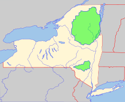
Van Loan Hill is a small mountain in Greene County, New York. It's part of the beautiful Catskill Mountains. You can find it southwest of a place called Maplecrest. Other hills nearby include Round Hill to the west, Elm Ridge to the north, and the East Jewett Range to the south.
Contents
What is Van Loan Hill?
Van Loan Hill isn't just any mountain! It's a special type of hill called a drumlin. A drumlin is a long, oval-shaped hill made of rock and dirt. It was formed by glaciers moving across the land a very long time ago. This happened during the Last Glacial Period, which was the most recent ice age.
The hill might be named after Walton Van Loan. He was a local person who wrote guide books and made maps.
Exploring the Area
In 1999, on a day called National Trails Day, a special area near Van Loan Hill was opened for hiking. This area is about 116 acres and is part of a watershed called the Maplecrest Unit. A watershed is an area of land where all the water drains into a common river or lake. This new hiking area lets people enjoy great views of the surrounding nature.
How to Get There
If you want to see Van Loan Hill by car, there are roads nearby. To the north and east, you can use County Route 40. To the south, there's Round Hills Road. If you go west past Round Hill, you'll find New York State Route 296.
Waterways Around the Hill
The Batavia Kill is a stream that flows along the northern side of Van Loan Hill. To the south, you'll find smaller streams that flow into the East Kill.
Recovering from Storms
The area around Van Loan Hill was hit by two big storms in 2011: Hurricane Irene and Tropical Storm Lee. These storms caused a lot of damage. In 2012, people worked hard to fix the Maplecrest Unit. They helped restore the land and stabilize the streams to prevent future damage.
 | Stephanie Wilson |
 | Charles Bolden |
 | Ronald McNair |
 | Frederick D. Gregory |


