East Kill facts for kids
Quick facts for kids East Kill |
|
|---|---|
|
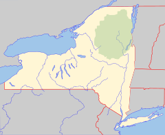
Location of mouth within New York
|
|
| Country | United States |
| State | New York |
| Region | Catskill Mountains |
| County | Greene |
| Physical characteristics | |
| Main source | 42°13′50″N 74°04′29″W / 42.2306434°N 74.0748589°W |
| River mouth | Schoharie Creek Jewett Center 1,381 ft (421 m) 42°14′11″N 74°19′09″W / 42.2364758°N 74.3190350°W |
| Length | 16 mi (26 km) |
| Basin features | |
| Basin size | 36.3 sq mi (94 km2) |
| Tributaries |
|
The East Kill is a river that flows for about 16 miles (26 km) in New York. It's a smaller stream that eventually joins the Schoharie Creek. Its waters then travel through the Mohawk River and finally reach the Hudson River.
Because the East Kill flows into the Schoharie Creek upstream of the Schoharie Reservoir, its water is an important part of the New York City water supply system. The river collects water from the southern parts of the Blackhead Mountains. These mountains include Thomas Cole Mountain, Black Dome, and Blackhead Mountain. These are some of the tallest peaks in the Catskill Mountains.
The area of land that drains into the East Kill is called its watershed. This watershed covers about 36.3 square miles (94 km2). It makes up a small but important part of the larger Schoharie Creek watershed.
Contents
Where Does the East Kill Flow?
The East Kill starts as a mountain stream. It drops quickly at first, losing about 780 feet (240 m) in its first mile. Then, it slows down a bit, dropping about 200 feet (61 m) in the next mile. For the rest of its journey, the river drops about 42 feet (13 m) per mile until it meets the Schoharie Creek.
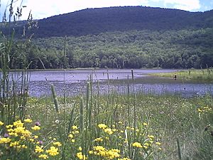
The East Kill begins on the slopes of Stoppel Point. It flows northwest, then turns west. After a short distance, it flows into Colgate Lake, which is a 29 acres (12 ha) lake. After leaving the lake, it passes by the East Kill Valley Church.
Soon, another stream called Halsey Brook joins the East Kill from the north. Halsey Brook drains water from Black Dome and Thomas Cole Mountain. These are two of the highest peaks in the Catskills. The East Kill then turns north, goes through East Jewett, and turns back west. It then reaches Camp Beecher, where it turns north again and flows next to State Route 296. After a short distance, it turns west and goes under State Route 296.
Soon after, Roaring Brook joins the East Kill from the north. Roaring Brook drains part of Cave Mountain. Finally, the East Kill turns southwest and meets the Schoharie Creek in Jewett Center.
What is the East Kill Watershed Like?
The East Kill's watershed covers about 36.25 square miles (93.9 km2). Most of this area is in the town of Jewett. Smaller parts extend into Windham, Ashland, and Lexington.
The East Kill watershed includes some of the highest mountains in the Catskills. These are the Blackhead Mountains, which include Thomas Cole Mountain, Black Dome, and Blackhead Mountain. The highest point in the East Kill watershed is 3,948 feet (1,203 m) at the top of Black Dome Mountain. The average height of the land in the watershed is about 2,674 feet (815 m).
Most of the land in the watershed, about 90 percent, is undeveloped forest. About 2.5 percent is developed land, and the rest is shrubland. There are also many wetlands (areas where the land is covered by water or is very wet) in the watershed. These wetlands help to filter water and provide homes for wildlife.
A Look Back in Time: East Kill's History
When the first settlers arrived in the East Kill Valley, they often met dangerous animals like bears and wolves. Because of this, many early settlers did not stay long. One man, John Godsell, known as Uncle John, was a very skilled trapper along the creek. He was known for catching many wolves in the valley.
From the late 1700s to the early 1800s, the local economy was strong because people sold hemlock bark. This bark was used to make leather. Later, as more wood was needed, the main business changed to logging. After most of the forests were cut down, dairy farms became the most important way for people to make money in the East Kill valley.
How Was the East Kill Valley Formed?
The Catskill Mountains began to form about 375 million years ago. The East Kill valley itself was shaped much more recently, during the last Ice Age, which ended about 12,000 years ago. As the ice melted, the water created many streams, which eventually formed the East Kill we see today.
The ground in the East Kill area often has a very dense, clay-rich type of soil called "lodgement till." This soil is very compact. The river's path is also shaped by bedrock, which are strong rock layers that limit how much the stream can change its course. You can see examples of this in the waterfalls near the river's source.
Water in the East Kill
How Much Water Flows?
The East Kill watershed gets a lot of rain and snow, about 44 inches (1,100 mm) each year. This makes it one of the wettest places in the Catskills. Most of the rain comes from summer thunderstorms, leftover hurricanes, or rain falling on snow in the spring. Because the land is steep and it rains a lot, the East Kill can have flash floods during big storms. However, most of the watershed is covered by forests, which helps to slow down the water.
The United States Geological Survey (USGS) has a special station on Mill Hollow Road that measures how much water flows in the East Kill. The most water ever recorded there was 28,400 cubic feet (800 m3) per second on August 28, 2011, when Hurricane Irene passed through the area. The least amount of water recorded was 0.84 cubic feet (0.024 m3) per second on August 13, 1997.
Is the Water Clean?
A study done in 2005 and 2006 showed that the East Kill has good water quality. It also showed that aquatic life (animals and plants living in the water) was healthy. The study found no problems that would stop people from enjoying activities like swimming or fishing. In the past, there was some erosion along the riverbanks, but the East Kill doesn't seem to have as many problems with mud and cloudiness as other streams in the area. However, the East Kill, along with the West Kill and Batavia Kill, does contribute some sediment to the Schoharie Reservoir.
The New York State Department of Environmental Conservation (NYSDEC) rates the East Kill's water as Class C. This means it's good for fishing and other fun activities where you don't touch the water directly. They also add "(TS)," which means the water is perfect for trout to lay their eggs. The water is clean enough to be part of the New York City water supply system. After flowing into the Schoharie Creek, the water is collected at the Schoharie Reservoir. From there, it can be sent through the Shandaken Tunnel to the Esopus Creek at Shandaken. Then it goes to the Ashokan Reservoir, which provides 10 percent of New York City's water, and finally to homes without needing extra filtering.
Protecting Against Floods
In 2006, the Greene County Soil and Water Conservation District and the DEP created a plan to manage the East Kill. They looked at the stream in detail to find areas that needed help with animal habitats and flood control. They then made suggestions for improvements.
After a flood in January 1996 caused damage along the creek, some parts of the river had to be rebuilt. For example, a section near the Farber Farm was rebuilt to prevent future flood damage. These projects also made the river a better home for aquatic life and improved water quality. In 2011, another project fixed an area where the creek had changed its path closer to Colgate Lake road. This project protected the road and involved planting native trees and shrubs to reduce erosion and prevent future flood damage.
Fishing in the East Kill
The East Kill is mostly a cold water stream. This means the water stays cool enough for fish like brook trout, which need water cooler than 72 °F (22 °C). About 2,700 brown trout are added to the creek each year, from its mouth up to just below Colgate Lake. Upstream of that point, there are enough wild trout, so no extra fish need to be added. The wild trout are mainly brown trout up to Harriman Lake, and mostly brook trout upstream of Harriman Lake.
Studies in 2000, 2002, and 2003 found many types of fish in the creek. Besides brown trout and brook trout, they found creek chub, common shiner, pumpkinseed, bluegill, white sucker, stone roller, cutlips minnow, and marginated madtom. Even though the East Kill is a cold water stream, largemouth bass, which prefer warmer water, were also found often in a 2006 study. These bass likely came from nearby ponds or were put into the stream.
To help people go fishing, the NYSDEC has gotten permission from landowners to allow public fishing along certain parts of the creek. On the lower part of the stream, you can fish on both sides of the creek from its mouth up to Roaring Brook. Colgate Lake, which is located along the East Kill within the Colgate Lake Wild Forest, is a popular spot for fishing all year round. About 750 brown trout, 8 to 15 inches (20 to 38 cm) long, are stocked there each year. The lake is also a great place for kayaking and has six campsites.
 | Tommie Smith |
 | Simone Manuel |
 | Shani Davis |
 | Simone Biles |
 | Alice Coachman |


