Villa Guerrero, Jalisco facts for kids
Quick facts for kids
Villa Guerrero
|
|
|---|---|
|
Municipality
|
|
 |
|
 |
|
| Country | |
| State | Jalisco |
| Area | |
| • Total | 673.3 km2 (260.0 sq mi) |
| • Seat | 2.42 km2 (0.93 sq mi) |
| Elevation | 1,767 m (5,797 ft) |
| Population
(2020 census)
|
|
| • Total | 5,525 |
| • Density | 8.2059/km2 (21.253/sq mi) |
| • Seat | 4,023 |
| • Seat density | 1,662/km2 (4,306/sq mi) |
| Demonym(s) | Villa Guerrense |
| Time zone | UTC-6 (Central (US Central)) |
| • Summer (DST) | UTC-5 (Central) |
| Postal code |
46-100
|
| Area code(s) | (52) 437 |
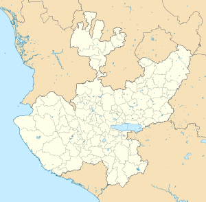
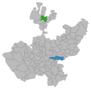
Villa Guerrero is a special area called a municipality in the northern part of Jalisco, a state in México. It sits between certain lines of longitude and latitude, about 1,767 meters (5,797 feet) above sea level. This municipality covers an area of about 673.3 square kilometers (260 square miles).
Contents
People and Places in Villa Guerrero
In 2005, about 5,182 people lived in the municipality. Most of them, 3,503 people, lived in the main town, which is also called Villa Guerrero. The rest of the people lived in smaller villages and areas nearby.
Some of these other places include:
- Ojo de Agua
- Azqueltán
- Santa Rita
- Las Adjuntas
- Izolta
- La Nopalera
- La Cienega de Marquez
- Uribes
- Patagua
In recent years, the number of people living here has gone down. This is mostly because many people have moved away to other places. In 2000, many people worked in farming and raising animals. Others worked in building things, selling goods, or making products.
A Look Back in Time: The History of Villa Guerrero
Before the Spanish arrived, the area of Villa Guerrero was home to the Tepehuan people. In 1530, a Spanish captain named Pedro Almíndez Chirino took control of the area. He was sent by Nuño Beltrán de Guzmán. Soon after, the Huichol (Wixarika) moved into the deep canyons and mountains nearby. Later, in the late 1500s, some Tlaxcaltec people also came to settle here with the Spanish.
The area was first called "Xonacatic." This name means "place of onions," but it referred to wild onions, like chives, that grow in wet, muddy places.
Early Spanish Settlements and Challenges
The first Spanish land grant in this area was given in 1579 to Luis de los Rios Proaño. This land was about 120 square kilometers (46 square miles) in the Juanacatic valley. Franciscans, a group of religious people, started missions here in the late 1500s.
In the early 1600s, the Wixarika and Tepecan people fought back against the Spanish. This caused the few Spanish settlers to leave the area for a while. Later, in 1622, new owners took interest in the land. By 1673, the place was a farm and ranch called Juanacatic, owned by a Spanish captain.
The Saltpeter Era and Indigenous Rights
Around 1676, a Spanish military leader started digging for saltpeter in the valley. Saltpeter was used to make gunpowder. Because of this, the place became known as El Salitre. However, digging for saltpeter became too expensive, and it was hard to find enough workers, so the mining stopped.
In 1702, the Tepehuan and Wixarika people from the mountains rebelled again. As a result, the Spanish Crown made a deal. A major Spanish landowner had to trade some of her farm land for land in the canyon. This way, the Tepehuan people got back some of their old lands in a place called Patahua. They officially received the land in 1733.
Growth and New Beginnings
By 1779, more Europeans were moving into the area. Farming and raising animals grew because of the mining happening in nearby Bolaños. El Salitre became a regular stop for mule trains carrying ore out of the canyon.
During the Mexican War for Independence in 1810, several battles took place here. Many local indigenous groups, including the Wixarika, fought on the side of the Spanish Crown.
After Mexico became independent in 1821, new laws changed how indigenous communities were treated. The shared lands of the Tepehuan people were divided among individuals. In 1838, the area became part of Jalisco state and was linked to the municipality of Totatiche.
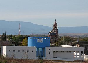
Construction on a stone church in El Salitre began in 1905. It took almost 20 years to finish, partly because of the Mexican Revolution. In 1921, El Salitre became its own independent municipality, separate from Totatiche. It was renamed Villa Guerrero to honor Vicente Guerrero, a hero of Mexican independence.
Nature and Landscape of Villa Guerrero
Where Villa Guerrero Is Located
Villa Guerrero shares its northern border with the state of Zacatecas and the Mezquitic Municipality. To the south, it borders Bolaños Municipality and Chimaltitán Municipality. On the east, it touches Totatiche Municipality, and to the west, it borders Mezquitic Municipality again.
Mountains and Valleys
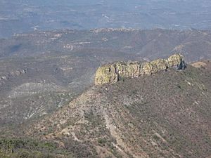
The land in Villa Guerrero is mostly mountainous, making up 46% of the area. About 34% is flat plains, and 20% is rolling hills. The height of the land changes a lot, from 900 meters (2,950 feet) to 2,100 meters (6,900 feet) above sea level.
Some of the highest points are:
- Mount of the Cross (Cerro de la Cruz) in the north.
- White Deer Mountain (Cerro del Venado Blanco) in the west.
- The Toril and Chihuahua Mesas (flat-topped hills).
- Pine Mountain (Cerro del Pino) and Thistles Mountain (Cerro de los Cardos) in the south and southeast.
Rivers and Streams
The main water source for the municipality is the Bolaños River. Other rivers that flow all year include the Sataray River, Blue Puddle (Charco Azul) River, and La Villa River. There are also many streams that flow only during the rainy season, like Chihuahua Creek and Juanacatic Creek.
Weather Patterns
Villa Guerrero has a semi-dry climate. This means winters and springs are dry. The winter is mild and dry, without a clear spring season. The average temperature for the year is about 18.7°C (65.7°F). It can get as high as 27.6°C (81.7°F) and as low as 9.8°C (49.6°F).
The rainy season is in June, July, and August. During these months, the area gets about 803.2 millimeters (31.6 inches) of rain. On average, there are 11 days of frost each year. The wind usually blows from the southeast.
Plants and Animals
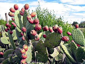
In the highest parts of the municipality, you can find natural forests with pine trees. Lower down, oak and live oak trees are common. The hills and lower areas have different types of cacti, acacia trees, Arizona kidneywood, and other plants. The flat areas and foothills are covered with natural grasses. Wild cacti like Stenocereus queretaroensis and Opuntia (prickly pear) also grow freely.
Many animals live in this region, including:
How Land is Used
The soil in Villa Guerrero is made up of different types, including Haplic Feozem, Regosol, and Chromic Luvisol. The municipality covers about 1,092.03 square kilometers (270,000 acres).
Here's how the land is used:
- 282.98 square kilometers (70,000 acres) are used for farming.
- 2,330.26 square kilometers (576,000 acres) are used for raising animals.
- 500 square kilometers (120,000 acres) are for forests.
- 0.3 square kilometers (74 acres) are urban areas (towns and cities).
- 75.73 square kilometers (18,713 acres) are used for other things.
Most of the land, 1047.03 square kilometers (258,726 acres), is owned by private people or groups. About 45 square kilometers (11,000 acres) are communal property, meaning they are owned and used by the community together.
 | John T. Biggers |
 | Thomas Blackshear |
 | Mark Bradford |
 | Beverly Buchanan |


