
Waihou River facts for kids
Quick facts for kids Waihou River |
|
|---|---|

The Waihou River near Putaruru
|
|

The Waihou River system
|
|
| Native name | Waihou |
| Other name(s) | Thames River |
| Country | New Zealand |
| Region | Waikato |
| Physical characteristics | |
| Main source | Mamaku Ranges 38°4′34″S 176°1′52″E / 38.07611°S 176.03111°E |
| River mouth | Firth of Thames Sea level 37°10′5″S 175°32′30″E / 37.16806°S 175.54167°E |
| Length | 150 kilometres (93 mi) |
| Basin features | |
| Tributaries |
|
| Bridges | Kopu Bridge |
The Waihou River is a long river in the northern part of New Zealand's North Island. It was once called the Thames River by Captain James Cook in 1769. He explored about 14 miles (23 km) of the river from its mouth. An even older name from the Māori people was "Wai Kahou Rounga". In 1947, the New Zealand Geographic Board officially decided its name would be Waihou.
Contents
Where is the Waihou River Located?
The Waihou River starts in the Mamaku Ranges and flows north for about 150 kilometers (93 miles). It passes by several towns like Putaruru, Te Aroha, Paeroa, and Turua. Finally, it reaches the Firth of Thames at the southern end of the Hauraki Gulf, close to the town of Thames.
The Hauraki Plains and Important Bridges
Near the ocean, the Waihou River and the nearby Piako River create the wide, flat alluvial Hauraki Plains. This area is made of rich soil carried by the rivers.
An important bridge called Kopu Bridge crosses the Waihou River just before it reaches the sea. This bridge is part of New Zealand State Highway 25. It used to be the country's longest single-lane bridge, measuring 463 meters (1,519 feet). It was also the only swing bridge left on a New Zealand state highway. A swing bridge can open to let boats pass. People often had to wait in long lines at this bridge, especially when traveling to the Coromandel Peninsula. A new two-lane bridge opened in December 2011, making travel much easier.
River Changes Over Time
In 1879, a waterfall called the Falls of Awotonga was removed using dynamite. This was done to make it easier for ships to travel up the river. About 200 pounds (91 kg) of dynamite caused a water column 150 meters (490 feet) high. Other parts of the river had been cleared in similar ways in earlier years.
In the 1910s, special walls called stopbanks and floodgates were built along the Waihou River. These structures help protect farmland from flooding. A canal was also built where the Waihou River and Ohinemuri River meet, west of Paeroa. More work was done in the 1980s after a big flood in 1981.
Who Lived Along the Waihou River?
Many areas along the Waihou River were home to the Hauraki Māori people. They built fortified villages called pā. Some examples include Oruarangi pā and Paterangi pā near Matatoki, and Te Raupa pā and Waiwhau pā near Paeroa. These places show the long history of Māori settlement in the area.
Fun Activities on the Waihou River
The Waihou River is known for its very clear water, which makes it a great place for fishing. Many rainbow trout and brown trout live in the river. A study in 2009 found that the upper part of the river had more than 700 fish per kilometer! This makes it a popular spot for anglers.
Images for kids
-
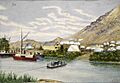
A painting of the Waihou River, entitled Dibsell's Landing, by John Philemon Backhouse
-
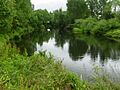
Waihou River


See also
 In Spanish: Río Waihou para niños
