Hauraki Plains facts for kids
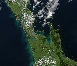
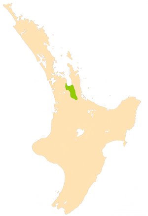
The Hauraki Plains are a large, flat area in the northern part of New Zealand's North Island. They are about 75 kilometres south-east of Auckland, near the bottom of the Coromandel Peninsula. This area is a wide valley, surrounded by hills and mountain ranges like the Hunua Ranges, Coromandel Range, and Kaimai Range.
This flat land was formed by mud and sand brought down by the Piako River and Waihou River, which flow north into the Firth of Thames. Long ago, the Waikato River also helped create these plains. Because of this, the land is very flat, often swampy, and has a lot of peat (decayed plant matter). This makes it excellent for dairy farming.
The main business here is dairy farming, but other types of farming also happen. Lately, more people are visiting the Hauraki Plains for tourism. The Hauraki Rail Trail, a popular bike path, runs through the area.
The biggest town completely within the Plains is Ngatea. Smaller towns include Turua and Paeroa, which is on the eastern edge. The southern part of the Hauraki Plains is generally considered to end around the towns of Te Aroha and Morrinsville.
Contents
People of the Hauraki Plains
| Historical population | ||
|---|---|---|
| Year | Pop. | ±% p.a. |
| 2006 | 3,963 | — |
| 2013 | 3,810 | −0.56% |
| 2018 | 4,053 | +1.24% |
In 2018, about 4,053 people lived in the northern part of the Hauraki Plains. This was an increase of 243 people since 2013. There were slightly more males than females. About 927 people (almost a quarter) were under 15 years old.
Most people living here are of European (Pākehā) background, making up about 86.6% of the population. About 20.2% are Māori, and smaller numbers are from Pacific Islands or Asia. Many people (59.5%) said they had no religion, while 26.6% were Christian.
History of the Plains
How the Hauraki Plains Formed
Millions of years ago, a huge part of the Earth's crust sank down, creating a deep valley called the Hauraki graben (a sunken block of land). The ancient Waikato River often flowed through this valley, filling it with pumice (light volcanic rock), mud, and gravel. This process slowly built up the land we see today.
The Original Wetlands
After the Waikato River changed its path to the west coast, the Waihou River and Piako River became the main rivers flowing through the Hauraki Plains. These rivers carried silt (fine sand and mud) into the Firth of Thames.
Before European settlers arrived, the plains were a huge wetland. They were covered in mangroves, raupo (a type of reed), harakeke (flax), and thick forests of kahikatea trees. It was a very wet, swampy area, perfect for wild ducks and eels. The rich plants and animals provided plenty of food for the Māori people who lived there. Many Māori settlements, called pā, were located along the Waihou River.
Early European settlers came for the tall kahikatea trees, which were good for timber. Timber millers, like the Bagnall family who settled in Turua in 1875, started cutting down these trees. After the trees were cleared, farmers wanted to use the land. However, the Waihou and Piako Rivers would flood every year, making farming very hard.
The settlers wanted to drain the land, but the government thought it was impossible because some parts of the plains were even below sea level! But in 1908, a law was passed to allow the land to be drained. The government paid workers to dig drains, a huge job that took ten years.
First Land Sales
In 1910, the government decided to open up about 16,299 hectares (163 square kilometres) of the Hauraki Plains for settlement. People interested in farming could apply for blocks of land. Many miners from the South Island were keen to move there. The first applications were made in Thames on May 18, 1910. Land prices ranged from $10 to $15 an acre. Some blocks were very popular, with almost 100 people wanting them.
How the Drainage System Works
Work began right after the Hauraki Plains Act was passed. A key challenge was stopping the Piako River from flooding every year. Workers built stop-banks (raised earth walls) to prevent floods and high tides from overflowing the riverbanks.
Farmers also had to dig drains, one to two metres wide, across their own land. These smaller drains connected to larger main drains, which carried the water away into canals. Special floodgates were put in place. These gates stop water from flowing into the canals from the sea but let floodwaters flow out. Because of this big drainage project, the wetlands shrank to less than 25% of their original size.
Once the land was mostly drained, farmers had to clear away scrub, logs, and tree stumps. They then leveled the ground and burned off waste to prepare the land for pasture (grassland for animals).
River Travel and Transport
In the early days, before good roads were built, rivers were the best way to move goods, people, and animals around the Hauraki Plains.
Ships on the Rivers
Many different kinds of boats used the rivers, from small rowboats to large sailing ships called barques. Most were steamers, and their engines were often made in Thames.
As industries grew, especially mining in Waihi, bigger ships were needed to carry heavier loads. Some passenger ships were very fancy, with comfortable lounges and even brass bands for dancing! There was also space for horses and other cargo. Some cargo boats had sides that could drop down, making it easier to load and unload goods and animals on the riverbanks.
In 1877, huge barques sailed up to Bagnalls’ mill in Turua to pick up kahikatea logs. These logs were taken to Auckland and Australia. You can still see parts of the old wharf where these ships docked.
Before bridges were common, there were punts (floating platforms) at places like Orchard (now Ngatea), Pipiroa, Kopu, and Paeroa. These punts carried people, horses, and carts across the rivers for a small fee.
The River Systems
Geologists say that long ago, the Waikato River flowed through the Hinuera valley, filling the Hauraki Basin with pumice, mud, and gravel. You can still see signs of old sea beaches in some areas.
Before Europeans arrived, the Hauraki Plains were about 400 square kilometres of peat and swamp land. This area acted like a giant pond, with two main rivers flowing through it: the Waihou and the Piako River.
Māori people used these rivers for hundreds of years to reach the rich food sources in the swamp. When Europeans came, they also relied on the rivers for transport because there were no roads in the swampy land.
The discovery of gold brought many ships up the Waihou and Ohinimuri rivers, carrying heavy machinery and miners. A special strong wharf was even built at Paeroa to handle the weight of the machines being unloaded.
Bagnalls’ mill at Turua was set up to cut down the tall kahikatea trees. Huge sailing ships came up the river on high tides to collect the wood, some of which was sent to Australia to make butter boxes.
After the trees and scrub were cleared, farming began. Farmers needed everything from food to animals, and boats on the rivers brought it all in.
In the early days, the rivers were like lifelines for the Hauraki Plains. But as roads improved and bridges were built, river transport became less important. Today, most river transport has stopped, except for a ferry that goes up the Waihou to Paeroa from Auckland, and a barge that picks up metal at Kopu.
The Waihou River
In 1769, Captain James Cook was the first European to travel up the Waihou River. He was amazed by the "lofty trees" along its banks. The river reminded him of the River Thames in London, so he named it the River Thames. This name was used for a long time, but now it's known as the Waihou. Cook's discovery of the kahikatea tree later brought many ships to the area looking for tall trees for ship masts.
In the early 1900s, the Waihou River was deep enough for boats to travel all the way up to Matamata. As you went upstream, you would pass towns like Kopu, Turua, Matatoki, Puriri, Hikutaia, Paeroa, Te Aroha, and finally Matamata.
The Piako River
The Piako River is smaller than the Waihou, but it was just as important for developing the Hauraki Plains. Traveling up the Piako, you would see towns like Pipiroa, then Ngatea, followed by Kerepehi, and the last town reachable by boat was Patetonga.
Supplies were brought up the Piako by small boats. These boats were the main connection to the outside world for the early settlers, many of whom were single men. It was easier for them to get stale bread delivered weekly by boat than to bake it themselves. The boat also brought mail and took cream back to Kopu, a trip that took four hours.
The rivers were vital for the plains in the early days. While not as busy as they once were, they are still a part of daily life.
Industries of the Plains
Dairy Farming
Dairy farming is the most important industry on the Hauraki Plains. It brings in the most money for the area. Dairy farms here can have anywhere from 100 to over 500 cows. A large part of the plains, about 66% of the land (779.34 square kilometres), is used for dairy farming.
Other Types of Farming
While dairy farming is the main industry, it's not the only one. Sheep farming and dry stock farming (raising animals like beef cattle) are also becoming more popular. There is still a need for wool and meat, and the Hauraki Plains helps provide these. There's even an ostrich farm near Turua that offers tourism, sells meat, and has a gift shop.
Schools in the Hauraki Plains
There are primary schools in Ngatea, Kaihere, Pipiroa, Waitakaruru, and Turua.
For high school, students can attend Hauraki Plains College in Ngatea, Paeroa College, or Thames High School.
Protecting the Wetlands
In the 1840s, it's thought that about 1,100 square kilometres of wetland covered the lower Waikato area and Hauraki Plains. Since then, 85% to 90% of New Zealand's wetlands have been lost. The Department of Conservation (DOC) believes that about 320 square kilometres of wetlands remain in the Waikato region. This is about 25% of their original size.
Roughly 80% of New Zealand's remaining wetlands are in the Waikato region, mostly in the Waikato, Matamata-Piako, and Hauraki Districts. Five of New Zealand's wetlands are so important that they are listed under an international agreement called the Ramsar Convention. Three of these are in the Waikato Region:
Kopuatai Peat Dome
The Kopuatai Peat Dome is New Zealand's largest natural peat bog, covering 9,238.44 hectares. It is also unique in the world. This area is protected as a Wetland Management Reserve under the Conservation Act 1987 and is looked after by the Department of Conservation.
Many different bird species live in the Kopuatai Peat Dome, with 54 types recorded. Twenty-seven of these are protected. Endangered birds like the Australasian bittern and the North Island fernbird can be found here, along with the banded rail and marsh crake.
See also
 In Spanish: Llanuras Hauraki para niños
 | Charles R. Drew |
 | Benjamin Banneker |
 | Jane C. Wright |
 | Roger Arliner Young |


