Wales Island (British Columbia) facts for kids

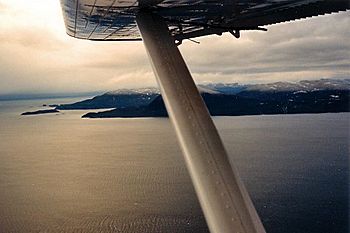
Wales Island looking northwards from Portland Inlet
|
|
|
Wales Island (British Columbia)
|
|
| Geography | |
|---|---|
| Location | Dixon Entrance |
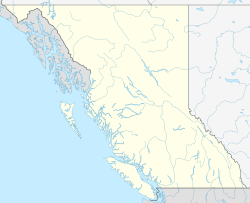
| Coordinates | 54°45′N 130°29′W / 54.750°N 130.483°W |
| Area | 35 sq mi (91 km2) |
| Coastline | 33 mi (53 km) |
| Administration | |
|
Canada
|
|
| Province | British Columbia |
| Regional District | Skeena-Queen Charlotte Regional District |
| Demographics | |
| Population | uninhabited (2006) |
Wales Island is a beautiful island located off the North Coast of British Columbia, Canada. It sits near the Dixon Entrance, which is like a big watery doorway to the Portland Inlet.
This island is about 91 square kilometers (35 square miles) in size. It is located about 48 kilometers (30 miles) north of the city of Prince Rupert. It is also about 89 kilometers (55 miles) south-east of Ketchikan, Alaska.
Wales Island has water all around it! To the north, you'll find the Pearse Canal and Wales Passage. To the south, there's Tongass Passage and Portland Inlet. A cool fact is that the border between Alaska and British Columbia actually runs through Pearse Canal. This means if you stand on the north-west shore of Wales Island, you can look right across to Alaska! Specifically, you can see Fillmore Island in the Misty Fjords National Monument. Close by in Canada, to the northeast, is Pearse Island.
Contents
How Wales Island Got Its Name
In August 1793, a famous explorer named Captain George Vancouver was exploring the west coast of North America. He was sailing on his ship, HMS Discovery. During his journey, he named a spot called Wales Point. This point was at the entrance to Portland Inlet.
Captain Vancouver named it after William Wales, who was a master at a special school in London. Both William Wales and Captain Vancouver had sailed together with Captain James Cook on his second trip around the world (1772–1775). Back then, Vancouver was a young midshipman, and Wales was the ship's astronomer. Vancouver later said that William Wales taught him important navigation skills. These skills helped Vancouver explore the Pacific in the 1790s. Vancouver also joined Captain Cook on his third and final voyage (1776–1779).
Later, in 1871, an official in Britain officially named the island "Wales Island." This was done to connect it with Wales Point, which Captain Vancouver had named almost 80 years earlier.
A Border Mystery: The Alaska Boundary Dispute
For a long time, Wales Island played a big role in a disagreement called the Alaska Boundary Dispute. This was a fight over where the border should be between Canada and the United States.
The problem started way back in 1825. Russia and Great Britain signed a treaty to try and draw a line between Alaska (which Russia owned then) and what was called British North America. This treaty said that the southern border of Alaska would go through Portland Canal. This would have put Wales Island in Alaskan territory.
The situation changed when Russia sold Alaska to the United States in 1867. Four years later, in 1871, British Columbia became a province of Canada. Between 1871 and 1903, both Canadian and American teams explored and mapped this rugged area. They often worked together.
In 1896, the United States Army built four stone houses in the Portland Canal area. This was to show that America believed the Canal was part of Alaska. One of these strong buildings was on the south shore of Wales Island. Another one, on the border between Stewart, BC, and Hyder, Alaska, can still be seen today!
Two years later, in 1898, the Klondike Gold Rush happened. People found lots of gold in the far north. This made both Canada and the United States realize they really needed to figure out the border quickly.
This led to a new agreement called the Hay-Herbert Treaty in January 1903. This treaty set up a special group called a tribunal. This tribunal would decide exactly where the border should be. Over the next few months, representatives from Canada, America, and Britain measured, mapped, and discussed. In October 1903, they announced their decision. One big result was that Wales Island officially became part of British Columbia.
The Wales Island Cannery
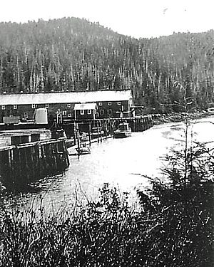
In 1902, before the border was settled, a salmon cannery was built on the north-west side of Wales Island. A cannery is a factory where fish are processed and put into cans. At that time, people thought Wales Island was still part of the U.S.
But after the 1903 border decision, the American owners of the cannery lost their property. By then, they had already canned over 3,500 cases of salmon!
Another cannery, called Hidden Inlet Cannery, was about 23 kilometers (14 miles) further north. It ended up in Alaskan territory. In 1910, Merrill DesBrisay, who used to own Hidden Inlet Cannery, bought the Wales Island Cannery and rebuilt it.
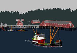
For the next 14 years, his company operated the cannery. Then, in 1925, they sold it to the Canadian Fishing Company. Wales Island Cannery had its best year in 1924, canning 50,000 cases of salmon! It made its last batch of 26,000 cases in 1949. It was the last of eleven canneries to operate in the Nass River-Portland Canal area.
For several years after that, the cannery was used as a summer fishing station. It was finally abandoned in the late 1950s. Today, a fishing lodge called Eagle Pointe is located where the old Wales Island Cannery used to be.
A final interesting fact: In 1936, the U.S. government gave $100,000 to the former American owners of Wales Island Cannery. This was to make up for them losing their property 33 years earlier.
Nature and Wildlife
Wales Island is located at the northern edge of the Hecate Lowland Ecosection. This area is a narrow strip of rainforest and islands that was once covered by glaciers. It stretches from Portland Inlet in the north down to Queen Charlotte Strait in the south.
The land on Wales Island is generally rough and rocky. It has many areas of wet, spongy ground called muskeg wetland and bog forest. You can find trees like western red cedar, yellow cedar, mountain hemlock, and fir. Underneath the trees, you'll commonly see plants like salal, ferns, berry bushes, and skunk cabbage. The weather here is often windy with heavy rainfall. This is because of the air currents coming from Dixon Entrance.
Many different kinds of waterfowl (birds that live near water) can be found in the protected inlets and bays along Wales Island's 53-kilometer (33-mile) coastline. These birds include murre, grebe, murrelet, gull, tern, loon, auklet, petrel, and eagle. The island's landscape provides many places for seabirds to breed and nest. It is also an important stop along the Pacific coast for birds migrating (traveling long distances).
 | Leon Lynch |
 | Milton P. Webster |
 | Ferdinand Smith |


