
Wamego, Kansas facts for kids
Quick facts for kids
Wamego, Kansas
|
|
|---|---|

Location within Pottawatomie County and Kansas
|
|

|
|
| Country | United States |
| State | Kansas |
| County | Pottawatomie |
| Platted | 1866 |
| Incorporated | 1869 |
| Area | |
| • Total | 2.41 sq mi (6.25 km2) |
| • Land | 2.37 sq mi (6.14 km2) |
| • Water | 0.04 sq mi (0.10 km2) |
| Elevation | 1,053 ft (321 m) |
| Population
(2020)
|
|
| • Total | 4,841 |
| • Density | 2,009/sq mi (774.6/km2) |
| Time zone | UTC-6 (CST) |
| • Summer (DST) | UTC-5 (CDT) |
| ZIP code |
66547
|
| Area code | 785 |
| FIPS code | 20-75325 |
| GNIS ID | 2397188 |
Wamego /wɔːˈmiːɡoʊ/ is a city in Pottawatomie County, Kansas, United States. In 2020, about 4,841 people lived there.
Contents
A Look at Wamego's Past
Wamego was officially planned out in 1866. It was named after an important Potawatomi Native American chief. The first post office in Wamego opened its doors in October 1866.
Where is Wamego Located?
Wamego covers about 2.25 square miles (5.83 km2) of land. Most of this area is land, with a small part being water.
The city is found where U.S. Route 24 and K-99 roads meet. It is about 14 mi (23 km) east of Manhattan. Wamego is also about 42 mi (68 km) west of Topeka. The Kansas River flows right along the southern edge of the city.
Wamego's Climate
Wamego has a climate with hot and humid summers. The winters are usually mild to cool. This type of weather is known as a humid subtropical climate.
Who Lives in Wamego?
| Historical population | |||
|---|---|---|---|
| Census | Pop. | %± | |
| 1890 | 1,473 | — | |
| 1900 | 1,618 | 9.8% | |
| 1910 | 1,714 | 5.9% | |
| 1920 | 1,585 | −7.5% | |
| 1930 | 1,647 | 3.9% | |
| 1940 | 1,767 | 7.3% | |
| 1950 | 1,869 | 5.8% | |
| 1960 | 2,363 | 26.4% | |
| 1970 | 2,507 | 6.1% | |
| 1980 | 3,159 | 26.0% | |
| 1990 | 3,706 | 17.3% | |
| 2000 | 4,246 | 14.6% | |
| 2010 | 4,372 | 3.0% | |
| 2020 | 4,841 | 10.7% | |
| U.S. Decennial Census | |||
Wamego is part of the larger Manhattan, Kansas Metropolitan Statistical Area.
Population in 2010
In 2010, Wamego had 4,372 people living there. There were 1,758 homes. The city had about 1,978 people per square mile.
Most of the people in Wamego were White (94.1%). A smaller number were African American (0.8%), Native American (0.6%), or Asian (0.5%). About 3.9% of the population was Hispanic or Latino.
About 37.3% of homes had children under 18. The average age in Wamego was 33.3 years old.
What Wamego is Known For
The main industry in Wamego is agriculture, which means farming. The wide river valley is great for growing crops like alfalfa, sweetcorn, maize (corn), and wheat. In the hills, you can find cattle grazing. There's even a factory in Wamego that processes alfalfa.
Another important industry is a factory that makes parts for large construction machines. This factory is owned by Caterpillar, Inc.. Many people who live in Wamego also travel to nearby cities like Manhattan and Topeka for work.
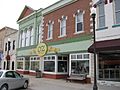
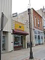
Fun Places to Visit in Wamego
Wamego City Park

Wamego has a 12-acre park right in the middle of town. It has several cool historical spots. You can see the Dutch Mill, which is a stone windmill built in 1879. The Wamego Historical Museum and Prairie Town Village are also in the park. Prairie Town Village is a collection of old buildings from the 1800s that show Wamego's history. The park also has a swimming pool, tennis courts, a playground, and a pond where you can fish.
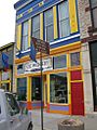
Oz Museum
Wamego is home to a special museum all about The Wizard of Oz. It has over 25,000 items related to Oz! The museum opened in 2004. Because of the museum, other businesses with an Oz theme have opened up nearby. These include the Oz Winery, Lincoln Street Station, Barleycorns, and Toto's Tacoz.
Every first weekend in October, Wamego hosts its Annual OZtoberFEST. This is a street festival with an Oz theme. You can often find hot air balloon rides, a beer garden, a bike ride called the Yellow Brick Road Bike Ride, and local music or plays.
-
OZ Museum (2008)
-
OZ Winery (2008)
-
Toto's Tacoz (2008)


Other Interesting Spots
- The Columbian Theatre
- Wamego City Park, Windmill, and Wamego Area Veterans Memorial
- Poppyfield Gallery
- Wamego Public Library
- Patti Page Exhibit
Wamego in Movies
Wamego was used as a filming location for the independent movie Firecracker. This film was a crime drama directed by Steve Balderson.
Learning in Wamego
The public schools in Wamego are part of the Wamego USD 320 district. They offer education from Kindergarten all the way through 12th grade. Highland Community College also has a campus in the city.
Famous People from Wamego
- Steve Balderson, a filmmaker
- Benjamin Butler, a painter
- Walter Chrysler, who founded the Chrysler Corporation, was born in Wamego. His family moved away soon after.
- Delmas Hill, a federal judge
- Travis Metcalf, a professional baseball player
- Wiley Taylor, a professional baseball player
See also
 In Spanish: Wamego (Kansas) para niños
