Ward's Point facts for kids
|
Ward's Point Archeological Site
|
|

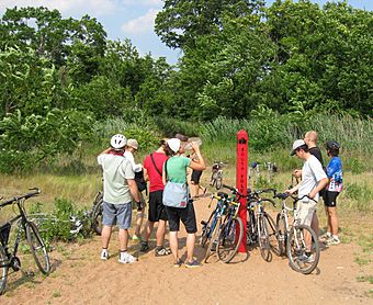
New York City Parks Department "South Pole" marker at Ward's Point
|
|
| Location | Tottenville, Staten Island, New York |
|---|---|
| NRHP reference No. | 93000609 |
Quick facts for kids Significant dates |
|
| Added to NRHP | April 19, 1993 |
| Designated NHL | April 19, 1993 |
|
Ward's Point Conservation Area
|
|
| Lua error in Module:Location_map at line 420: attempt to index field 'wikibase' (a nil value). | |
| Area | 33.5 acres (13.6 ha) |
|---|---|
| NRHP reference No. | 82003402 |
| Added to NRHP | September 29, 1982 |
Ward's Point is the most southern spot in New York State. You can find it in Tottenville, on Staten Island in New York City. It sits where the Arthur Kill river meets the Raritan Bay. Right across the water is Perth Amboy, New Jersey. Today, Ward's Point is part of a bigger area called Conference House Park.
Contents
What is the Ward's Point Conservation Area?
The Ward's Point Conservation Area is a special place. It is both an old archaeological site and a historic district. This means it's an important area where people have found clues about the past. The conservation area includes nine important historical spots. One of these is the Conference House, which became a National Historic Landmark in 1966. This area was set aside to protect information about how Native American people lived on Staten Island long ago. Many ancient remains have been found here. It was added to the National Register of Historic Places in 1982.
What is the Ward's Point Archeological Site?
Close to Ward's Point is the Ward's Point Archeological Site. This is another important archaeological spot inside Conference House Park. It was named a National Historic Landmark in 1993. People have known about this site since 1858, when old human remains were first found. It is one of the biggest and best-preserved places to learn about Native American people in the New York area.
Exploring Burial Ridge
Burial Ridge is a Native American archaeological site. It is also a burial ground located at Ward's Point.
The History of Burial Ridge
The earliest signs of people using this site date back about 8,000 years ago. These were Paleo-Indians, who lived during the Early Archaic Period. The burial ground was used by the Lenape people for a very long time. They used it from the Woodland period until they gave Staten Island to the Dutch. This is the largest Native American burial ground from before Europeans arrived in New York City. Today, it has no markers and is part of Conference House Park.
You can still see signs of ancient Native American life along the beach. When the land wears away, it shows remains of large shell piles called middens. These piles are mostly made of Eastern oyster shells.
People reported finding bodies at Burial Ridge many times in the 1800s, starting in 1858. A researcher named George H. Pepper studied the site. He even uncovered some bodies himself. In 1895, the American Museum of Natural History hired him to do more archaeological research there.
Many of the skeletons found were buried in a special way. Their knees were pulled up to their chests. Fewer were found lying flat. Most graves were not very deep, only about 1 to 3 feet below the ground. Many graves also held special items. These included arrowheads and stone tools like ax heads and hammerstones.
One discovery included the skeletons of three males. Their bones had 23 arrowheads stuck in them. These arrowheads were made from bone, antler, argillite, and flint.
Near these three males, the body of a child was found. It had many items buried with it. These included yellow jasper pendants and different tools. The child's body also showed signs of copper. This means copper ornaments were likely buried with the child. Another skeleton was found lying on its stomach. The part above the knees was completely burned. This suggests the person might have been burned alive.
Images for kids
 | Laphonza Butler |
 | Daisy Bates |
 | Elizabeth Piper Ensley |


