Warden, Washington facts for kids
Quick facts for kids
Warden
|
|
|---|---|
| Warden, Washington | |
 |
|

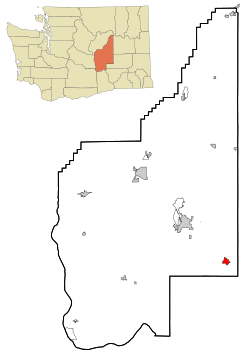
Location of Warden, Washington
|
|
| Country | United States |
| State | Washington |
| County | Grant |
| Area | |
| • Total | 2.95 sq mi (7.65 km2) |
| • Land | 2.93 sq mi (7.60 km2) |
| • Water | 0.02 sq mi (0.05 km2) |
| Elevation | 1,302 ft (397 m) |
| Population
(2020)
|
|
| • Total | 2,449 |
| • Density | 958.75/sq mi (370.12/km2) |
| Time zone | UTC-8 (Pacific (PST)) |
| • Summer (DST) | UTC-7 (PDT) |
| ZIP code |
98857
|
| Area code(s) | 509 |
| FIPS code | 53-76160 |
| GNIS feature ID | 1512775 |
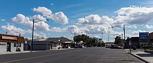
Warden is a city located in Grant County, Washington, United States. In 2020, about 2,449 people lived there. It's a small city with a rich history and a diverse community.
Contents
History of Warden
Early Settlers and Farming
The area where Warden is now was first settled in the late 1800s. Immigrants from Russia and Germany, specifically from a region called Bessarabia, moved here. They became "homesteaders," meaning they claimed and farmed land. They mostly grew wheat without irrigation, which is called dryland wheat. Before these settlers, local Salish Native American tribes lived in the area. They had contact with early Spanish and British traders.
Railroad and Town Name
The Milwaukee Railroad arrived in the early 1900s. This brought more people to the area. One of these new settlers was Doc Harris, who opened a store and offered medical help around 1905.
The name "Warden" comes from the German language spoken by the Bessarabian settlers. It means "worthy" or "treasured." Some local stories say the town was named after Doc Harris's son, Ward. However, old church records show that the German settlers were calling the area "Warden" long before Doc Harris arrived. Other nearby towns, like Lind, Ruff, and Odessa, also have names from this Bessarabian German heritage.
Changing Cultures
Over time, the strong Bessarabian German traditions in Warden faded. The city's culture became a mix of Anglo (English-speaking) and Hispanic influences. Today, about 72% of the people in Warden have Hispanic heritage.
Some Hispanic families have roots in the area that go back even before the German settlers arrived. Later, many more Hispanic people came to work in the fields. This happened after the federal Columbia Basin Project brought irrigation to the area, allowing for more types of farming. Many of these families came from Texas but originally had roots in Mexico. They have a unique "Tejano" culture. More recently, people have moved to Warden from western Mexican states like Jalisco and Sonora. Their culture, including language, music, and food, is different from the Tejanos. Many in this newest group might still speak only Spanish, while others are bilingual or speak only English.
Growth and Development
The Town of Warden officially became a city on June 28, 1910. By 1917, about 300 people lived there. Electricity came to Warden in 1939. However, the population went down during World War II.
A big change happened in 1945 with the start of the Columbia Basin Project. This project brought irrigation water from the Grand Coulee Dam to over 530,000 acres (2,145 square kilometers) of dry but fertile land. In 1948, the government started selling irrigated farm units. Veterans were given first choice. By 1954, a major canal called the East Low Canal was finished. Because of this project, Warden's population grew a lot. It went from 322 people in 1950 to 949 in 1960, and then to 1,639 in 1990. It has continued to grow since then.
Geography of Warden
Warden is located at 46°57′59″N 119°2′35″W / 46.96639°N 119.04306°W. The city covers a total area of about 2.61 square miles (6.76 square kilometers). Most of this area, about 2.58 square miles (6.68 square kilometers), is land, and a small part, about 0.03 square miles (0.08 square kilometers), is water.
Climate in Warden
Warden has a semi-arid climate. This means it's usually dry, but not a desert. It gets some rain, but not a lot.
| Climate data for Warden, Washington | |||||||||||||
|---|---|---|---|---|---|---|---|---|---|---|---|---|---|
| Month | Jan | Feb | Mar | Apr | May | Jun | Jul | Aug | Sep | Oct | Nov | Dec | Year |
| Mean daily maximum °C (°F) | 1 (34) |
6 (43) |
12 (53) |
17 (62) |
22 (71) |
26 (79) |
31 (87) |
29 (85) |
25 (77) |
17 (62) |
8 (46) |
3 (37) |
16 (61) |
| Mean daily minimum °C (°F) | −8 (18) |
−4 (25) |
−1 (30) |
2 (35) |
6 (43) |
10 (50) |
12 (54) |
12 (53) |
7 (45) |
2 (35) |
−2 (28) |
−5 (23) |
3 (37) |
| Average precipitation cm (inches) | 2.5 (1) |
1.8 (0.7) |
1.5 (0.6) |
1.3 (0.5) |
1.8 (0.7) |
1.5 (0.6) |
0.76 (0.3) |
1.0 (0.4) |
1.0 (0.4) |
1.8 (0.7) |
2.5 (1) |
2.8 (1.1) |
20 (7.9) |
| Source: Weatherbase | |||||||||||||
Population Facts
Demographics are facts about a population, like how many people live somewhere, their ages, and their backgrounds.
| Historical population | |||
|---|---|---|---|
| Census | Pop. | %± | |
| 1920 | 173 | — | |
| 1930 | 100 | −42.2% | |
| 1940 | 78 | −22.0% | |
| 1950 | 322 | 312.8% | |
| 1960 | 949 | 194.7% | |
| 1970 | 1,254 | 32.1% | |
| 1980 | 1,479 | 17.9% | |
| 1990 | 1,639 | 10.8% | |
| 2000 | 2,544 | 55.2% | |
| 2010 | 2,692 | 5.8% | |
| 2020 | 2,449 | −9.0% | |
| U.S. Decennial Census 2020 Census |
|||
Warden's Population in 2010
According to the census from 2010, Warden had 2,692 people living in 759 households. A household is a group of people living together in one home. The city had about 1043 people per square mile (403 people per square kilometer), which is called the population density.
- About 48% of the people were White.
- About 46.2% were from other races.
- About 4% were from two or more races.
- A large part of the population, 77.1%, identified as Hispanic or Latino.
Many households (57.7%) had children under 18 living with them. The average household had about 3.55 people. The average age of people in Warden was 24.9 years old. This means it's a relatively young community.
- 39.3% of residents were under 18.
- 10.8% were between 18 and 24.
- 25.1% were between 25 and 44.
- 18.1% were between 45 and 64.
- 6.7% were 65 or older.
The city had slightly more females (51.9%) than males (48.1%).
See also

- In Spanish: Warden (Washington) para niños
 | George Robert Carruthers |
 | Patricia Bath |
 | Jan Ernst Matzeliger |
 | Alexander Miles |

