Warm front facts for kids
A warm front is like a slow-moving boundary where a large mass of warm air meets and moves over a cooler air mass. It's often found in areas of lower air pressure. Warm fronts usually move slower than cold fronts because cold air is heavier and stays closer to the ground. This means the temperature changes across a warm front happen over a larger area.
Before a warm front arrives, you'll often see flat, layered clouds. Rain usually gets heavier as the front gets closer. Sometimes, fog can appear before a warm front passes. After the front moves through, the sky usually clears up, and it gets warmer quickly. If the warm air is unstable (bubbly), thunderstorms might happen within the layered clouds before the front, and even continue after it passes. On weather maps, a warm front is shown with a red line that has half-circles pointing in the direction the front is moving.
Contents
How Warm Fronts Form
Air masses are huge chunks of air that have similar temperature and moisture levels. They form over specific areas. The warm air behind a warm front is not only warmer but often has more moisture than the colder air in front of it.
Because warm air is lighter, it cannot push the cooler, heavier air out of the way. Instead, the warm air gently slides up and over the cooler air. This process is called "overrunning." The boundary between the two air masses is very gentle, like a long, slow ramp.
As the warm air rises, it moves into areas where the air pressure is lower. This causes the air to expand and cool down. When the air cools, any water vapor in it turns into tiny water droplets or ice crystals, forming clouds.
Clouds Before a Warm Front
The first clouds you might see, signaling an approaching warm front, are usually high, wispy cirrus clouds. As the front gets closer, these change to cirrostratus clouds, which look like a thin, whitish veil. If you also see lumpy cirrocumulus clouds, it means the air ahead of the front is becoming more unstable.
When these high clouds slowly cover more of the sky and the air pressure starts to drop, it usually means rain or snow is about 6 to 8 hours away. As these high clouds get thicker and lower, turning into middle-level altostratus or altocumulus clouds, the warm front is closer. Rain or snow might begin in less than six hours.
Once the clouds thicken to about 2,500 meters (8,200 feet) from the ground, steady rain or snow can start falling from thick nimbostratus clouds. If unstable altocumulus clouds that look like small towers appear, or take the place of the altostratus layer, then showers or thunderstorms might follow. Low, flat stratus and stratocumulus clouds often form below the main rain-producing clouds.
A warm front is simply the area where warmer air is replacing cooler air. In many parts of the world, warm fronts generally move from the southwest to the northeast. If the warmer air comes from over the ocean, it will be not only warmer but also more moist than the air it's replacing.
What to Expect with a Warm Front
If the air mass is fairly stable, the rain will get heavier until the front reaches your location. At that point, the clouds can even extend all the way down to the ground as fog. Once the front passes, the weather usually clears up, and it gets warmer. If the air mass is unstable, thunderstorms might happen both before and after the front, and the temperature changes will be more noticeable.
In the northern hemisphere, a warm front causes the wind to shift from blowing from the southeast to blowing from the southwest. In the southern hemisphere, the wind shifts from northeast to northwest.
Here's a quick look at what usually happens with a warm front:
| Weather Event | Before the Front | As the Front Passes | After the Front |
|---|---|---|---|
| Temperature | Cool | Gets warmer suddenly | Warmer, then stays steady |
| Air Pressure | Slowly drops | Stays steady | Slight rise, then drops again |
| Winds |
|
Changeable |
|
| Rain or Snow | Usually none, but light to moderate showers can happen in summer. | Steady rain or snow, usually moderate. In winter, snow might turn to rain after passing through ice pellets and freezing rain. | Light drizzle, slowly stopping. |
| Clouds | Cirrus, cirrostratus, altostratus, nimbostratus, then stratus. Other clouds like cirrocumulus and altocumulus can also appear. Sometimes cumulonimbus (thunderstorm clouds) can form in summer. | Nimbostratus, sometimes cumulonimbus | Clearing skies with scattered stratus and stratocumulus clouds. |
| Visibility | Poor | Poor, but getting better | Sunny |
| Dew point | Slowly rises | Stays steady | Rises, then stays steady |
The Warm Sector
The warm sector is a section of warm, moist air found between a warm front and a cold front in a storm system. Because this air is warm and humid, it can easily become unstable. This means it's a good place for thunderstorms to form, especially when the advancing cold front pushes this warm air upward.
How Warm Fronts Look on Maps
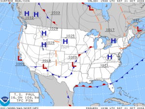
On weather maps, you'll see a warm front marked with a red line that has half-circles. These half-circles point in the direction the front is moving. If the map uses colors, warm fronts are shown as a solid red line.
See also
 In Spanish: Frente cálido para niños


