Cirrostratus cloud facts for kids
Quick facts for kids Cirrostratus cloud |
|
|---|---|

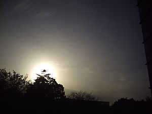
Cirrostratus nebulosus clouds being illuminated by the sun
|
|
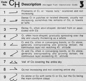
| Abbreviation | Cs |
| Genus | Cirrus- "curl" and -stratus "layered" |
| Species |
|
| Variety |
|
| Altitude | 6,000 - 13,000 m (20,000 - 43,000 ft) |
| Classification | Family A (High-level) |
| Appearance | Thin, transparent, high-altitude layer capable of producing a halo. |
| Precipitation | No, but usually signal the approach of a warm front. But rain in 24 hours |
Cirrostratus clouds are very high, thin clouds that look like a uniform layer or veil. They are made of tiny ice crystals, which are pieces of frozen water. These clouds are often hard to see because they are so transparent.
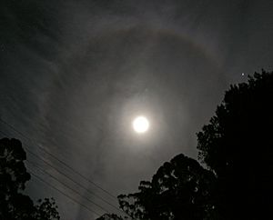
One cool thing about cirrostratus clouds is that they can create halos around the sun or moon. These halos happen when light bends as it passes through the ice crystals in the cloud.
Contents
What are Cirrostratus Clouds?
Cirrostratus clouds are found very high up in the sky, usually above 6,000 meters (20,000 feet). Their presence often means there's a lot of moisture in the upper part of the troposphere, which is the lowest layer of Earth's atmosphere.
There are two main types, or species, of cirrostratus clouds:
- Cirrostratus nebulosus (Cs neb): This type looks like a thin, featureless veil. It's the one that often creates those beautiful halos around the sun or moon.
- Cirrostratus fibratus (Cs fib): This type has a more fibrous or streaky texture, like wispy strands. It usually doesn't create halos.
Sometimes, cirrostratus clouds can also form in very cold polar regions, even higher up in the stratosphere. These are called polar stratospheric clouds.
What Do Cirrostratus Clouds Tell Us About the Weather?
Cirrostratus clouds can be like a weather forecast in the sky! If you see them forming after cirrus clouds and spreading across the sky, it often means a warm front is coming. A warm front is when a mass of warmer air moves into an area.
When a warm front is approaching, these clouds can signal that rain or snow might fall within the next 12 to 24 hours. If the front is moving fast, you might see precipitation even sooner, in about 6 to 8 hours.
Sometimes, if the cirrostratus clouds look broken or wispy (the fibratus type), it might mean the warm front is weak. In this case, you might get light drizzle or snow grains instead of heavy rain or snow.
Other Sky Sights with Cirrostratus
You might notice other clouds below cirrostratus formations, like Cumulus humilis or stratocumulus clouds. This happens because the stable air linked with cirrostratus can flatten out other clouds.
Also, Contrails (the vapor trails left by airplanes) can spread out and stay visible for a long time when cirrostratus clouds are present.
People sometimes describe the sky as having a "milky sunshine" when cirrostratus clouds are around. This is because the thin cloud layer makes the sun look hazy or milky, similar to how light mist or haze can appear.
See also
- Stratus cloud
- Altostratus cloud
- Nimbostratus cloud
- Cirrostratus nebulosus
- Altostratus undulatus cloud
- Fractus cloud


