West Azerbaijan province facts for kids
Quick facts for kids
West Azerbaijan province
استان آذربایجان غربی
|
|
|---|---|

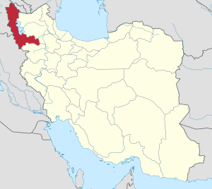
Location of West Azerbaijan province in Iran
|
|
| Country | |
| Region | Region 3 |
| Capital | Urmia |
| Counties | 19 |
| Area | |
| • Total | 37,437 km2 (14,455 sq mi) |
| Population
(2016)
|
|
| • Total | 3,265,219 |
| • Density | 87.2190/km2 (225.8963/sq mi) |
| Time zone | UTC+03:30 (IRST) |
| Main language(s) | Persian (official) local languages: Armenian Assyrian Neo-Aramaic Azerbaijani Kurdish Lishán Didán |
| HDI (2017) | 0.758 high · 26th |
West Azerbaijan Province (Persian: استان آذربایجان غربی, romanized: Āzarbāyjān-e Gharbī) is one of Iran's 31 provinces. Its capital and largest city is Urmia. This province is located in the northwest of Iran. It shares borders with Turkey, Iraq, and Azerbaijan's Nakhchivan Autonomous Republic. It also borders other Iranian provinces like East Azerbaijan, Zanjan, and Kurdistan.
The province covers an area of about 39,487 square kilometers. If you include Lake Urmia, the area becomes 43,660 square kilometers. In 2016, the population of West Azerbaijan Province was 3,265,219 people.
| West Azerbaijan Province Historical Population | ||
|---|---|---|
| Year | Pop. | ±% |
| 1956 | 721,136 | — |
| 1966 | 1,087,182 | +50.8% |
| 1986 | 1,971,677 | +81.4% |
| 2006 | 2,831,779 | +43.6% |
| 2011 | 3,080,576 | +8.8% |
| 2016 | 3,265,219 | +6.0% |
Contents
Discovering Ancient History
This province has been home to people for a very long time. Permanent settlements were built here as early as 6,000 BC.
Famous Discoveries
- At a place called Teppe Hasanlu, a famous Golden Vase was found in 1958.
- Tepe Hajji Firuz is another important site. It has some of the earliest proof of wine making in the world.
- At Gooy Teppe, a metal plaque from 800 BC was discovered. It shows a scene from the ancient story, the Epic of Gilgamesh.
These old ruins, like the UNESCO world heritage site at Takht-i-Suleiman, show how important this area has been throughout history. The province has many historical places, with 169 sites officially recognized by the Cultural Heritage Organization of Iran.
A Look at the Past
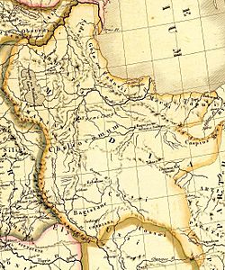
The earliest known civilization in this area was the Mannaeans. They lived between the powerful Urartian and Assyrian empires. The Mannaeans spoke a language similar to Urartian. Later, the region was known as Mantiene in Greek writings.
Armenian History
This region is also important in Armenian history. It was known as Vaspurakan and Nor Shirakan. It was a key part of historical Armenia and a birthplace of Armenian culture.
A very important battle happened here on May 26, 451 AD. The Armenian army, led by Vardan Mamikonian, fought the Sasanian army on the Avarayr Plain. This place is now called Churs in West Azerbaijan province. Even though the Persians won the battle, it was a big win for Armenians in the long run. The Battle of Avarayr led to the Nvarsak Treaty (484 AD). This treaty allowed Armenians to practice Christianity freely.
Changes in Control
In the late 4th century AD, the Sasanians took control of the area. They made it part of the nearby Adhurpadagan region. The name Adhurpadagan later became Azerbaijan. It comes from Atropates, an Iranian governor under the Achaemenid empire.
By the 7th century, the area came under Islamic rule. Over time, different local rulers took charge. In the 11th and 12th centuries, the Seljuk Turkic tribes conquered the region. During the 14th century, under Timurid rule, the city of Khoy became very important.
Later, local Kurdish groups like the Mukriyans, Bradosti, and Donboli ruled the region for centuries. They sometimes sided with the Ottomans or the Safavids. A famous battle, the battle of DimDim, happened here between the Safavids and the local Bradosti Kurds. After a long fight, the Castle of Dimdim was captured.
Modern History
The Safavid rulers, especially Shah Abbas, brought the region back under firm control. But later, in the 18th century, the Ottomans took over the northwestern parts of Iran. Nadir Shah then drove them out and brought the area back under Iranian rule.
In the 20th century, the region saw more changes. The Russian army occupied it several times. The Ottomans also occupied it. In 1941, Soviet forces took over, leading to a short-lived state called the Republic of Mahabad (1945-1946).
The province was renamed several times. In 1937, it was called Shomal-e gharb (northwestern province). Later, it was divided into western and eastern parts. In 1961, the western part was officially named West Azerbaijan by Iran.
Key Events in Recent History
- There were some periods of unrest and changes in control in the region.
- The Soviet occupation happened in 1944.
- The Republic of Mahabad was formed and later ended in 1946.
The Zoroaster Claim
Some researchers have suggested that the prophet Zoroaster was born near Lake Orumieh in this area. However, newer studies suggest he was more likely born in Central Asia.
Geography and Weather
West Azerbaijan Province is in the northwest of Iran. It covers 43,660 square kilometers, including Lake Urmia.
Climate
Cold winds from the north bring heavy snow in winter. Temperatures vary across the province. For example, the average temperature is 9.4°C in Piranshahr and 11.6°C in Mahabad. In Urmia, it's about 9.8°C. The highest temperature in the province can reach 34°C in July, and the lowest can be –16°C in January.
How the Province is Divided
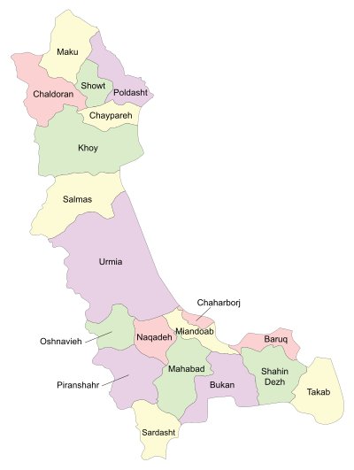
 The province is divided into different areas called counties. Here's a look at how the population has changed in these counties:
| Administrative Divisions | 2006 | 2011 | 2016 |
|---|---|---|---|
| Baruq County1 | — | — | — |
| Bukan County | 202,637 | 224,628 | 251,409 |
| Chaharborj County1 | — | — | — |
| Chaldoran County | 44,572 | 46,398 | 45,060 |
| Chaypareh County2 | — | 43,206 | 47,292 |
| Khoy County | 365,573 | 354,309 | 348,664 |
| Mahabad County | 197,441 | 215,529 | 236,849 |
| Maku County | 174,578 | 88,863 | 94,751 |
| Miandoab County | 245,153 | 260,628 | 273,949 |
| Naqadeh County | 117,831 | 121,602 | 127,671 |
| Oshnavieh County | 63,798 | 70,030 | 73,886 |
| Piranshahr County | 107,677 | 123,639 | 138,864 |
| Poldasht County3 | — | 42,071 | 42,170 |
| Salmas County | 180,708 | 192,591 | 196,546 |
| Sardasht County | 104,146 | 111,590 | 118,849 |
| Shahin Dezh County | 89,356 | 91,113 | 92,456 |
| Showt County3 | — | 52,519 | 55,682 |
| Takab County | 81,395 | 78,122 | 80,556 |
| Urmia County | 856,914 | 963,738 | 1,040,565 |
| Total | 2,831,779 | 3,080,576 | 3,265,219 |
| 1Separated from Miandoab County 2Separated from Khoy County 3Separated from Maku County |
|||
Major Cities
Many people in West Azerbaijan Province live in cities. Here are some of the largest cities based on the 2016 census:
| Rank | City | Population (2016) |
|---|---|---|
| 1 | Urmia | 736,224 |
| 2 | Khoy | 198,845 |
| 3 | Bukan | 193,501 |
| 4 | Mahabad | 168,393 |
| 5 | Miandoab | 134,425 |
| 6 | Salmas | 92,811 |
| 7 | Piranshahr | 91,515 |
| 8 | Naqadeh | 81,598 |
| 9 | Takab | 49,677 |
| 10 | Maku | 46,581 |
| 11 | Sardasht | 46,412 |
| 12 | Shahin Dezh | 43,131 |
| 13 | Oshnavieh | 39,801 |
| 14 | Qarah Zia od Din | 26,767 |
| 15 | Showt | 25,381 |
People and Languages
West Azerbaijan Province is home to different groups of people. Most of the population are Azerbaijanis and Kurds. There are also smaller groups of Armenians, Assyrians, and Jews.
It's not fully clear which language is spoken by the most people in the province. Some parts, including the capital city of Urmia, mostly speak Azerbaijani. However, some studies suggest that Kurdish might be the main language for a slightly larger number of people across the whole province.
Where People Live
- The counties of Bukan, Mahabad, Oshnavieh, Piranshahr, and Sardasht are mainly populated by Kurds.
- Counties like Chaldoran, Maku, Miandoab, Naqadeh, Salmas, and Takab have a mix of both Azerbaijanis and Kurds.
- Salmas also has a small Christian community.
Learning and Education
West Azerbaijan Province has several important universities.
Urmia University
Urmia University was first started by an American Presbyterian missionary in 1878. A medical school was also built there, led by Joseph Cochran and other American doctors. These doctors dedicated their lives to helping people in the region. They are buried in an old cemetery near Urmia.
Other Universities
Today, the province has many major places for higher education, including:
- Urmia University [1]
- Urmia University of Medical Sciences
- Urmia University of Technology
- Islamic Azad University of Urmia
- Islamic Azad University of Salmas
- Islamic Azad University of Khoi
- Islamic Azad University of Piranshahr
- Islamic Azad University of Mahabad
See also
 In Spanish: Provincia de Azerbaiyán Occidental para niños
 | Selma Burke |
 | Pauline Powell Burns |
 | Frederick J. Brown |
 | Robert Blackburn |


