West Beck facts for kids
Quick facts for kids West Beck |
|
|---|---|

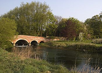
Wansford Bridge spanning the West Beck
|
|
| Lua error in Module:Location_map at line 420: attempt to index field 'wikibase' (a nil value).
Point at which West Beck becomes the River Hull shown within the East Riding of Yorkshire
|
|
| Country | England |
| Physical characteristics | |
| Length | 15.3 miles (24.6 km) |
| Basin features | |
| River system | River Hull |
| Basin size | 90.5 square miles (234.3 km2) |
| Tributaries |
|
West Beck is the name for the beginning part of the River Hull. It starts in the hills known as the Yorkshire Wolds. When it reaches Frodingham Beck at Emmotland, it officially becomes the River Hull.
This beck is very special because it's the most northern "chalk stream" in England. Chalk streams are rivers that get their water from underground chalk rocks. This makes their water very clear and clean. People often come here to enjoy fly fishing for wild brown trout and grayling.
Where West Beck Flows
West Beck starts as a spring in Elmswell. This spring comes from a chalk aquifer, which is like a natural underground water storage.
The beck then flows past Little Driffield and around the town of Driffield. It continues through Wansford and past a place called Corpslanding. Finally, it joins the Driffield Navigation at Emmotland.
In its upper parts, the beck has different names. It's first called Elmswell Beck, then Driffield Beck, and finally West Beck. As it leaves Driffield, some maps even call it the River Hull, even though it traditionally becomes the River Hull only when it meets other waterways at Emmotland. The last 1.5 miles (2.4 km) of the river near Corpslanding Bridge is also known as Driffield Navigation (West Beck).
Because many springs feed the beck in its early stages, West Beck provides over 80% of the water that flows into the River Hull.
History and Uses
For a long time, West Beck was used to power two corn mills. These were called Kings Mill and Bell Mills. Kings Mill is now a private home, and Bell Mills are used for industrial work. Bell Mills were built in 1792, and you can still see the old sluice gates and a mill race nearby.
The lower parts of West Beck were once used by boats. Large boats called Yorkshire Keels could travel all the way to Wansford. However, the river was quite shallow. So, in 1801, a special law was passed to create the Driffield Navigation. This project made a new canal route further north. It went from Fisholme through Wansford to Driffield. The law also allowed boats to reach Corpslanding.
The nearby village of Hutton Cranswick built a wharf at Corpslanding. A wharf is a place where boats can load and unload goods. Today, this spot is the highest point on the waterway where boats are legally allowed to go.
The river is also a popular spot for fly fishing. Only dry flies or nymph patterns are allowed. Many parts of the river are owned by fishing groups. However, you can buy a day ticket to fish at a place called Mulberry Whin. Mulberry Whin offers over a mile of fishing on both sides of the chalk stream.
Nature and Wildlife
West Beck flows past two important wetland areas. These areas are cared for by the Yorkshire Wildlife Trust. They are called Snakeholm Pastures and Skerne Wetlands.
The entire area where the river begins, known as its headwaters, is a special protected area. It's called a SSSI. This is because of the unique chalk base of the river, its excellent water quality, and the special plants that grow there.
 | Sharif Bey |
 | Hale Woodruff |
 | Richmond Barthé |
 | Purvis Young |

