
West Brownsville, Pennsylvania facts for kids
Quick facts for kids
West Brownsville
|
|
|---|---|
|
Borough
|
|
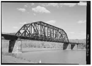
West Brownsville Junction Bridge, spanning the Monongahela River
|
|

Location of West Brownsville in Washington County, Pennsylvania.
|
|

West Brownsville
Location in Pennsylvania
|
|
| Country | United States |
| State | Pennsylvania |
| County | Washington |
| Established | 1831 |
| Area | |
| • Total | 1.42 sq mi (3.68 km2) |
| • Land | 1.30 sq mi (3.36 km2) |
| • Water | 0.12 sq mi (0.32 km2) |
| Population
(2020)
|
|
| • Total | 977 |
| • Density | 752.12/sq mi (290.42/km2) |
| Time zone | UTC-4 (EST) |
| • Summer (DST) | UTC-5 (EDT) |
| ZIP code |
15417
|
| Greater Pittsburgh | 724 |
West Brownsville is a small town, called a borough, in Washington County, Pennsylvania, USA. It is part of the larger Pittsburgh metropolitan area. In 2020, about 972 people lived there.
West Brownsville is closely linked to its "sister city," Brownsville, which is just across the river. For a long time, these two towns were connected by an old Native American trail. This trail later became a wagon road after the American Revolution.
Brownsville was an important spot because it was the first place where travelers could safely reach the Monongahela River after coming down from the Appalachians. Between West Brownsville and Brownsville, the river was shallow enough to cross by foot or wagon. This crossing was a key part of a major Emigrant Trail leading to new lands in the west. This trail later became the first National Road, known as the Cumberland Pike, which is now U.S. Route 40.
Contents
About West Brownsville
Where is West Brownsville?
West Brownsville is located at 40°1′47″N 79°53′11″W / 40.02972°N 79.88639°W.
The United States Census Bureau says the borough covers about 1.4 square miles (3.6 square kilometers). Most of this area, about 1.3 square miles (3.3 square kilometers), is land. The rest, about 0.1 square miles (0.3 square kilometers), is water.
A Look Back in Time
West Brownsville was built on a flat area next to a curve in the Monongahela River. This made it different from Brownsville, which had steep hills. West Brownsville's flatter land meant it was more likely to flood.
Long ago, near where the Brownsville-West Brownsville Bridge is now, there was a shallow river crossing. This was used by Native Americans and later by wagons carrying early settlers heading west.
A few hundred yards west of the river, PA Route 88 enters the town. It follows the base of the steep hills, going through most of West Brownsville. Then, it turns uphill and climbs northwest towards Blainsburg. Blainsburg is a larger community located above West Brownsville.
The steep hills behind West Brownsville had two paths that became early U.S. roads. One path, an old wagon road, went west and steadily climbed for about 2.5 miles. This road later became the National Road. It followed an old Native American trail called Nemacolin's Path. This path led to a shallow river area, or ford, which attracted settlers traveling west. The other path allowed PA Route 88 to climb out of the valley and connect to California.
Trains and Travel
.png)
West Brownsville and Brownsville were very important for transportation. They were connected by a ferry that started in the early 1800s. Brownsville became a center for building and equipping riverboats. West Brownsville's shallow riverbanks were a good place to tie up new boats and load them with goods.
Today, the main street in West Brownsville is famous for its on-street running trains. Freight trains run right down the middle of the street! This is considered one of the longest railroad crossings in the United States.

Both West Brownsville and Brownsville had many rail yards. These yards were packed into the narrow spaces along the Monongahela River. A special feature of these rail yards was that they shared bridges that formed a rare "reversing loop." This allowed entire trains to turn around easily.
These rail yards were very important for the coking ovens located upriver. They helped transport coal and coke, which were key to the famous Pittsburgh Steel Industries. Many different railroads, like the Monongahela Railroad, used these tracks. Today, Norfolk Southern operates the tracks.
Population in West Brownsville
|
||||||||||||||||||||||||||||||||||||||||||||||||||||||||||||||||||||||||||||||||||||||||
In 2000, there were 1,075 people living in West Brownsville. There were 459 households and 312 families. The population density was about 831 people per square mile.
About 24.4% of households had children under 18 living with them. About 51% of households were married couples. The average household had 2.34 people. The average family had 2.82 people.
The population was spread out by age. About 16.8% were under 18 years old. About 22% were 65 years or older. The average age was 43 years. For every 100 females, there were about 96.5 males.
See also
 In Spanish: West Brownsville (Pensilvania) para niños
