West Green, London facts for kids
Quick facts for kids West Green |
|
|---|---|
 |
|
| Population | 13,372 (2011 Census) |
| OS grid reference | TQ324892 |
| • Charing Cross | 5.7 mi (9.2 km) S |
| London borough | |
| Ceremonial county | Greater London |
| Region | |
| Country | England |
| Sovereign state | United Kingdom |
| Post town | LONDON |
| Postcode district | N15, N17 |
| Dialling code | 020 |
| Police | Metropolitan |
| Fire | London |
| Ambulance | London |
| EU Parliament | London |
| UK Parliament |
|
| London Assembly |
|
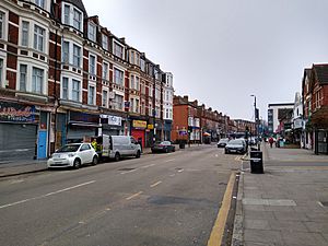
West Green is a lively area in north London, England. It's part of the London Borough of Haringey and is about 5.7 miles (9.22 km) north of Charing Cross, a famous spot in central London.
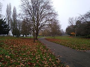
This area is mostly where people live, with lots of homes and buildings. It also has two nice green spaces: Chestnuts Park and Downhills Park. West Green's boundaries are roughly defined by Downhills Park to the north, Higham Road and Clonmell Road to the northeast, Avenue Road to the southeast, St Ann's Road to the south, and Belmont Road to the west.
Contents
History of West Green
West Green started as a small village way back in the Middle Ages. People first lived here around 1393. By the early 1600s, there were only eight buildings in West Green. It was the only tiny village in the middle of the Tottenham area.
It didn't grow much until 1800. But by 1840, it had 18 houses, which made it bigger than Wood Green at that time. West Green really started to grow after the 1860s, especially when the Tottenham & Hampstead Junction Railway arrived in 1878.
A writer named Charlotte Riddell lived nearby in the 1800s. In her 1874 book Above Suspicion, she described how much West Green changed. She wrote that just 16 years before, West Green felt like a village far from London. The lanes leading to it were quiet and rural. But then, new houses, a pub, and a church appeared. These changes brought London's busy city life with them. She felt that West Green changed from a pretty village to a less desirable suburb very quickly. By 1890, the area had become fully urban, meaning it was a built-up part of the city.
West Green Ward
Since May 2022, there is an official electoral area called West Green. This ward is much larger than the original district of West Green. It includes nearby places like Duckett's Green and stretches north to Lordship Lane. The areas next to the West Green ward are Noel Park, White Hart Lane, Bruce Castle, Tottenham Central, St Ann's, and Harringay.
Education in West Green
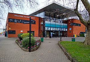
Park View School is a secondary school located right in West Green. It's a great place for students to learn and is situated next to the lovely Downhills Park.
Getting Around West Green
West Green is well-connected, making it easy to get to other parts of London.
Nearby Places to Visit
- Duckett's Green (West)
- Harringay (SouthWest)
- St Ann's (SouthEast)
- Seven Sisters
- Tottenham
- Turnpike Lane
- Wood Green
Nearest Underground Stations
You can catch the Underground (Tube) from these stations:
Nearest Train Stations
For train travel, these stations are close by:
- South Tottenham railway station
- Seven Sisters station
- Harringay Green Lanes station
Bus Routes Serving West Green
Several London bus routes pass through West Green, making it easy to travel by bus. These include routes 41, 67, 230, 341, N41 (a night bus), and W4.
 | Aaron Henry |
 | T. R. M. Howard |
 | Jesse Jackson |


