West Side, Jersey City facts for kids
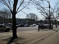
The West Side of Jersey City is a lively area with many different neighborhoods. It's located on both sides of West Side Avenue, which is one of the city's main streets for shopping and getting around. This important street runs next to and west of Kennedy Boulevard and is part of the county's road system.
West Side Avenue starts in the northern part of the city, in an area called the Marion Section. It ends near the PATH trains, though there isn't a train station right there. As you travel along West Side Avenue, you'll pass by Holy Name Cemetery on one side and Saint Peter's University on the other. You might even spot "The Bubble," which is a cool dome-shaped building that's part of the university's sports center.
Contents
Exploring Lincoln Park

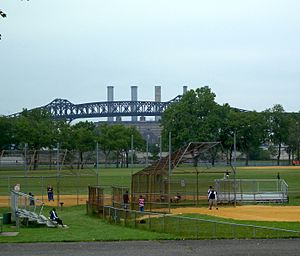
Lincoln Park is one of the biggest parks in Hudson County. It's a great place for outdoor fun! You can play tennis, run on the track, use the athletic fields, or practice your golf swing. There are also nice spots for picnics and paths for biking and running.
Park Sections and Architecture
The park is split into two parts by Truck 1-9. Pedestrian bridges help people cross safely from the older, more city-like eastern side to the natural western side, which is near the Hackensack River. The streets leading up from the park in the Bergen Section have many interesting old buildings. You can see beautiful Victorian and Edwardian homes, plus pre-war and Art Deco apartment buildings. A well-known church, St. Aloysius Church, is also close to the park.
West Bergen and Mallory Square

When West Side Avenue reaches Communipaw Avenue, you enter the heart of West Bergen. This area gets its name because it's west of the Bergen-Lafayette Section. A long time ago, in the 1800s, it was part of Bergen Township and Bergen. The name "Bergen" comes from the original settlement of Bergen, New Netherland, which was centered around Bergen Square.
One of the few older neighborhoods with homes west of West Side Avenue is found around Mallory Avenue. This street runs south from Lincoln Park. Mallory Square is a small, special area within West Bergen that is home to many Filipino American families.
West Side Avenue Light Rail Station
The West Side Avenue Station is the last stop for one branch of the Hudson Bergen Light Rail. This station is built on a raised area above the east side of the street. It has a platform in the middle with two tracks. At the end of the station, there are special blocks to stop the trains. A bridge and an elevator connect the station to a large parking lot and bus stops.
Future Plans for the Rail Line
In the past, the train tracks used to continue west across the Newark and New York Railroad Bridge over Newark Bay. There are ideas to extend the light rail line even further in the future. The Jersey City Board of Education building is also located nearby, making it easy to get to by public transport.
New Jersey City University's West Campus
The West Campus of New Jersey City University started to be developed in 2006. This expansion will make the university campus much larger. It will include new buildings for classes, places for students to live, shops, and parking areas. There will also be a "University Promenade," which is like a walking path or plaza.
Expanding the West Side Community
Along with another planned community called Bayfront, Jersey City, the West Side area is growing. These projects will add more homes, shops, and fun places for people to enjoy.
Southern End of West Side Avenue
West Side Avenue's southern end is in the Country Village part of Greenville. It's close to Danforth Avenue and NJ-440. Across NJ-440, you can find Droyer's Point and parts of the Hackensack RiverWalk, which is a pathway along the Hackensack River.
Many New Jersey Transit bus routes serve the West Side, making it easy to travel around the area and to other parts of Jersey City.
 | May Edward Chinn |
 | Rebecca Cole |
 | Alexa Canady |
 | Dorothy Lavinia Brown |

