Whangaroa Harbour facts for kids
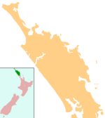
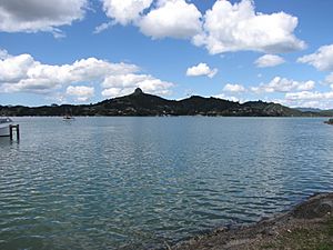
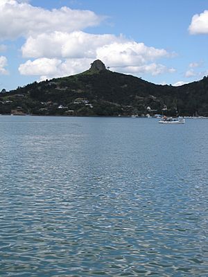
Whangaroa Harbour is a beautiful inlet on the northern coast of Northland, New Zealand. It used to be spelled Wangaroa Harbour. To the north, you'll find Whangaroa Bay and the big Pacific Ocean.
Around the harbour are several small towns. Totara North and Saies are on the west side. Waitaruke is on the south side, and the town of Whangaroa is on the east. State Highway 10 goes right through Waitaruke.
The name "Whangaroa" comes from an old Māori story. It means "what a long wait," like a sad song sung by a woman waiting for her warrior husband to return.
This harbour was formed about 6,000 years ago. The sea level rose and covered a river valley, creating the harbour we see today. You can still see steep rocks that are left over from ancient volcanoes.
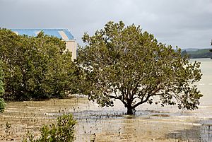
At the very end of the harbour, there are large mangrove swamps. These are special trees that grow in salty water. Also, some of the oldest fossils in the North Island have been found here. They are about 270 million years old!
Contents
History of Whangaroa Harbour
According to Māori traditions, the Māhuhu-ki-te-rangi canoe explored Whangaroa Harbour a long time ago. This was during the early Māori settlement of New Zealand. People who came from the Te Māmaru and Mataatua canoes later settled in this area.
Early European Visits and the Boyd Incident
From 1805 to 1809, ships came to Whangaroa for whaling and other trade. These ships included the General Wellesley and Commerce in 1806, and the Elizabeth in 1809.
In 1809, a sad event happened involving a ship called the Boyd. A conflict broke out between the ship's crew and local Māori, and many crew members were killed. Because of this, ships stopped visiting the harbour for a while. Visits started again in 1819 when the ship Dromedary came to load timber.
Sadly, Southern Right Whales were hunted so much that they almost disappeared from this area. However, dolphins and killer whales (orcas) still visit the harbour often today.
Missionaries and Settlements
A Christian mission was started by the Wesleyan church in June 1823. In 1827, a famous Māori chief named Hongi Hika attacked local Māori. He wanted to control the valuable kauri trees in the area. Some of his warriors, without his knowledge, damaged the mission, and it had to be closed. Hongi Hika himself died at Whangaroa in 1828 from an injury he got earlier.
Europeans began to settle around the harbour in the 1840s. A Catholic mission was also set up in Waitaruke. Whangaroa Harbour became a busy place for cutting down trees (timber milling) and digging for kauri gum. This started after a ship called the Lancashire Witch arrived in 1865 with new settlers.
Shipyards were built in Totara North in 1872. Giant kauri logs were tied together to make rafts. These rafts were then pulled by steamships all the way to Auckland, which took about three days!
In the early 1900s, there was a whaling station at Sea Sick Bay, near the south entrance of the harbour. By the 1920s, it had moved to Ranfurly Bay, near the north entrance.
After the Mangamuka Gorge road was paved in 1961, it became the main way to travel from Whangarei to the Far North. This new road meant that Whangaroa was no longer on the main route.
Schools in the Area
There are a few schools near Whangaroa Harbour that serve the local children.
Te Kura o Hato Hohepa Te Kamura
This is a primary school (for years 1-8) located in Waitaruke. It's a coeducational school, meaning both boys and girls attend.
Totara North School
This is another primary school (for years 1-6). It is also coeducational.
Other schools in the wider area include those at Oruaiti, Kaeo, and Matauri Bay.
See also
 In Spanish: Whangaroa Harbour para niños
 | Frances Mary Albrier |
 | Whitney Young |
 | Muhammad Ali |


