
Whitesboro, New York facts for kids
Quick facts for kids
Whitesboro, New York
|
||
|---|---|---|
|
Village
|
||

Commercial buildings on Main Street in Whitesboro
|
||
|
||

Location in Oneida County and the state of New York.
|
||
| Country | United States | |
| State | New York | |
| County | Oneida | |
| Founded by | Hugh White | |
| Area | ||
| • Total | 1.05 sq mi (2.72 km2) | |
| • Land | 1.05 sq mi (2.72 km2) | |
| • Water | 0.00 sq mi (0.00 km2) | |
| Elevation | 423 ft (129 m) | |
| Population
(2020)
|
||
| • Total | 3,612 | |
| • Density | 3,440.00/sq mi (1,328.72/km2) | |
| Time zone | UTC-5 (Eastern (EST)) | |
| • Summer (DST) | UTC-4 (EDT) | |
| ZIP code |
13492
|
|
| Area code(s) | 315 | |
| FIPS code | 36-81710 | |
| GNIS feature ID | 0971160 | |
| Website | Official website: https://villagewhitesboro.digitaltowpath.org:10045/content | |
.png)
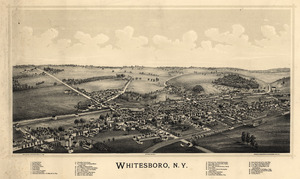
Whitesboro is a small village located in Oneida County, New York, in the United States. In 2010, about 3,772 people lived there. The village got its name from Hugh White, who was one of the first people to settle in the area. Whitesboro is part of a larger area called the Town of Whitestown.
Contents
A Look Back in Time
The area that is now Whitesboro began to be settled in 1784. It officially became a village in 1813. In 1851, the Iroquois people had a name for Whitesboro in their language: Che-ga-quat-ka.
An important school called the Oneida Institute was in Whitesboro from 1827 to 1843. This school was known for supporting the end of slavery.
The older part of the village was once next to the Erie Canal and Main Street. In the early 1900s, the canal was filled in. A road called Oriskany Boulevard was built where the canal used to be. The streets that connect Main Street and Oriskany Boulevard make up the oldest part of Whitesboro.
The Whitestown Town Hall is a historic building. It was added to the National Register of Historic Places in 1973. Today, this building serves as the village courthouse. The main offices for the Town of Whitestown are now in newer buildings outside of Whitesboro.
Where is Whitesboro?
Whitesboro is located at coordinates 43°7′N 75°18′W / 43.117°N 75.300°W. This means it is at 43.124 degrees north and 75.296 degrees west. The United States Census Bureau says the village covers about 1.1 square miles (2.72 square kilometers) of land. There is no water area within the village limits.
The Sauquoit Creek forms the border between Whitesboro and Yorkville. Areas of Whitesboro that are close to this creek sometimes experience flooding.
People of Whitesboro
| Historical population | |||
|---|---|---|---|
| Census | Pop. | %± | |
| 1870 | 964 | — | |
| 1880 | 1,370 | 42.1% | |
| 1890 | 1,663 | 21.4% | |
| 1900 | 1,958 | 17.7% | |
| 1910 | 2,375 | 21.3% | |
| 1920 | 3,038 | 27.9% | |
| 1930 | 3,375 | 11.1% | |
| 1940 | 3,532 | 4.7% | |
| 1950 | 3,902 | 10.5% | |
| 1960 | 4,784 | 22.6% | |
| 1970 | 4,805 | 0.4% | |
| 1980 | 4,460 | −7.2% | |
| 1990 | 4,195 | −5.9% | |
| 2000 | 3,943 | −6.0% | |
| 2010 | 3,772 | −4.3% | |
| 2020 | 3,612 | −4.2% | |
| U.S. Decennial Census | |||
In 2000, there were 3,943 people living in Whitesboro. These people lived in 1,778 households, and 992 of these were families. The village had about 3,675 people per square mile (1,419 people per square kilometer). There were 1,921 homes, with about 1,791 homes per square mile (691 homes per square kilometer).
Most of the people in Whitesboro were White (97.69%). A small number were African American (0.53%), Native American (0.03%), or Asian (0.33%). Some people were from other races (0.53%) or from two or more races (0.89%). About 1.47% of the population was Hispanic or Latino.
In 2000, about 27.3% of households had children under 18 living with them. About 36.9% were married couples. About 15.0% were single mothers. Many households (44.2%) were not families. About 39.0% of all households were people living alone. Of these, 18.7% were people aged 65 or older living by themselves. The average household had 2.21 people, and the average family had 2.98 people.
The age of people in the village was spread out. About 23.3% were under 18 years old. About 7.8% were between 18 and 24. About 31.7% were between 25 and 44. About 20.3% were between 45 and 64. And 17.0% were 65 years or older. The average age was 37 years. For every 100 females, there were about 86.7 males.
The average income for a household in the village was $31,947. For a family, the average income was $42,741. The average income per person in the village was $17,386.
Famous People from Whitesboro
Many interesting people have connections to Whitesboro, including:
- Sidney Breese – A pioneer from Illinois.
- Calvert Coggeshall – A well-known painter.
- Alexander L. Collins – A politician.
- Harriet Elizabeth Cook – One of the wives of Brigham Young, born in Whitesboro in 1824.
- Simon Newton Dexter – A politician.
- Robert Esche – A former professional ice hockey goaltender. He is now the President of the Utica Comets.
- John Frink – A writer and executive producer for The Simpsons TV show.
- George Washington Gale – The person who started the Oneida Institute of Science and Industry.
- Thomas R. Gold – A politician.
- Beriah Green – The president of the Oneida Institute.
- John Grimes – A Roman Catholic bishop.
- Mark Lemke – A former Major League baseball player for the Atlanta Braves.
- William A. Moseley – A former US Congressman.
- Mark Mowers – A former professional ice hockey winger.
- Harry S. Patten – A politician.
- Charles Edward Pearce – A congressman.
- Fred Sisson – A politician.
- John T. Spriggs – A politician.
- Henry R. Storrs – A lawyer.
- Johnny Sullivan – A wrestler.
- William Whipple Warren – A historian of the Ojibwe people and a legislator. He went to school at the Oneida Institute.
- Philo White – A former Wisconsin state senator and U.S. diplomat.
See also
 In Spanish: Whitesboro (Nueva York) para niños
